JAP | ENG
Long-term stay in Brazil #5/15
Outer Port of Santos
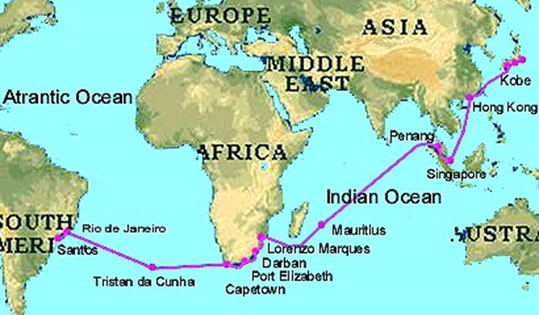
Overseas travel, 1962
Topography of the state of São Paulo
A large detour through the rivers of state of São Paulo
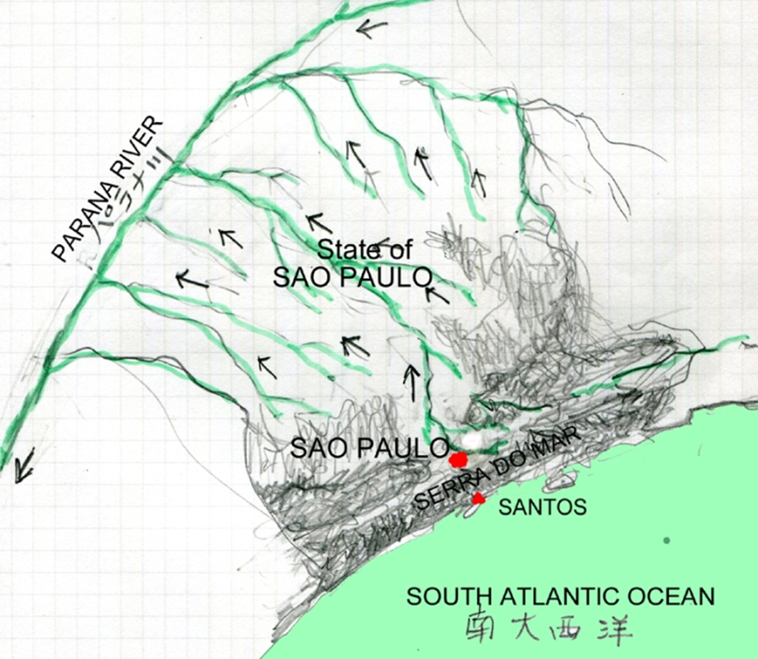
Topography of the state of São Paulo
The Tiete River, which originates near São Paulo, a large city at an altitude of 750 meters, is blocked by the SERRA DO MAR and cannot flow into the Atlantic Ocean, which is only 75 km away.
Therefore, the river flows 500 km inland, joins the Paraná River, changes course to the south, and makes a large loop from the mouth of Buenos Aires, 3,000 kilo meters away, to the Atlantic Ocean.
The inland area of the state of São Paulo is home to large swaths of land suitable for agriculture and livestock farming, including coffee, sugar, various vegetables, and beef cattle.
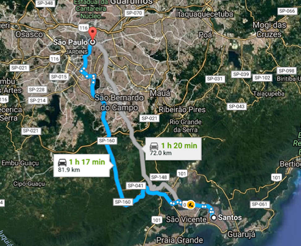
Anchietà Highway

It connects Santos-Sao Paulo by about 70 km.
It is an independent two-lane highway.
It climbs a short distance from the Atlantic coastal plain to the coastal mountain range 750 meters above sea level, then reaches the plateau area and the remaining 50 km to Sao Paulo.
One side is uphill and the other is downhill, and they are separate roads.
The Anchieta Highway was built on the former route taken by European immigrants, and later Japanese immigrants, heading inland via Santos and Sao Paulo. Photographed around 1965.
Anchieta was a Jesuit missionary from the Spanish Canary Islands who evangelized in Brazil in the second half of the 16th century. Called the Sao Paulo Piratininga Jesuit School, it soon expanded and flourished as the core of the population.
Anchieta was also one of the founders of the founding of Sao Paulo in 1554 and Rio de Janeiro in 1565.
Peace making with the indigenous people was extremely important for the stable colonial migration to new lands.
Aerial view of Santos city and the South Atlantic Ocean from the Anchieta Expressway
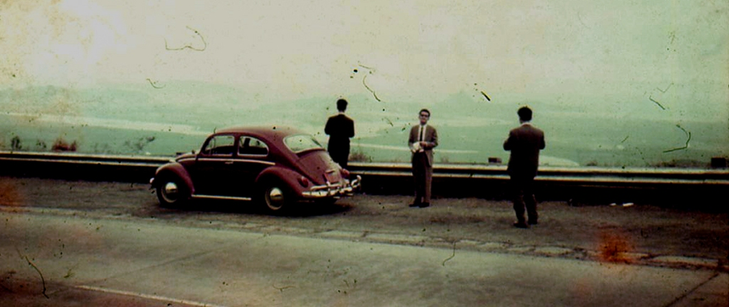
Photo of author
If you go down the Ancieta Road from São Paulo for about 60 km, you can enjoy a spectacular view like the one in the photo. To the lower is the city of Santos and to the right is the endless coastline of Praia Grande.
In addition, there is a height difference of 750m between São Paulo and Santos, so the temperature difference is 4-5 degrees.
You can experience the warmth of the 80km downhill by car and the coolness of the uphill journey.
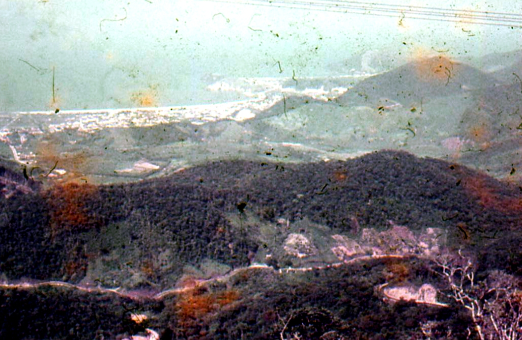
Photo by author
SERRA DO MAR AND Santos
The distant view of the mountains in the background, SERRA DO MAR.
On a plateau 75 kilometers up this mountain range is São Paulo, the largest city in South America.
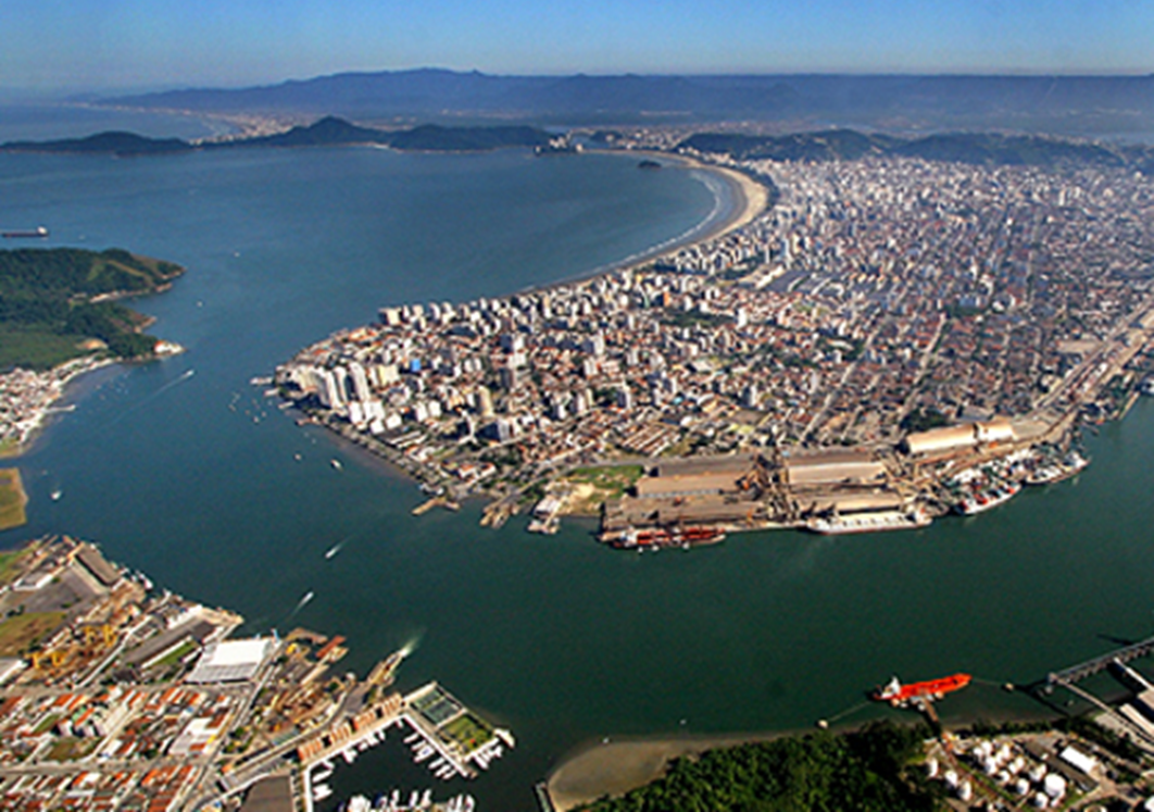
City of Santos, Port of Santos. The front is the wharf of the ocean shipping
The wharf of Santos Port, the port of coffee shipment and the landing point for Brazilian immigrants.
They landed here in 1962 and set sail for Europe from here in 1969.
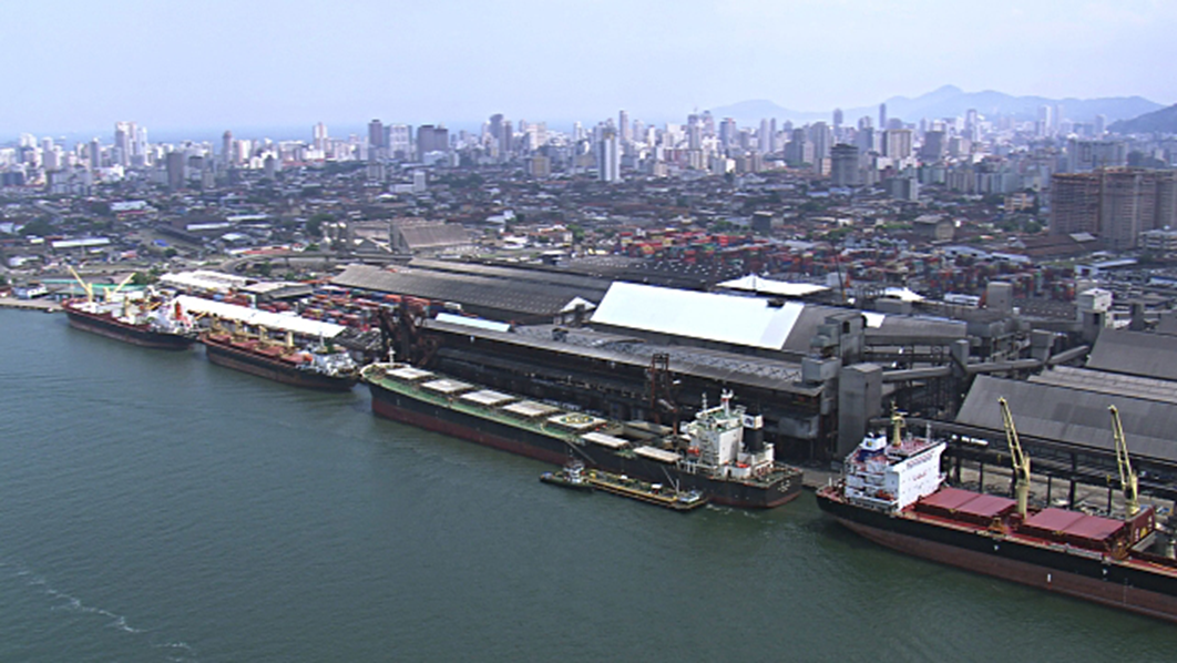
Port of Santos
Beaches in Santos
The South Atlantic Ocean and the white sand coastline.
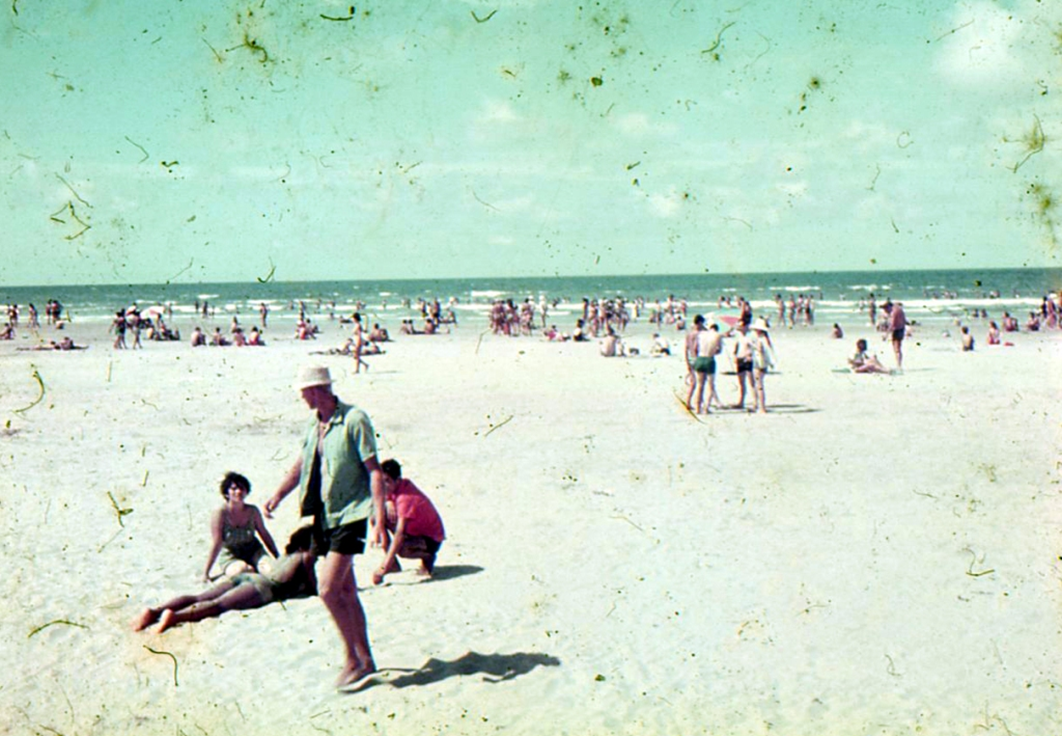
Santos Beach facing the Atlantic Ocean in the 1960s, Photo by author
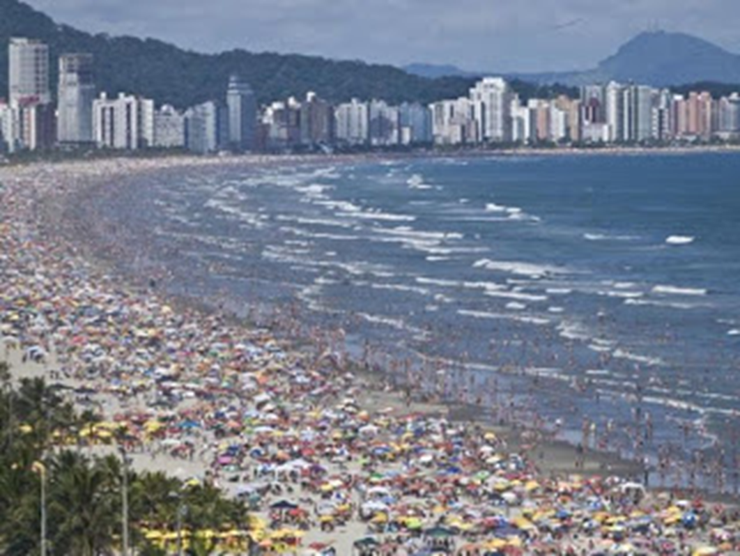
The crowded beach today