JAP | ENG
Southeast Asian Waterfront
#4/6
Straits Region
Singapore Strait
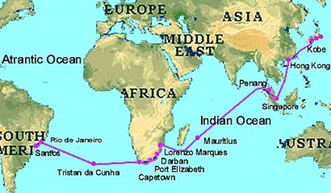
The most important region for global maritime trade
The Strait of Malacca, between the Malay Peninsula and Sumatra, and the Singapore Strait, between Singapore Island and the Liau Islands, are extremely narrow strips of sea, with only the white areas (indicate in map below) of 25m deep. The minimum width is about 2.8km.
120,000 ships sail through this sea lane every year.
Various ferries cross the sea lane at right angles, connecting Singapore with the ports of the Riau Islands in Indonesia.
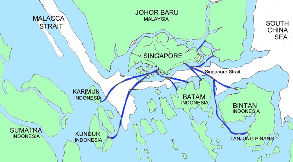
Ferry route between Singapore and the Liau Islands in Indonesia
Author’s sketch
Tanjung Pinang
The administrative capital city of the Indonesian province of Riau Islands Province. The population is about 200,000.
Located in the southern part of Bintan Island, it is a maritime town unique to the region founded by the Malay maritime peoples.
It takes about two hours by direct ferry from Singapore.
There are 2-5 daily trip.
Indonesian currency is the rupiah, but the Singapore dollar is usually widely accepted there.
In contrast to these, the northern part of Bintan Island has a new international resort zone that has been developed since around 1990.
It can be reached by ferry from Singapore, which takes about one hour.
Maritime settlements
As shown in the sketch below, it can be seen that the maritime settlement naturally extends from the land Tanjung Pinang City (white background in map below) towards the sea.
The reason for this is that it is cooler to live at sea than on land, and it is advantageous for the distribution of goods.
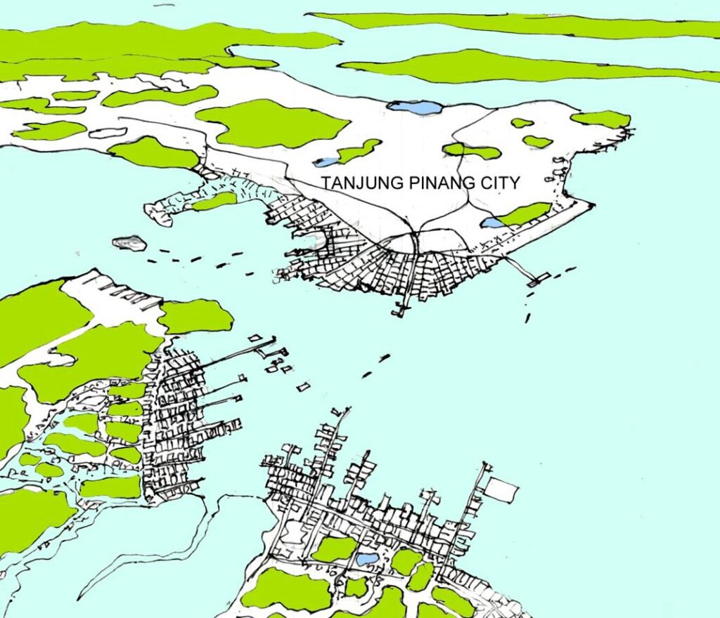
Author’s sketch
Living on the sea
A small island settlement halfway between Singapore Island and Batam Island.
The Sea Peoples live on the sea as if they are attached to the islands.
Maritime settlements such as the one pictured below can be commonly seen on most of the remote islands in the waters between Singapore and Sumatra.
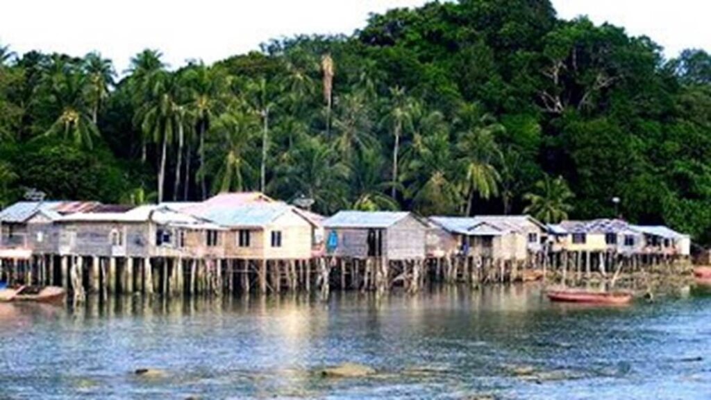
Photo by author, early 1980s
View of Indonesian Batam Island from the south deck of the Singapore Strait ferry.
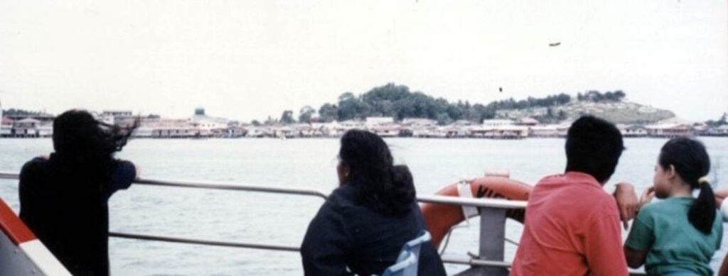
Photo by author, early 1980s
Floating houses stretching out towards the sea
Tanjung Pinang city. You can clearly see the boundary line between the land in the foreground and the floating houses that extend out over the sea.
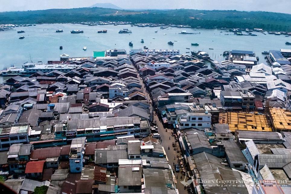
Tanjung Pinang Maritime Settlement Area.
Alleys and shops stretched from the shore of the land side to the sea.
It’s crowded and hot and humid. Below the passage is the sea.
Malays and Chinese people live in the area. The common language is Malay.
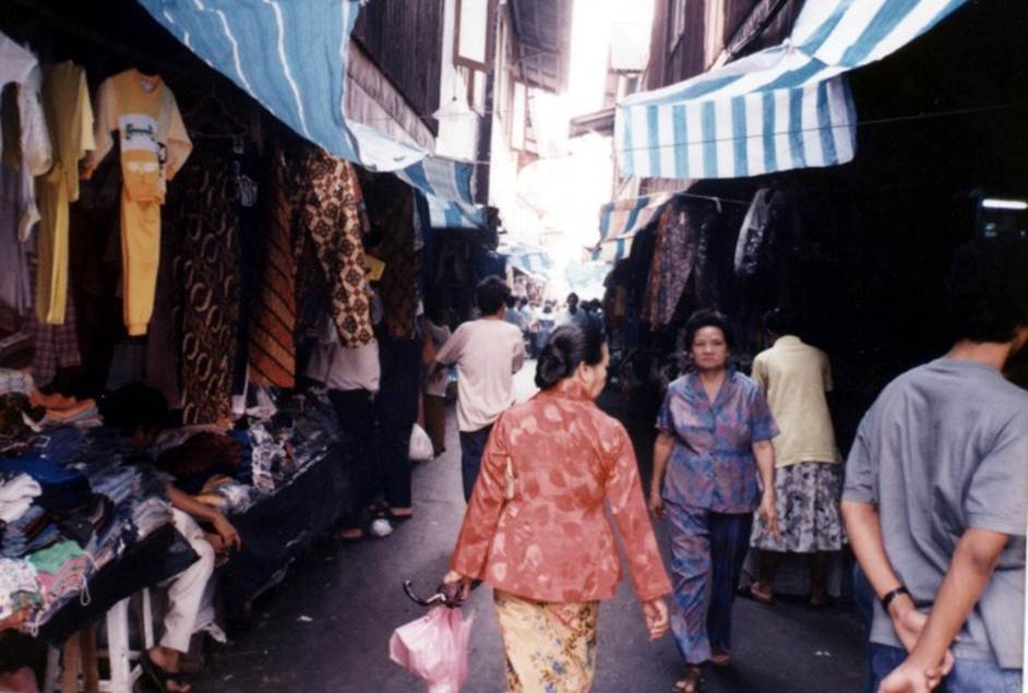
Photo by author, early 1980s
Bird’s eye view sketch of the tip of the sea village
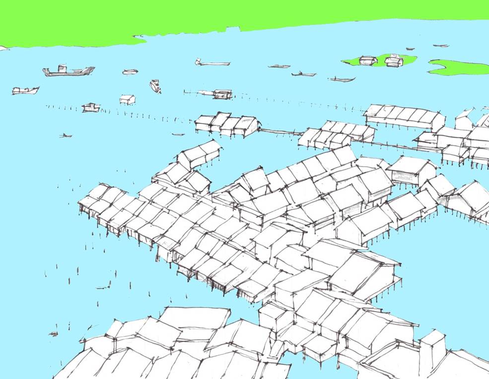
Author’s sketch
A sketch of the middle part of the sea village.
Cars are not allowed and the road is always paved.
This is based on a human scale, and you can always take a pleasant walk.
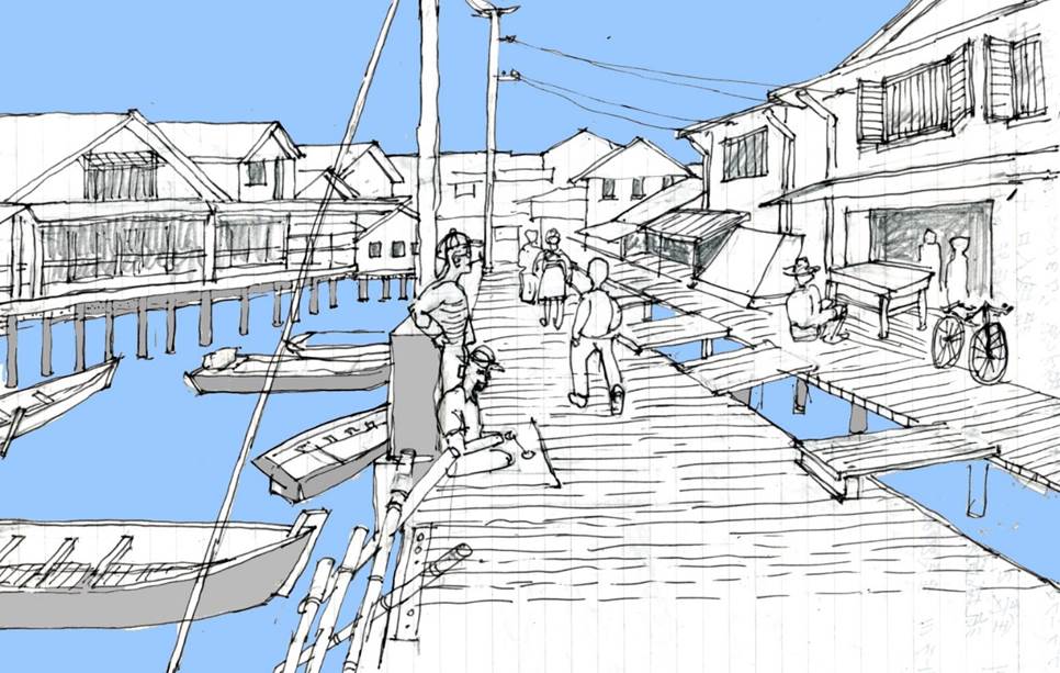
Author’s sketch
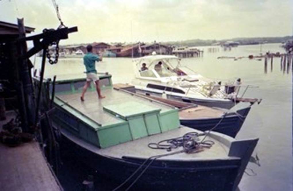
Photo by author, early 1980s
A two-story floating house.
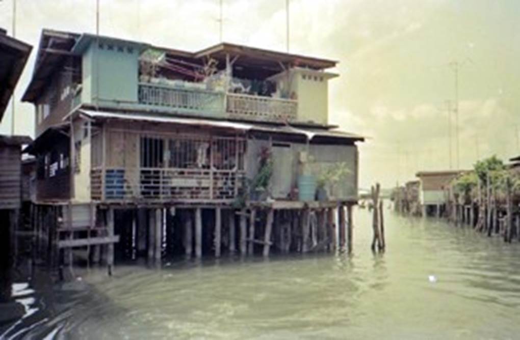
Photo by author, early 1980s
A narrow waterway between the houses of the sea village.
Boats can travel back and forth through this network of waterways.
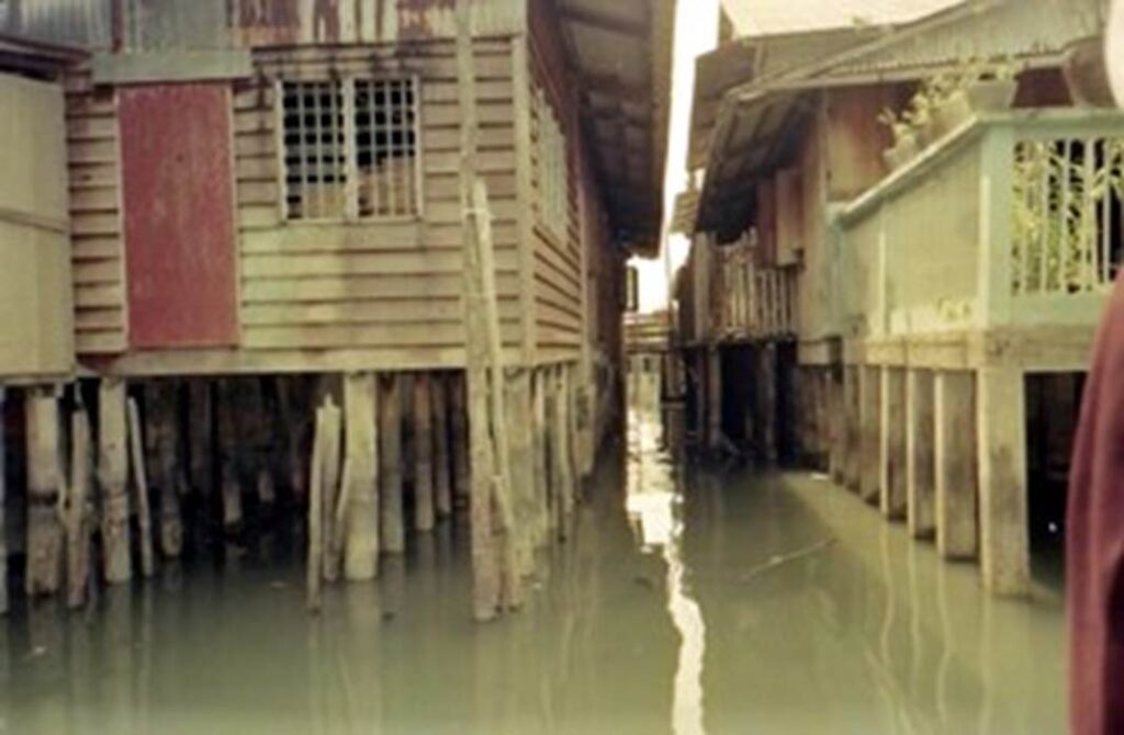
Photo by author, early 1980s
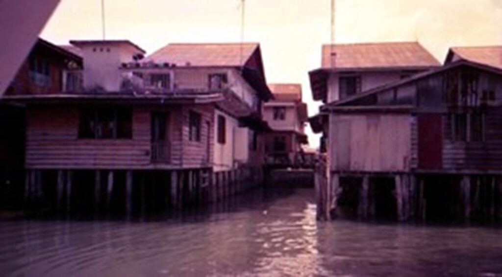
Photo by author, early 1980s
View of the floating houses from the dock.
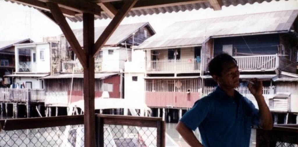
Photo by author, early 1980s
Simple docks set up at various location
All kinds of daily necessities, including food, are brought in by access from the sea side.
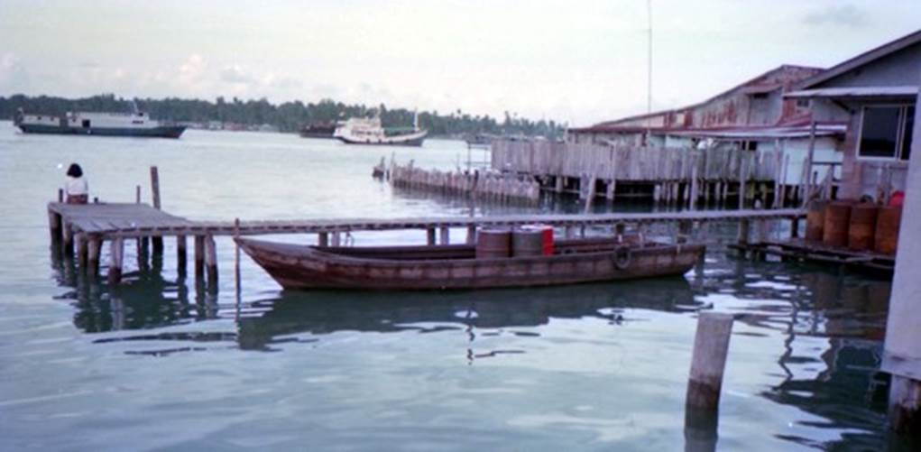
Photo by author, early 1980s
Materials and equipment for the construction of sea village
A construction site where an offshore village is being built.
A scaffold has been erected and piles are being driven.
Wooden materials such as piles are cut from dense forests and mangrove forests in neighbouring islands and transported by the sea.
Construction equipment and other power machinery can be transported easily from the neighbouring island of Batam.
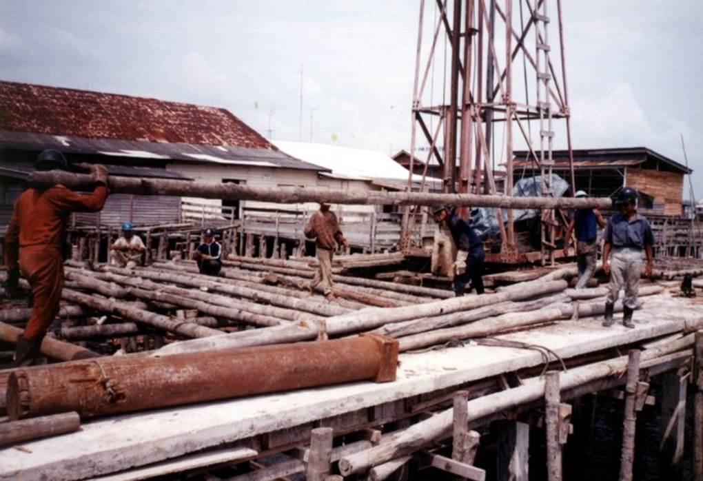
Photo by author, early 1980s
Logs quarried from the rainforest.

Pile wood cut from a mangrove forest.
It can withstand seawater for a long period of time.
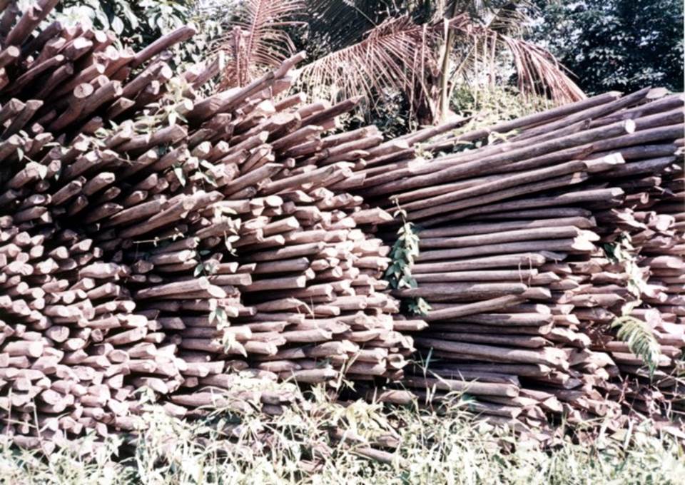
Photo by author, early 1980s
Piling work
All photos were taken by the author in the early 1980s.
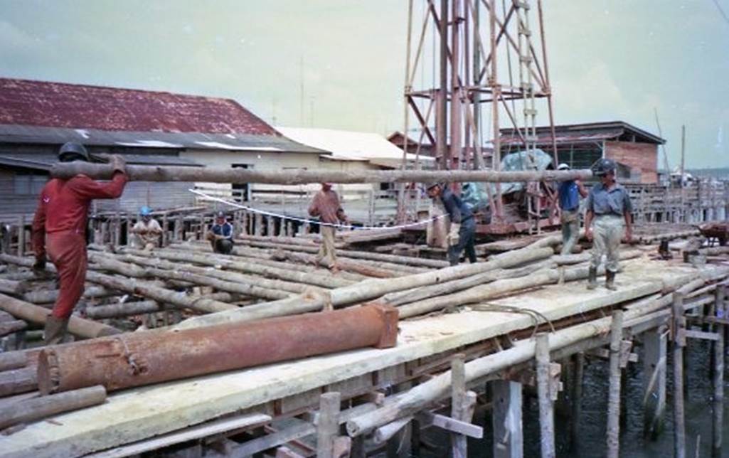
Photo by author, early 1980s
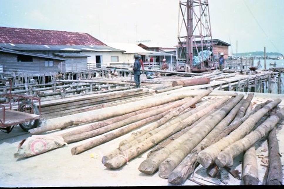
Photo by author, early 1980s
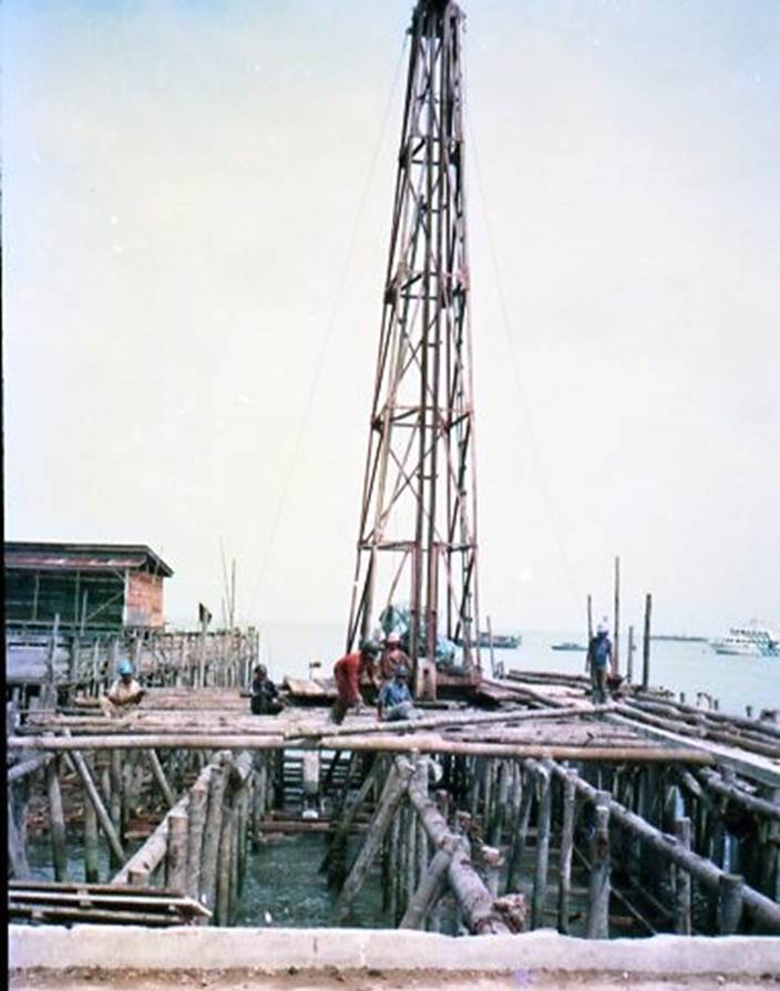
Photo by author, early 1980s
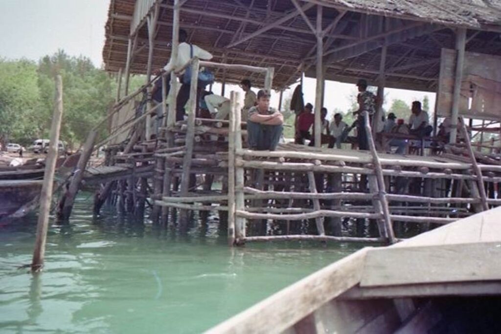
Photo by author, early 1980s
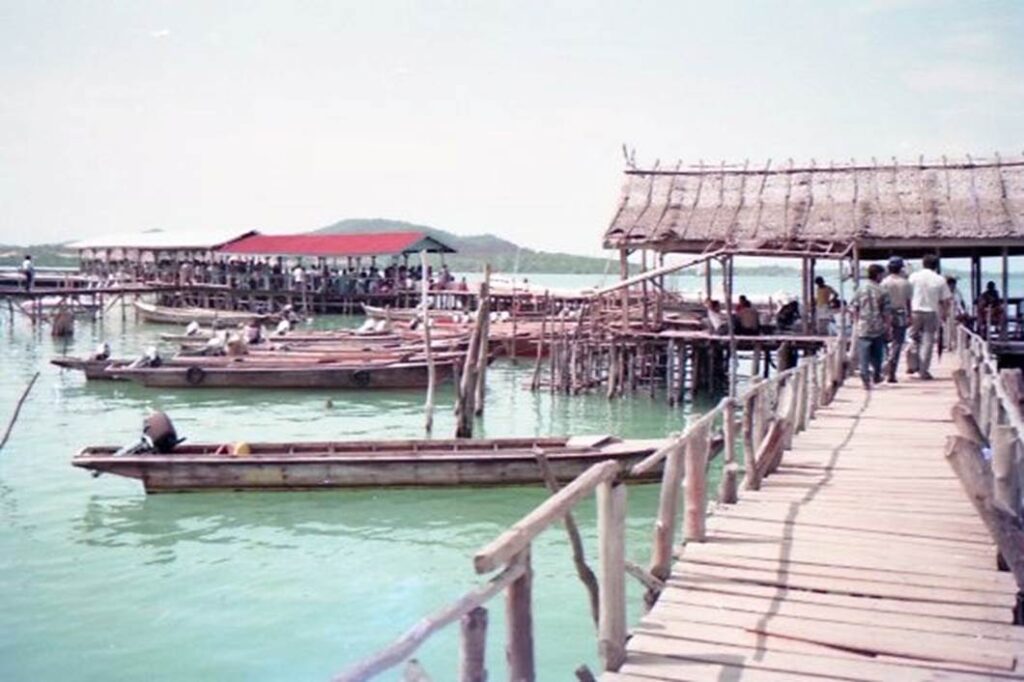
Photo by author, early 1980s
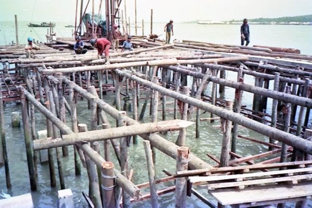
Photo by author, early 1980s
I went to see the floating houses on the small islands around Batam.
There are many small islands scattered around Batam, each with a pier like the one in the photo. Passengers disembarking from small boats can climb the ladder stairs using their hands and feet.
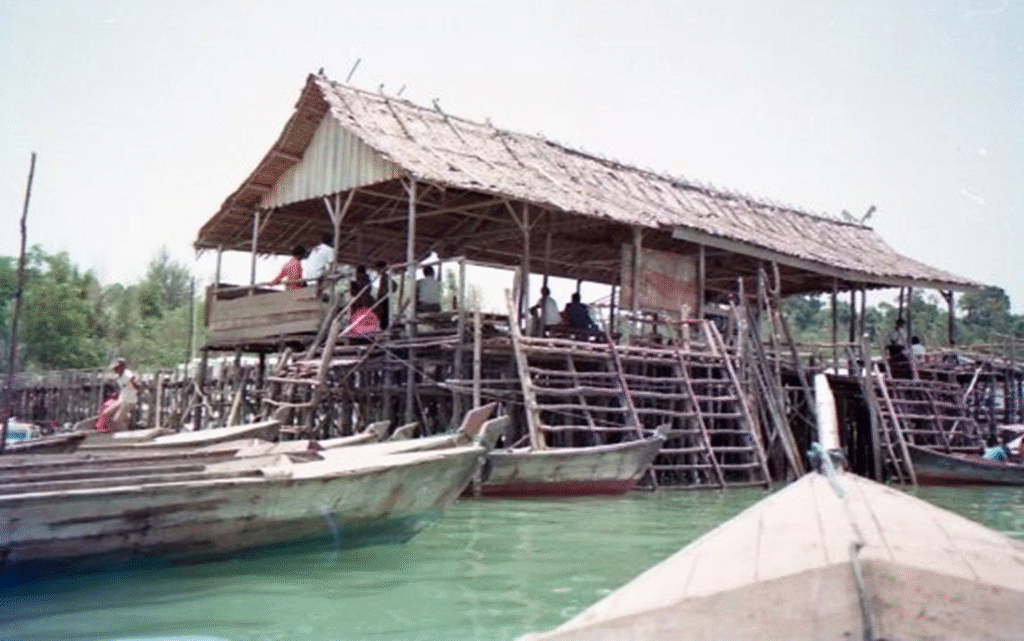
Photo by author, early 1980s
Photo by author, early 1980s
The bridge stretches out far, as the water around the island is shallow.
Photo by author, early 1980s
I discovered a floating house under construction.
I used this chance to take a look around.
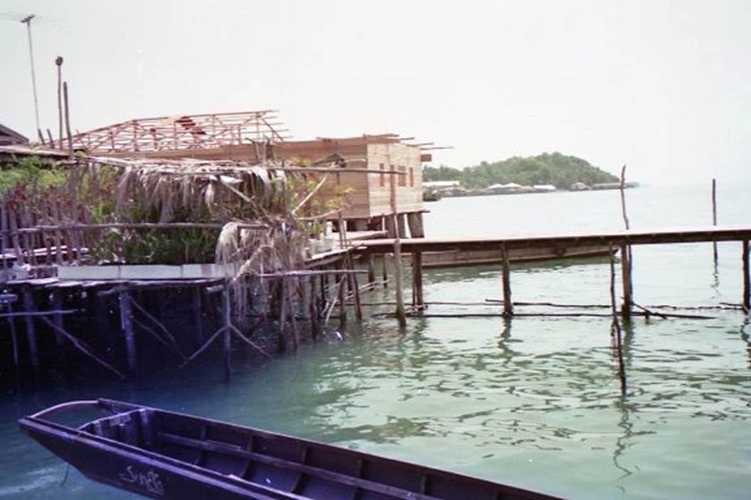
Photo by author, early 1980s
The walls are made of solid tropical rainforest wood, which is resistant to rain and the salty sea breezes.
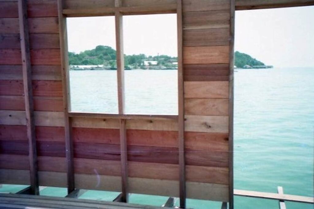
Photo by author, early 1980s
The floor below is at the sea. Human waste goes straight down.
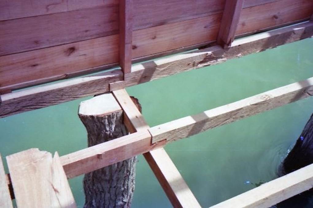
Photo by author, early 1980s
Solid log piles under the floor.
It is waterproofed with cement spray.
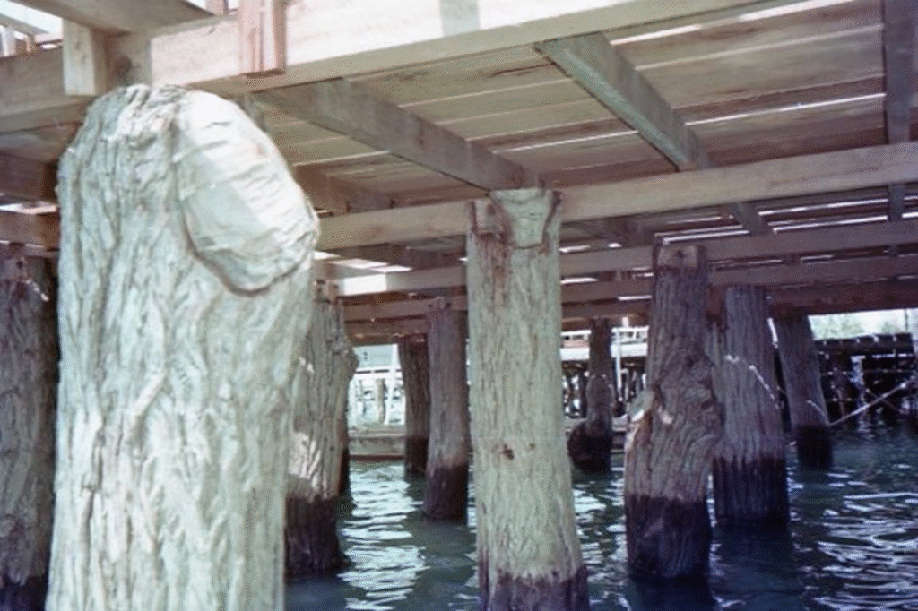
Photo by author, early 1980s