JAP | ENG
Singapore’s Early Days
1970s
#4/10
Lost seaside scenery
PUNGGOL POINT
On the north side of the island of Singapore, a protruding land overlooking Malaysia via the Strait of Johor is called Punggol Point.
It is located 20 km northeast of the city center.
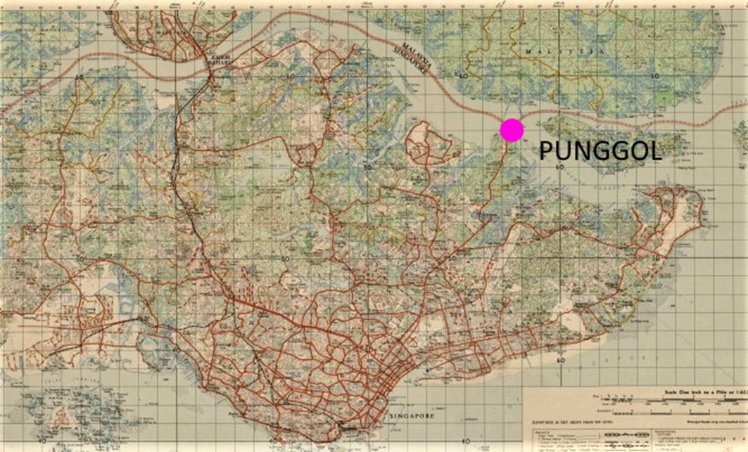
Reprinted and edited from National Archives of Singapore Ref: TM001021
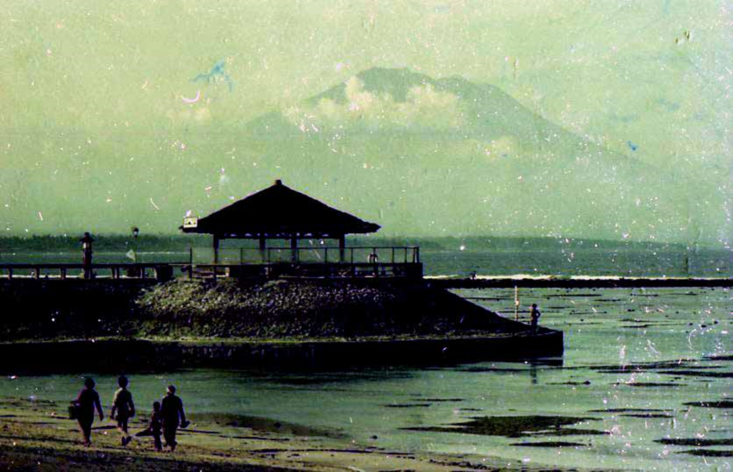
1971 view of Pungol Point
Visiting here to take a break from the battle and hustle of downtown Singapore’s construction sites is a refreshing change of pace, so I often visit Punggol Point on weekends.
After passing through the city, farms, fruit orchards, pig farms, and poultry farms spread out on the side of the road for 10 km, and at the end of the road, it was an idyllic dead-end point with a boat dock and an open-air seafood restaurant.
Punggol Point.
On the right is a seafood restaurant
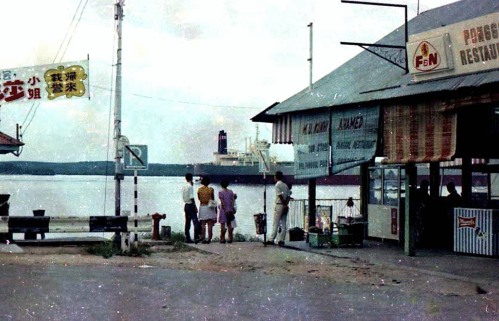
Photo by author, 1971
Street vendors at Punggol Point.
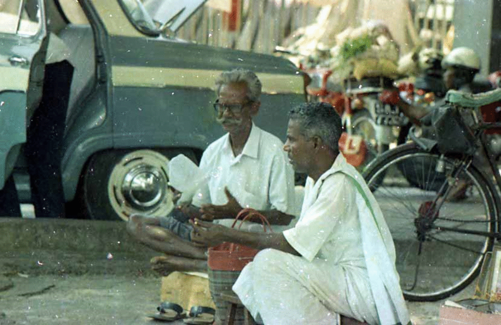
Photo by author, 1971
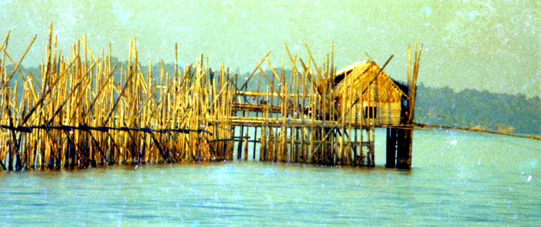
House on the sea
On the beach, there are huts (kelong) that juts out into the sea.
On weekends, you can grill fresh seafood caught right below you in these Kelong huts, eat and drink, and play mahjong at night. (Photo below)
Later, these temporary facilities were subject to demolition as illegal constructions by law. After that, you had to go to Malaysia or Indonesia to enjoy these tropical marine facilities.

Punggol Point “Kelong” Photo by author, 1971
A boat in the evening. The opposite shore is Malaysia.
This is the view of the “Southern Ocean.”
Off the coast of Punggol Point , on the calm waters of the Straits of Johor, there was an ocean-going restaurant where you could eat freshly caught seafood. You could also bring your own knives, soy sauce, wasabi, etc. from home and make your own sashimi, which was a great way to relax on the weekends.
Rowboat heading to a restaurant on the sea in the Strait of Johor.
On the other side of the sea is Malaysia
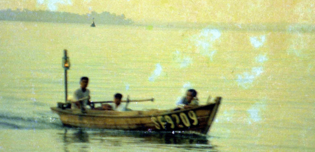
Photo by author, 1971
Increase the land area !
Large-scale land excavation and reclamation have begun
Around 1970, I was driving around the northeastern suburbs of Singapore on a weekend when I happened to come across a site where large-scale drilling was taking place, as shown in the few photos below.
The vegetation must have been cut down, and the wooden houses and orchards as shown in the previous photo must have been removed at the same time.
A child playing on the exposed ground
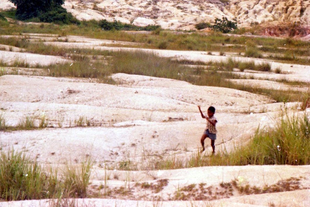
Photo by author, 1971
At that time, the population of Singapore around 1970 was said to be 2 million. The area was said to be about the same as Awaji Island in Japan (about 580 km2).
After a while, the area was compared to the 23 wards of Tokyo (about 620 km2), and around 2017, the land area of the country was about 720 km2.
This is an increase of about 24% in 47 years, which is about that the area of Kawasaki City added to the 23 wards of Tokyo.
In the 1970s, there was a narrow road (East Coast Road) that was probably built before the war from the center to Changi Village, and right next to it was the coastline, and there was a large seafood restaurant facing the sea.
Children playing outdoors,1
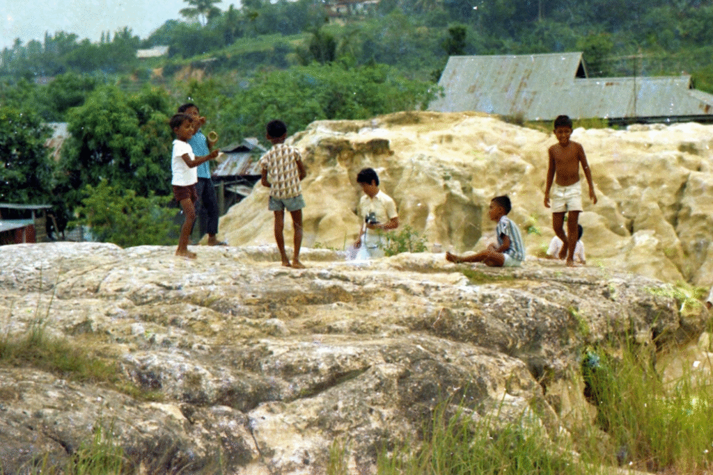
Photo by author, 1971
Large quantities of soil excavated from these plateaus in eastern Singapore were transported by conveyor belts to the seaside and used to reclaim land for the present day Changi Airport. In addition, large-scale high-rise housing complexes were built on the excavated land.
Children playing outdoors, 2
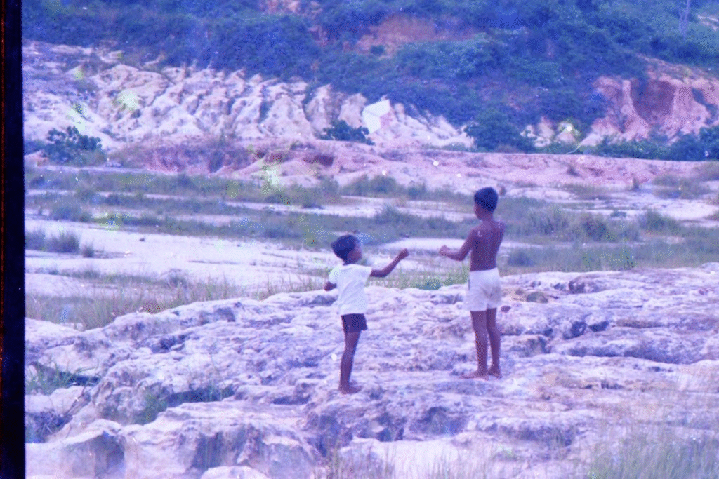
Photo by author, 1971
You can see the sea in the distance.
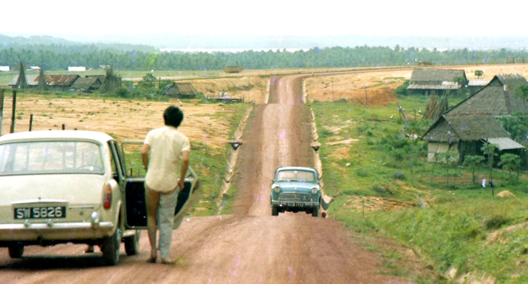
Photo by author, 1971
The current three-lane road that connects the airport to the city center, which emerged through land reclamation, has been transformed into a wonderful access road lined with bougainvillea and rain trees. All of this was done by land reclamation, stretching for about 15 kilometers.
Expansion of national land by reclaiming land from the sea
About 80% of Singapore’s coast has been transformed by land reclamation from naturally formed sandy beaches and mangrove forests into artificial sandy beaches or concrete seawalls. (Map below)
Colored areas were reclaimed land. It is estimated that 60% of the coral reefs that inhabited the area around the 60 or so large and small islets and reefs off the coast were lost as a result of this reclamation project.
Singapore’s coastline in 2002
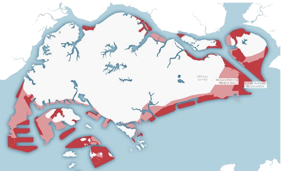
Source: Singapore Waters: Unveiling our Seas
Transporting sand and gravel from abroad
With the vigorous land reclamation for national land expansion and the boom in civil infrastructure public works, office buildings, and public housing construction, a time came when it was difficult to domestically produce construction materials such as sand and gravel.
Since then, the country has continued to increase its land for many years by cutting down the hills of a small island (Karimun Island), which is Indonesian territory, and importing gravel and sand by tugboats and using it for building materials and land reclamation. (Map below)
When this was not possible, they reached as far as Cambodia and tried to import river sand. An acquaintance of mine was involved in the import of materials, so I came to know about it.
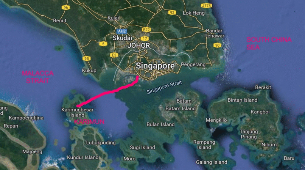
Maritime route map for gravel hauling
Development Supremacy and Lost Ecosystems
Around 1820, mangrove forests accounted for 18 percent of the country’s land area (green area in the map below), but today, this has decreased to 0.5%.
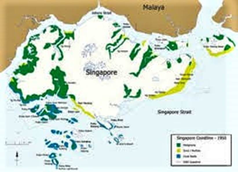
Loss of coastal ecosystems
Economic growth and population growth
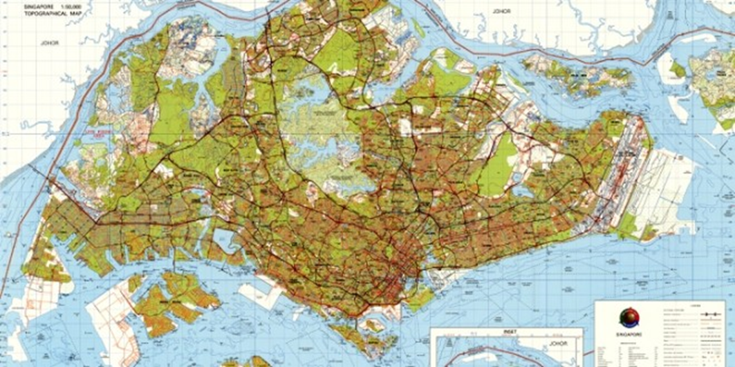
The map below is a map of Singapore created in 1941.
It is clear that the city was covered with forests such as orchards and rubber orchards. There was also a complex air-water system that cut into the land, and mangrove forests would have flourished, creating a rich ecosystem.
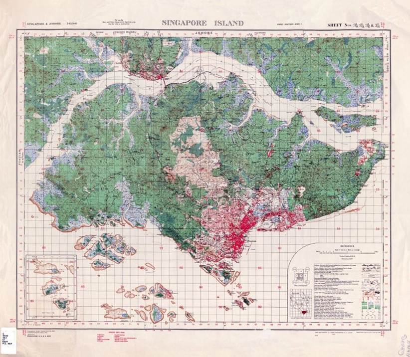
Map of the British Colonial War Office depicting Singapore island’s urban landscape and forests, 1941.
The map below is a map of Singapore around 2010.
Since the 1980s, Singapore has experienced explosive economic growth and urban development, with the city area continuing to expand.
Reprinted from singaporerecords.com/fastest-growing-country-through-land-reclamation
Current forest reserves
The last remaining natural forest areas in Singapore are two on the main island and two outer islands in the Strait of Johor, and the surrounding area has been converted into a business building and public housing area.
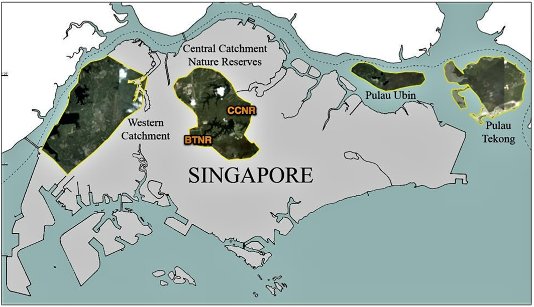
Reprinted from 8404577234_dfb6e70c84_b