JAP | ENG
Southeast Asian Waterfront
#6/6
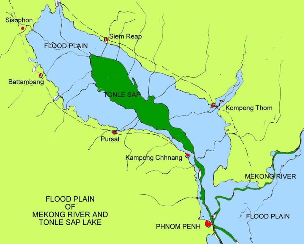
Mekong River (Cambodia)
Mekong Floodplain
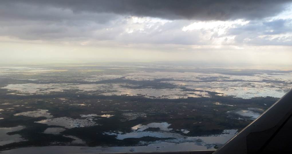
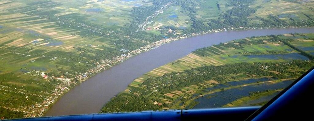
Phnom Penh’s international airport is located at an altitude of 12 meters.
When preparing to land during the rainy season, you will have a bird’s-eye view of the endless flooded land.
From the sky above Bangkok and Yangon, you can see cultivated rice paddies all over the flatlands.
A very different scene emerges during the approach to Phnom Penh Airport during the rainy season.
It is a different view from other rice paddy areas in Southeast Asia, which are man-made, divided, and covered with water.
Here, countless amoeba-shaped, amorphous puddles that have not been touched by human hands come into view.
This is the huge floodplains of the Mekong River basin in the rainy season.
On the small amount of land that remains unsubmerged, there are urban areas, roads, settlements, and farmland.
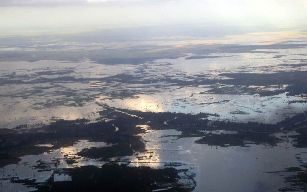
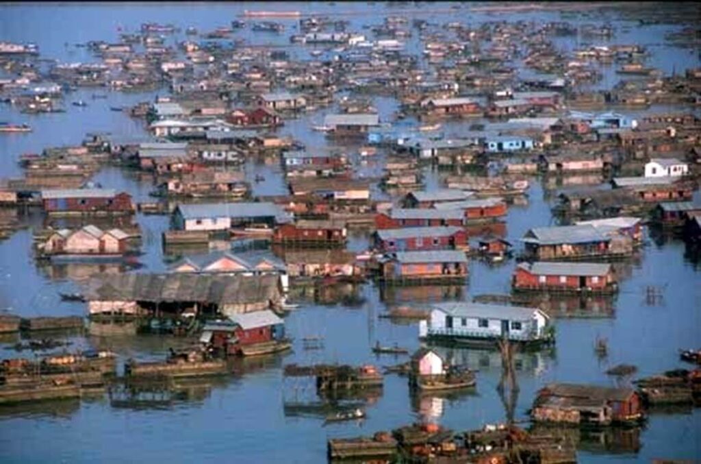
Mekong floodplain during the rainy season,
Photo by author, 2006
Mekong floodplain, suburbs of Phnom Penh, capital city,
Photo by author, 2006
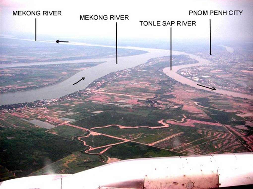
Phnom Penh, the capital of Cambodia, is located on the west bank of the Tonle Sap River, a tributary of the Mekong River, and the capital can be seen from the air surrounded by such floodplains.
Although it is located about 300 km inland from the mouth of the Mekong River, the altitude of the urban area, including the airport, is about 10-15 meters.
The residential area surrounded by roads in the city is less than 10 meters above sea level, are flooded during the rainy season, and has poor drainage.
Dry season Photo by author, 2006
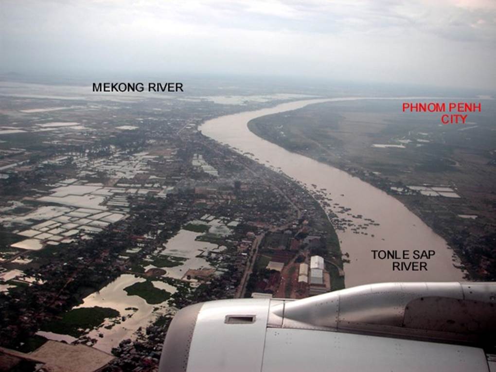
Right now, the river is flowing backwards
Due to the rise in the Mekong River on the left, a large amount of water has nowhere to go and is flowing backwards up the Tonle Sap River on the right.
The overflowing water creates floodplains.
This process is repeated every year during the rainy season.
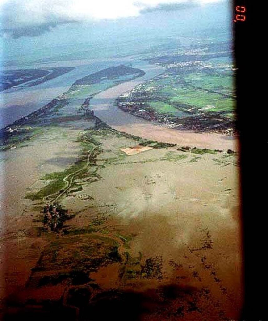
Mekong floodplain during the rainy season,
Photo by author, 2006
The aircraft is preparing to land at Phnom Penh Airport and is circling at the circumference of the Mekong River and the Tonle Sap River.
Mekong floodplain during the rainy season,
Photo by author, 2006
Strip-shaped river terraces
The strip-shaped river terraces that have developed on the banks of the Mekong River can be observed from the aircraft.
Cultivated land is created on this small plateau, roads and villages are formed, and trees are planted.
Most of the national highways and main roads around the capital, Phnom Penh, are built along these natural river terraces.
Mekong Floodplain and River Terraces
Photo by author, 2006
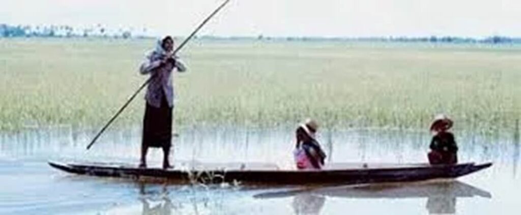
Fishermen fishing on the Mekong River in two small boats
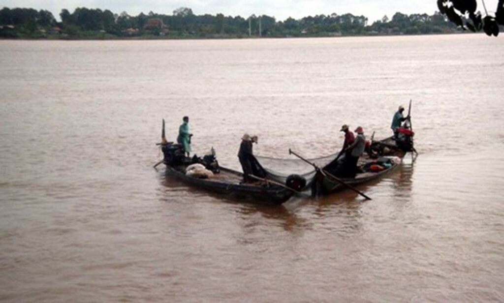
Photo by author, 2006
Farmer’s children playing in the water in the creek of the floodplain
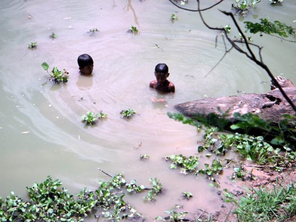
Photo by author, 2006
In the dry season, the creek remained like a mesh in the floodplain.
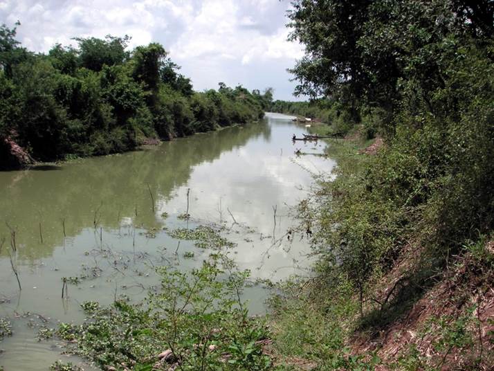
Photo by author, 2006
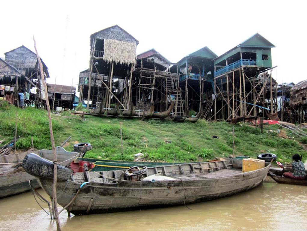
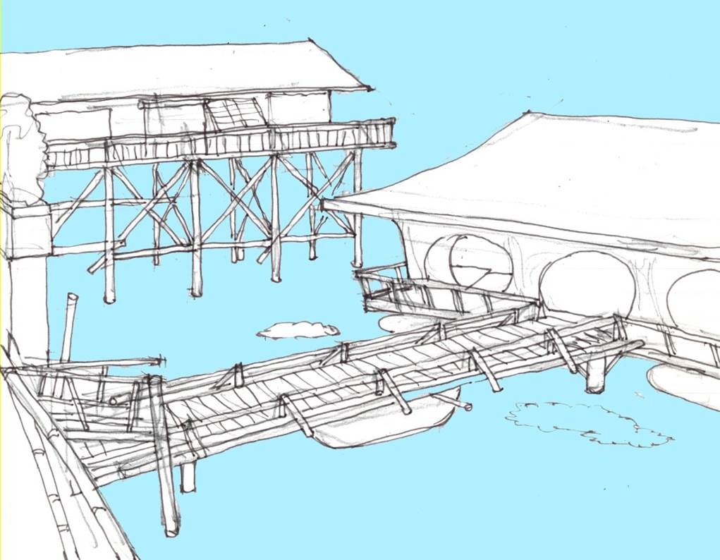
Amphibious fishing houses
Fishermen’s houses in the Mekong floodplain. When the water level rises during the rainy season, it becomes a house on the water, and when the water level drops during the dry season, it lands at the water’s edge and becomes a house on land.
At the base of the house are a number of large floats.
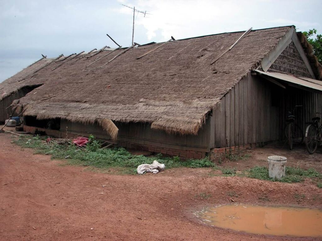
Mekong Floodplain Photo by author, 2006
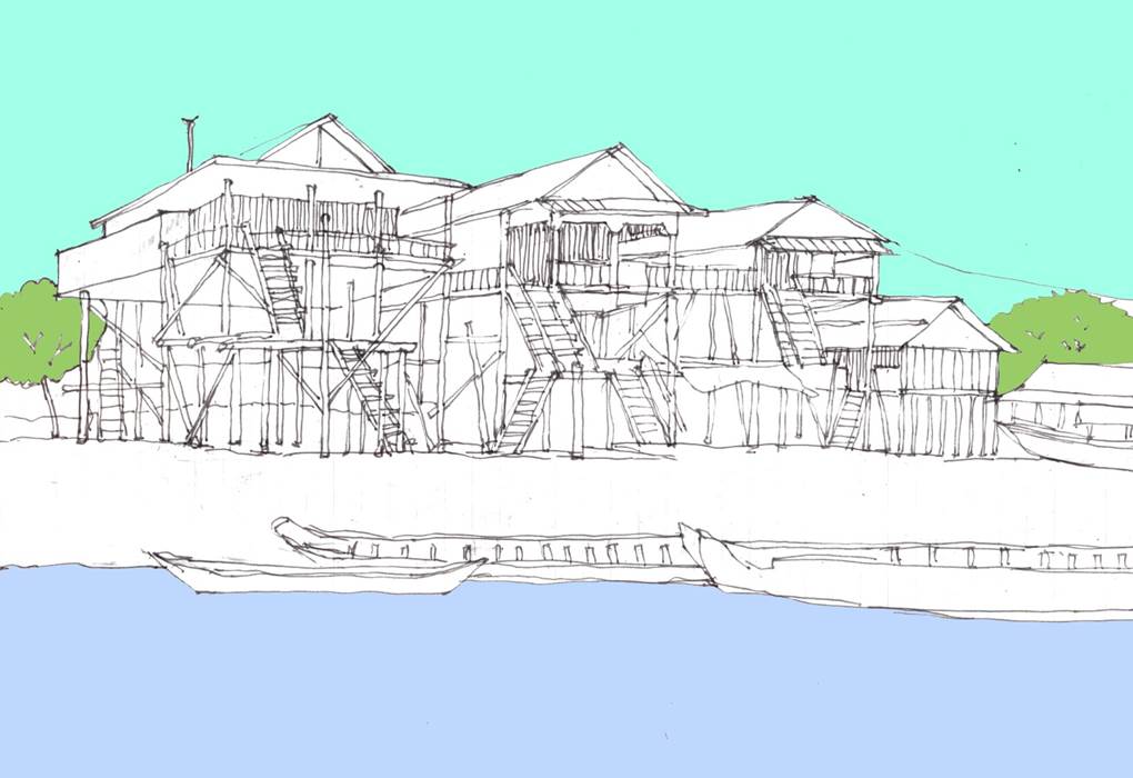
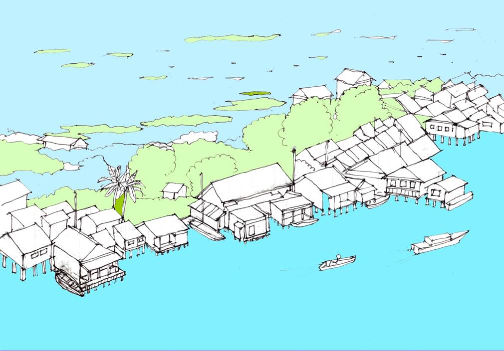
Floating House Residence
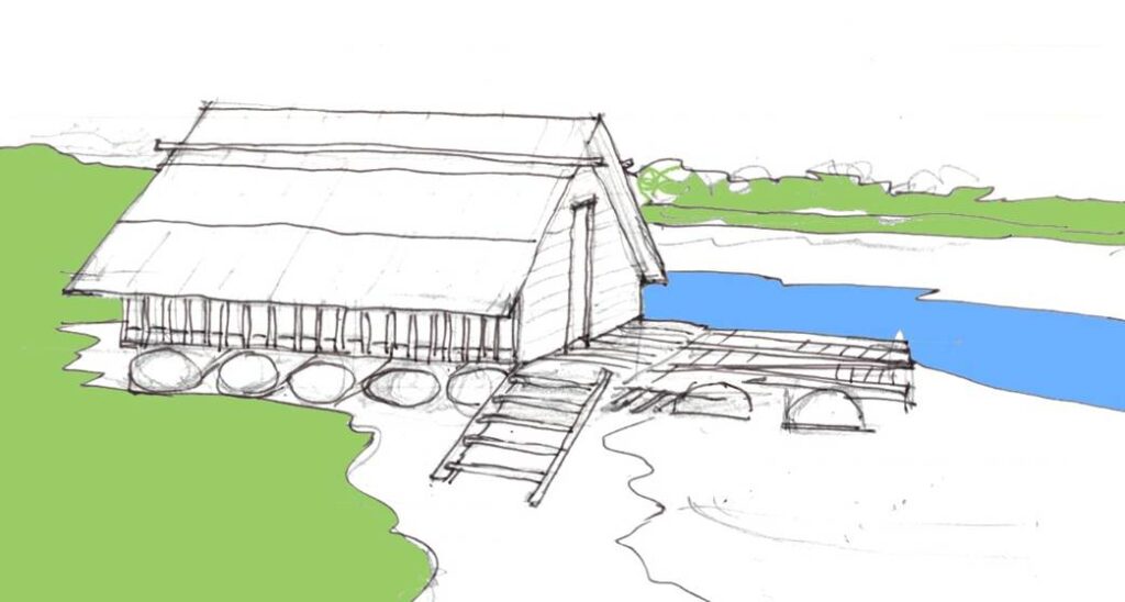
Author’s sketch
Roofing materials
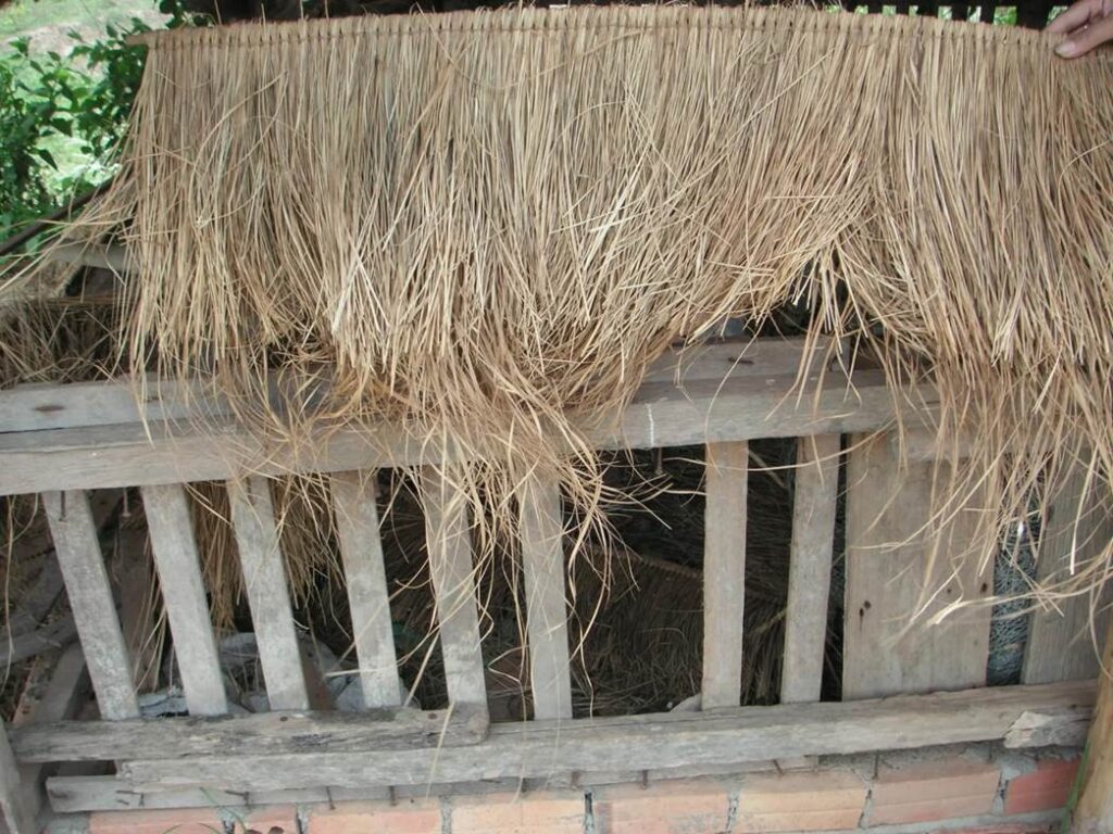
Photo by author, 2006
Attic
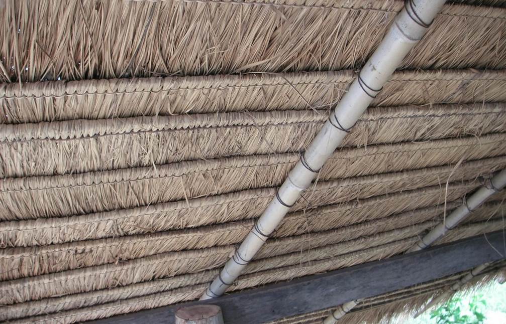
Photo by author, 2006
Fishermen in the floodplain making fish nets.
He earns a living by fishing for freshwater fish.
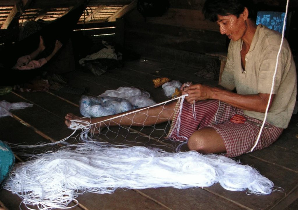
Photo by author, 2006
A high-floor house built on 4~5 meters stilts.
(Phnom Penh suburbs).
Typical floodplain private house built to prepare for flood. The first floor is a workplace and parking lot, and the residence is on the second floor.
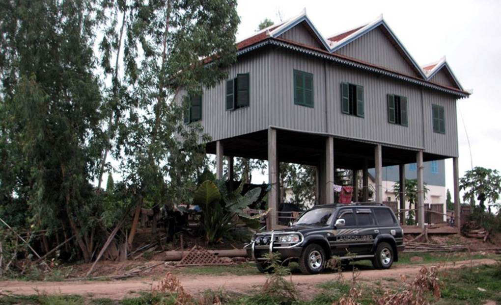
Photo by author, 2006
Homemade concrete pillars of a stilt dwelling for flood proofing.
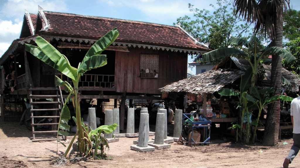
Typical high-floor farmer houses.
Photo by author, 2006
Tonle Sap Lake
From May to November, when the Mekong River is at high tide at the mouth of the river downstream toward Vietnam, the Mekong River usually swells, and its enormous flow has nowhere to go. The large amount of water that has nowhere to go flows back down the Tonle Sap River and flows into the Tonle Sap Lake.
This backflow causes the surface area of Tonle Sap Lake to triple.
The backflow of the river brings abundant nutrients from the Mekong River, making it a rare treasure trove of fish stocks.
It is also a valuable source of protein for residents.
The houses in this region are built in accordance with the workings of nature as described above.
Author’s sketch
The expanse of the water surface of Lake Tonle Sap during the rainy season is projected onto the Kanto Plain, Japan.
Its length corresponds to the length from the Boso Peninsula to Niigata Prefecture.
Comparison of the Tonle Sap Basin and the Kanto Plain, Japan.
Author’s sketch
1,000,000 people living on the water !
The area of Tonle Sap Lake expands from 2,500 km2 in the dry season to 10,000 km2 in the rainy season. You can get a sense of its scale by comparing it to Lake Biwa, which has an area of 650 km2, and Shiga Prefecture, which has an area of 4,000 km2.
It is said that there are 1 million people living on the water, a population equivalent to that of a large city.
The Tonle Sap Lake is rich in fish because nutrient-rich water from the Mekong River flows back into it once a year, making it capable of supporting a large population.
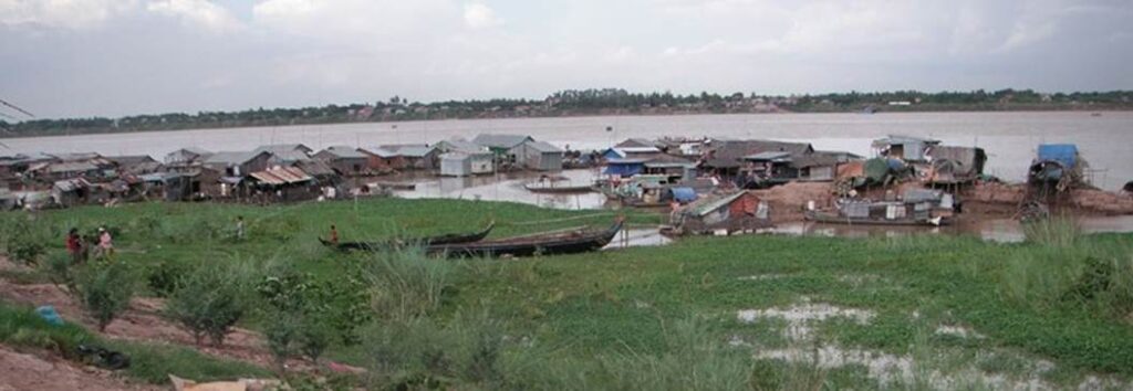
Photo by author, 2006
The flow direction of the river changes depending on the season.
The Mekong River is an international river with a total length of 4,000 kilometers, and its basin area is more than twice the land area of Japan. When the Mekong River rises, the Tonle Sap River flows back to the left (upstream) and floods Tonle Sap Lake.
During the dry season, the water of Tonle Sap Lake flows to the right (downstream) and returns to the Mekong River.
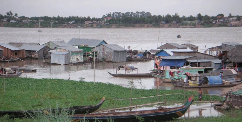
Photo by author, 2006
A house on stilt on land on the shore of Tonle Sap Lake.
During the full water season, the amount of water increases to the bottom of the floor, and the boat can be moor directly.
Author’s sketch
Floating houses on Tonle Sap Lake.
As the water rises, the entire village rises to the surface.
Author’s sketch
A floating restaurant that rises with the water level as it rises.
The restaurant on stilts is in the back left. The restaurant on a floating platform is in the foreground right.
Author’s sketch
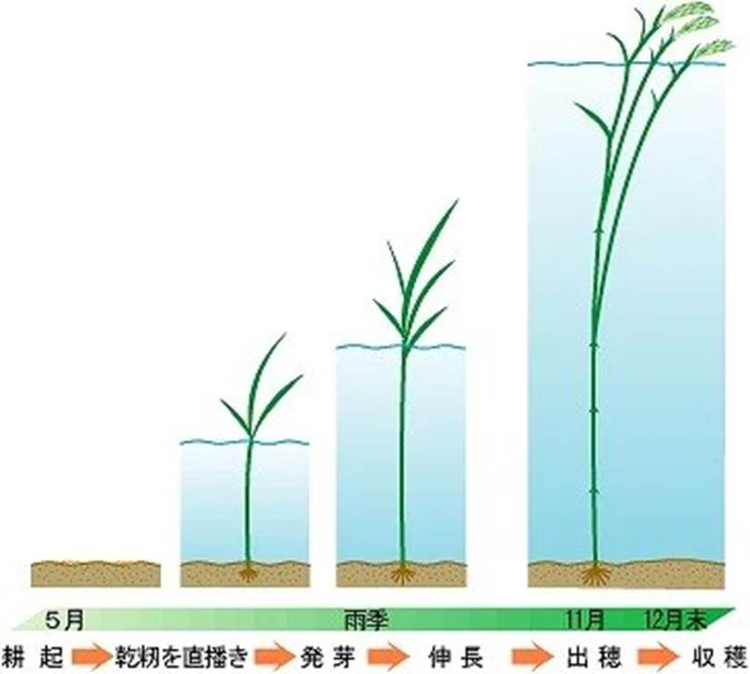
Floating rice
One day, after visiting Cambodia several times, I was intrigued by a local person who told me about the existence of floating rice. It is a type of rice that I have never heard of in Japan. Floating rice plants are sown directly in the ground when the water recedes from the floodplain. It is flooded by the rising waters of the Mekong River, and as the water level gradually rises, the new leaf part always extends above the water. Even if the water reaches a depth of 4 m, the tip will not be submerged and will be on the surface of the water. When the harvest time comes, the ears of rice are harvested from boats that are out on the water. It is a type of indica rice.
I went to a rice wholesaler in Phnom Penh and asked for a few kilograms of floating rice, which I cooked and tried, but it wasn’t delicious. It’s a type of farming that can’t be mechanized or streamlined, so labour productivity is low and it’s not tasty, but I hope it will continue to exist as a tourist resource.
Floating Rice
ameblo.jp より
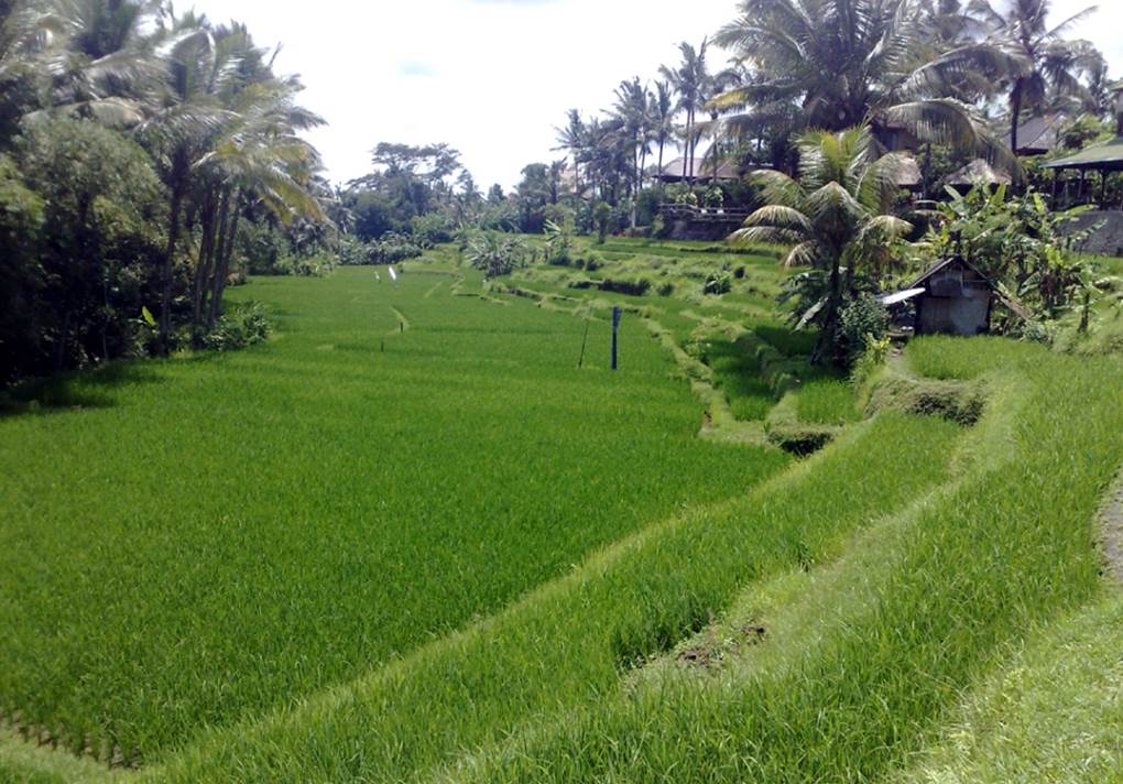
Floating rice on a floodplain. The rice is harvested by cutting the tops of the heads with a cutter from a boat. It is a single crop. The well-irrigated rice terraces in Bali are a triple crop, so it is easy to see how inefficient floating rice is.
Source: kyoritsu-wu.ac.jp