JAP | ENG
Southeast Asian Waterfront
#1/6
SINGAPORE
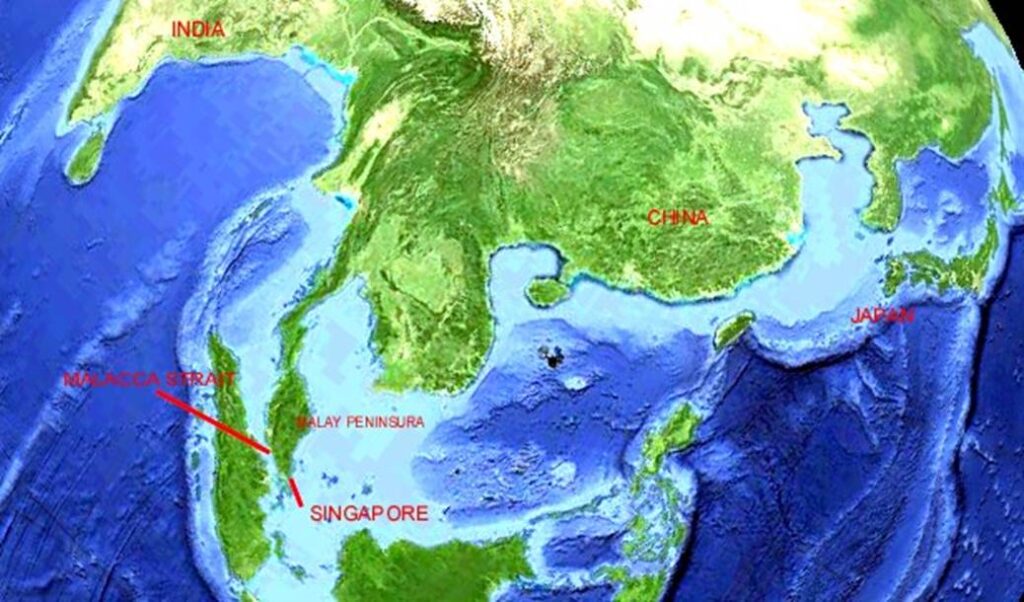
Strait of Malacca, a key location
The Strait of Malacca is a key shipping point connecting the Indian Ocean and the South China Sea to the Pacific Ocean.
The Port of Singapore, located at the entrance to the Strait of Malacca, is at the southernmost point of the Asian continent Landmass, and due to its outstanding geographical location, it is the most important transit point connecting Europe, the Middle East and the Far East Asia.
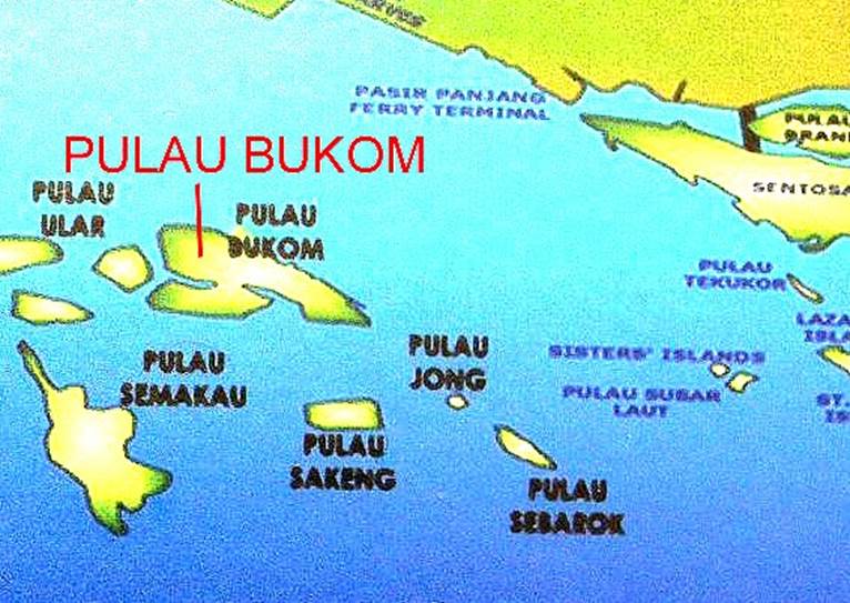
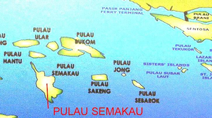
Singapore’s Outer Islands
According to documents, Raffles was sent to Penang Island as an employee of the East India Company in London, and later became involved in the management of the colonies of Java and Sumatra. Raffles finally saw the geographical importance of the island of Singapore and established his base here to start the Straits Settlements.
Map of the outer islands of Singapore
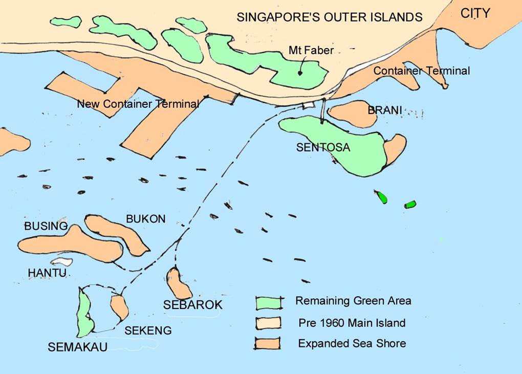
Author’s sketch
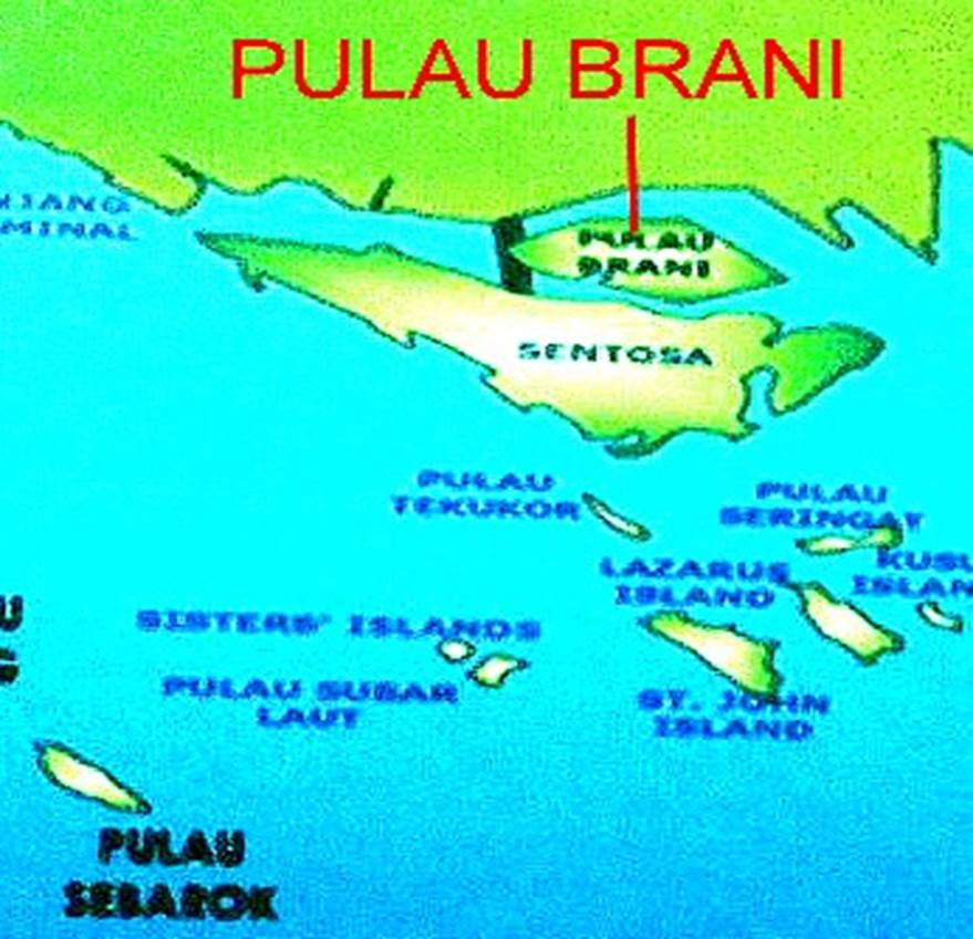
Pulau Brani (Brani Island)
Burani Island is a small island with an area of about 1.2 km2 between the main island of Singapore and Sentosa Island.
No other island has changed as much as this one in the century since independence from the British colony. It has transformed from a quiet, self-sufficient island into a tin refinery, a naval port, and now a container island.
Canals were excavated, sturdy seawalls were built, the island’s highlands were carved and leveled, and the area was expanded. The surface of the island has changed from a forested area with sea breeze to a concrete-covered flat land with unbearably hot sunlight.
Maritime settlement on the island of Brani in the early 20th century.
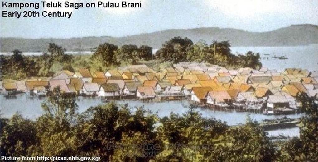
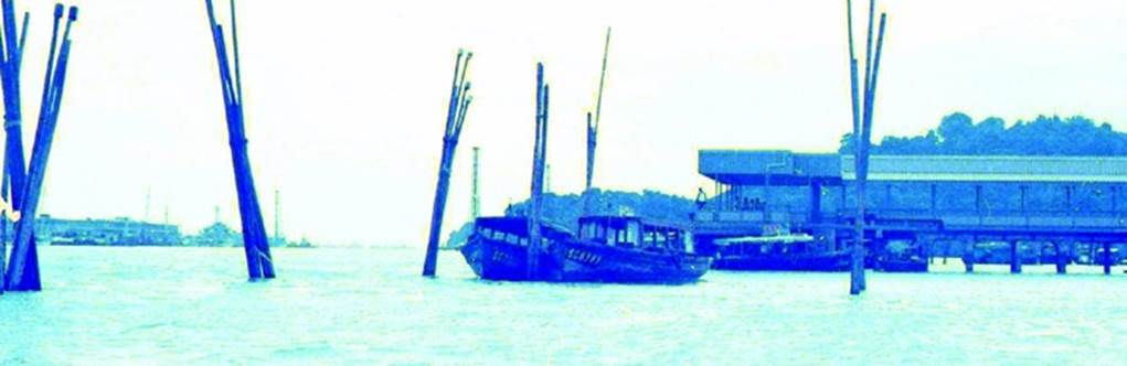
The floating settlement on Brani Island in the early 20th century.
Source: picas.nhb.gov.sg
Around 1968, a floating dwelling on the island of Brani.
The houses on stilts were built by fishermen and spontaneously appeared on the cool shoreline.
Later, they were evicted all at once.
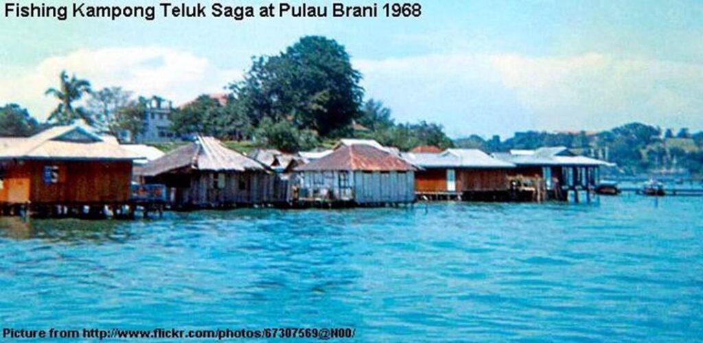
Photo of floating dwelling on Brani Island.
Source: flicker photo
Container port on the island of Burani at the beginning of the 21st century.
The concrete ground is unbearably hot with the direct rays and radiant heat of the tropical sun.
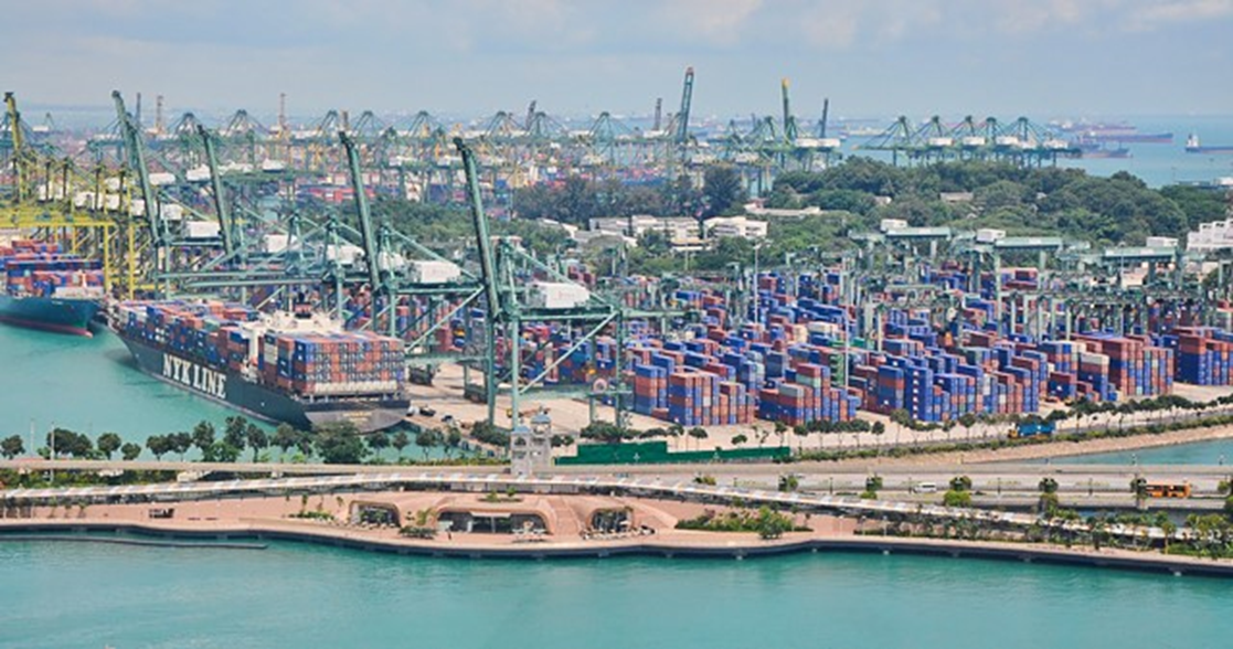
Container port on the island of Burani at the beginning of the 21st century.
Photo by author
Sentosa Island
Sentosa Island is located to the south of the main island of Singapore, overlooking the Singapore Strait. Sir Stamford Raffles, the British Admiral of the Colony, set up a battery on the tip of a small hill on the island.
The battery, called Fort Siloso, was originally primarily designed to prepare for attacks from warships entering the Singapore Strait from the Indian Ocean, the Strait of Malacca, and the South China Sea.
However, in 1970, a friend in Singapore explained to me that the Imperial Japanese Army of Japan had advanced from the northern side (behind Singapore Island) from the British Malaya (now Malaysia) by land, and the strong fortress of Sentosa Island had become useless.
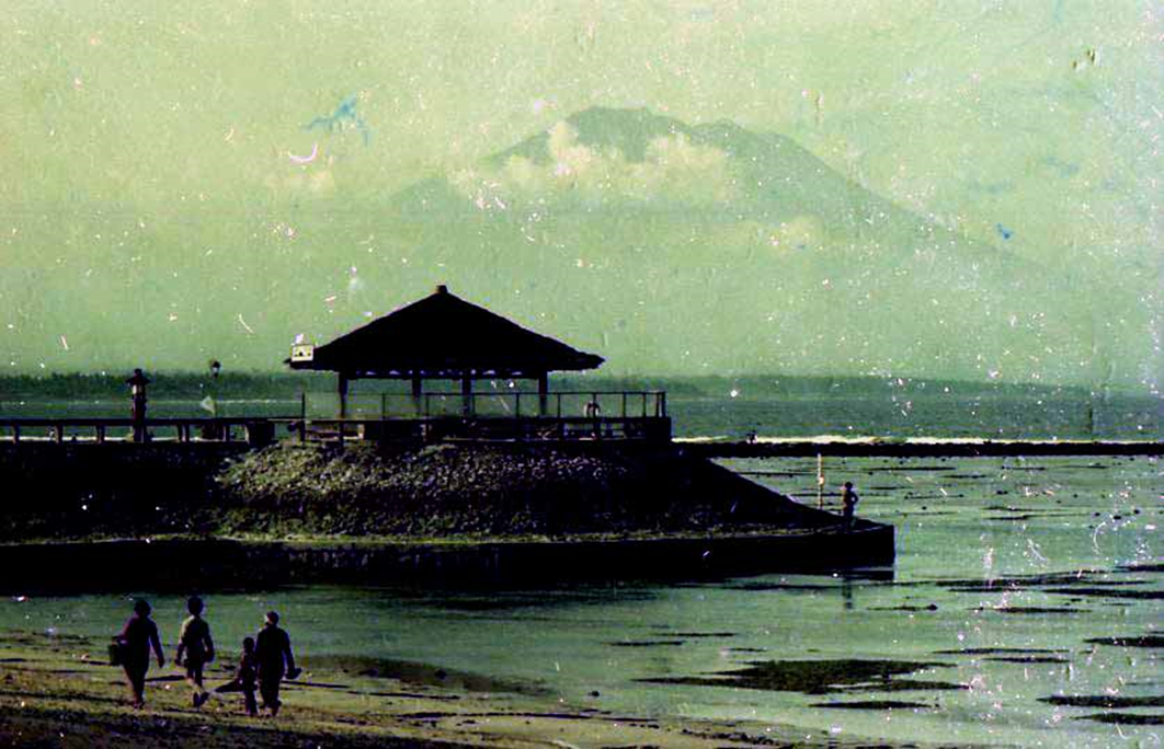
The photo below shows the untouched beach front in the early 1970s, before Sentosa was developed.
Diesel refueling station at sea. Now it no longer exists.
Photo by author
After the war, Singapore became independent and the withdrawal of British Allied forces began, the island came under the control of the Singapore government, and the useless artillery battery became a war museum.
Subsequently, Sentosa Island was developed under the direct control of the government.
Initially, access to Sentosa from the mainland of Singapore was limited to sea boats and new aerial cables (cable cars).
The policy was to eliminate cars and not bring air pollution to Sentosa Island.
View of Singapore Strait from Sentosa Island in 1970. Island’s state left as after the war.
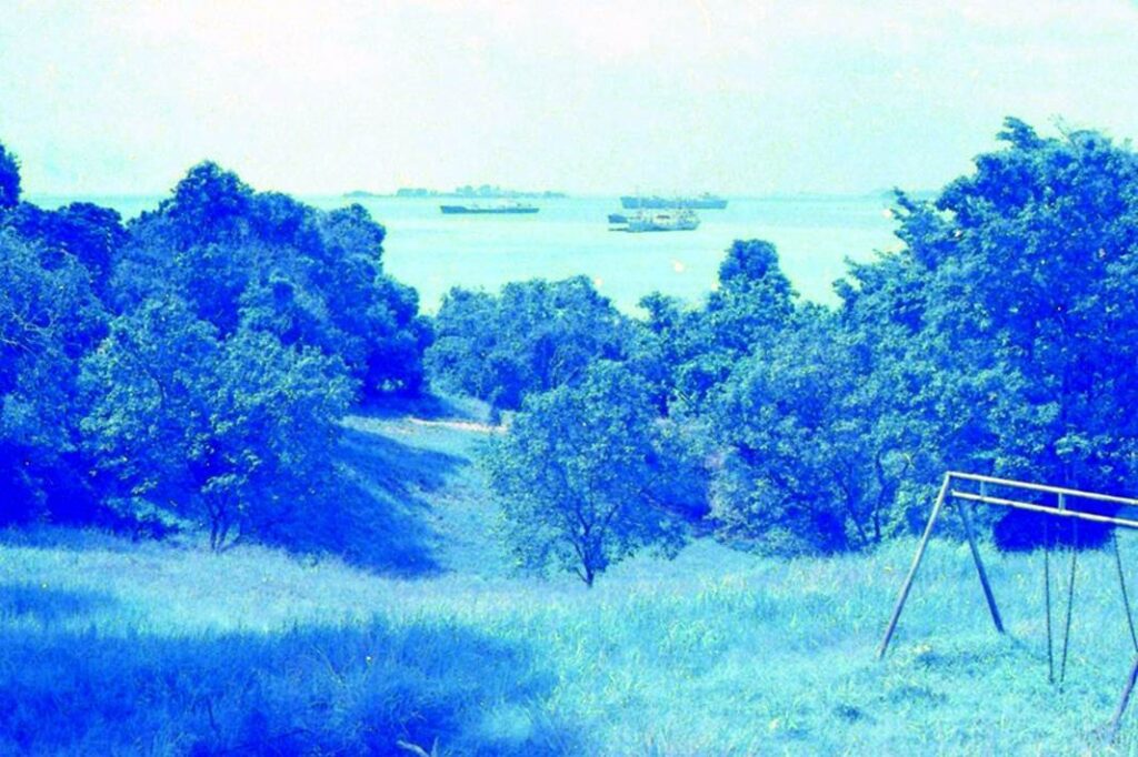
Photo by author, 1979
Former British Army barracks
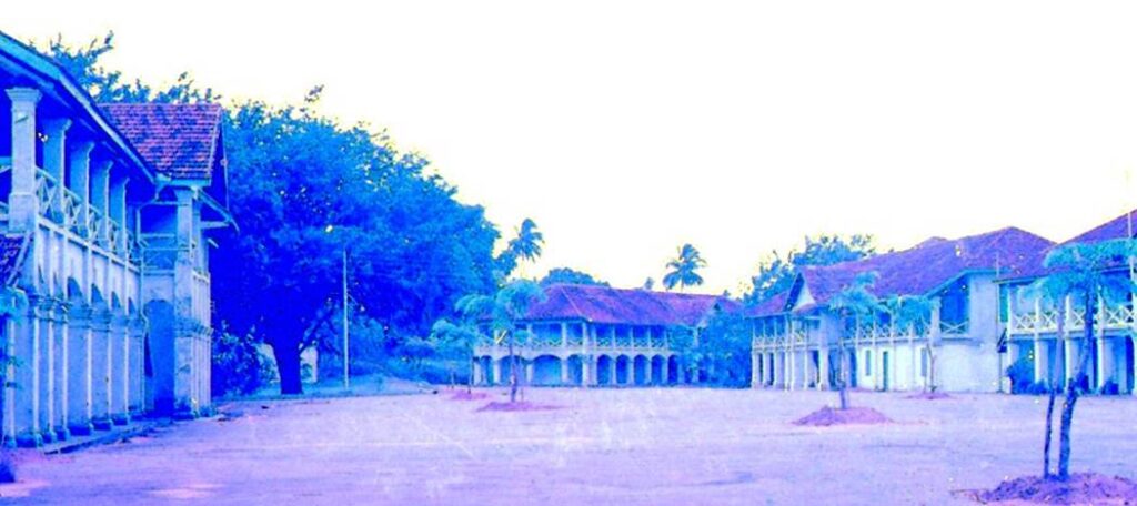
Photo by author, 1970
The signboard of the government-affiliated development company Sentosa Development Corporation.
This photo was taken just before the development of Sentosa Island began.
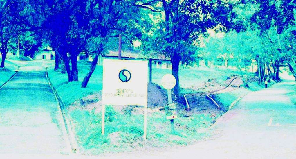
Photo by author,1976
Sentosa Island
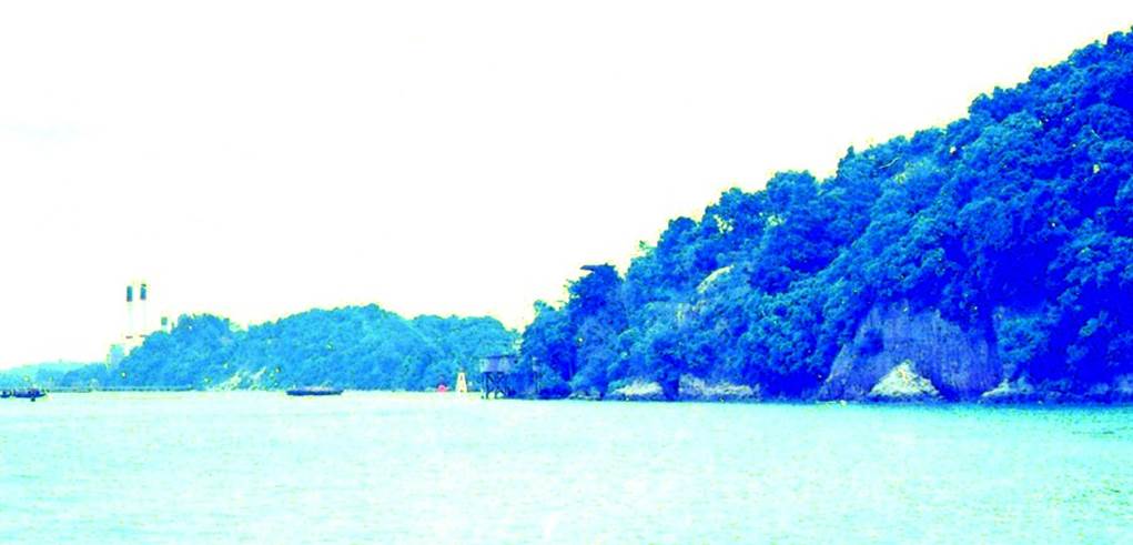
Photo by author, 1976
A private seafood restaurant on the beach of Sentosa Island. (no longer exists)
On the weekend, I was able to enjoy diving on a chartered boat, and then I was able to dock the boat and quench my thirst with a beer.
In the 1980s, the entire coast was nationalized and subsequently disappeared.
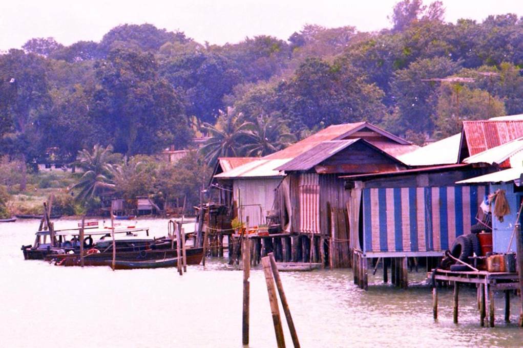
Photo by author, 1976
After a while, as the potential value of tourism on the island increased, a change in development policy was announced, and after the construction of road bridges, golf courses, resort hotels, and houses with marinas were successively developed and built.
For the economic benefit of tourism development, the idea and principle of environmental protection has taken a back seat.
A new casino and a huge parking lot opened on the island in 2010.
Sentosa Cove
A group of mansions developed around 2005 on reclaimed land of the east coast of Sentosa Island. Yachts and motorboats can dock directly in front of the houses. In Singapore, there are various legal restrictions for foreigners to own a house with land.
On the other hand, in the residential area of Sentosa Cove, foreigners can purchase vacant land as a special case and freely build houses of their own design on it.
An Indonesian client of mine bought a property in 2006, so I was invited to visit it. At that time, there was a bubble state due to demand from overseas ultra-wealthy people and celebrities, and transactions were carried out in billions per house.
After that, after the Lehman shock, real estate prices crashed, and there was a lot of selling, and the real estate price here saw the most drop in Singapore, and it has not yet returned to the original purchases price.
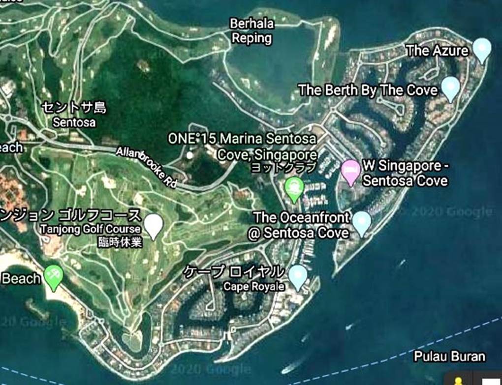
Location map of Sentosa Cove
Pulau Bukom (Bukom Island)
This is the collective name for three small islands that were originally swamps covered with mangrove forests and were reclaimed to form one island.
About a century ago, it served as a base to supply water to ships, but after the war, Shell Oil built a large refinery and subsequently invested in integrated production facilities for petrochemicals. It is one of the largest facilities of its kind in the world.
During the 50 years of post-war independence, the island’s landscape has changed dramatically due to government development plans.
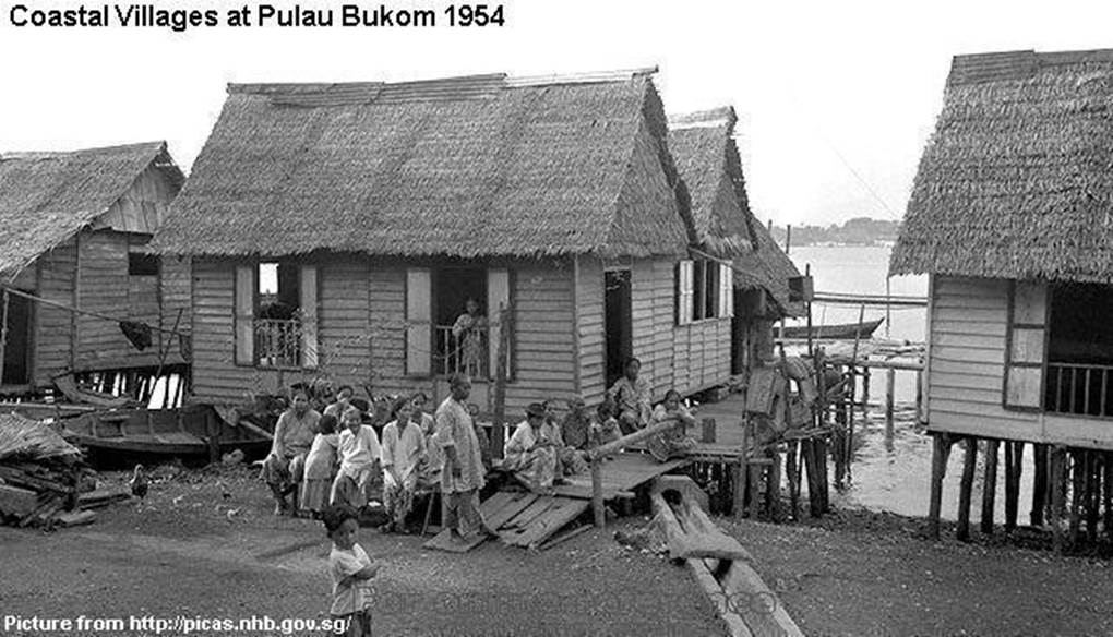
Bukom island before independence from the British colony.
Source: picas.nhb.gov.sg
Japanese Red Army !
Pulau Bukom is located 5 km off the coast of the main island of Singapore, and a strict identification check is conducted on the island.
(According to the records, in 1974, two members of the Japanese Red Army attacked the island and blew up an oil tank facility. At the time of the Vietnam War, the island supplied oil to the U.S. military.)
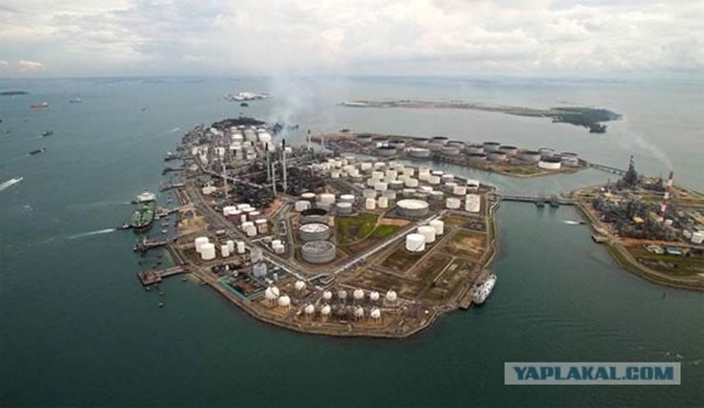
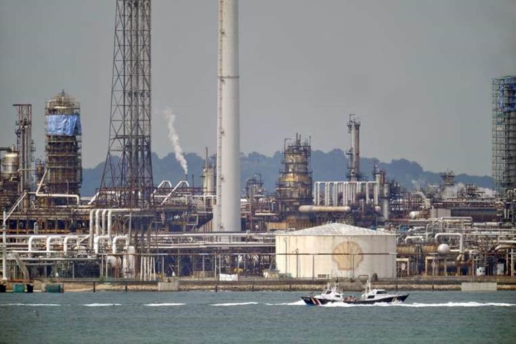
The current oil complex on the island of Bukom
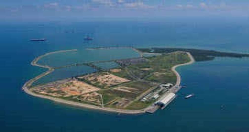
Pulau Semakau (Semakau Island)
An island located 3 km further south of Pulau Bukom.
Saving Lives!
One weekend, our diving boat was hit by a squall off the coast of Pulau Bukom.
In the middle of the heavy squall, we found a Malay family of five drowning.
The currents in the Singapore Straits are fast. In addition, the heavy rain pounding the sea surface must have made visibility poor.
We approached them, and my friend and I extended our oars to pull them from the sea to our boat, and the rescue was successful.
They turned out to be inhabitants of nearby islands. It was decided to send them to the island by boat and deliver them to the villages there. They were so scared and upset that they couldn’t even say thank you.
After confirming their safety, we left the island. That island was the island of Semakau. It turned out that there was only a palm forest on this island, no arable land, and the villagers made their living from the sea.
At first glance, the islanders seemed very poor.
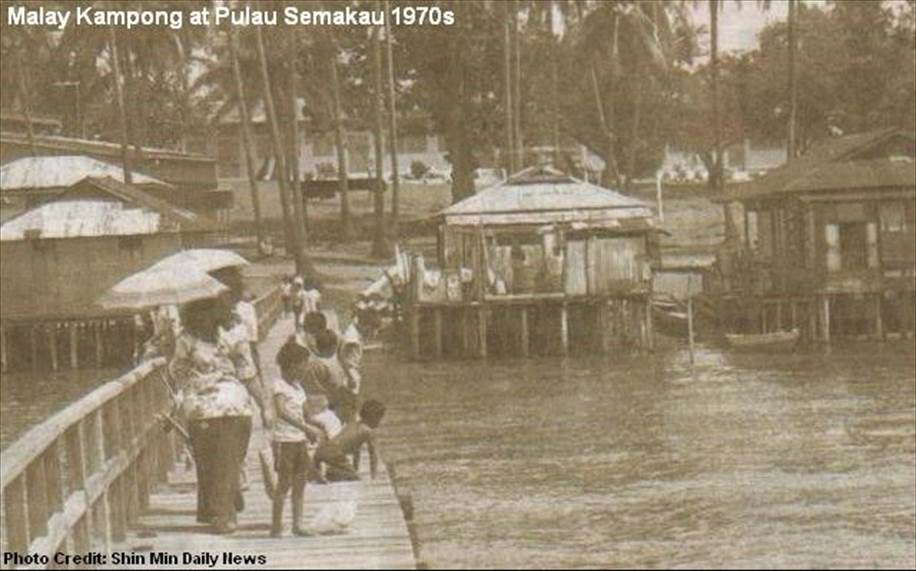
Source: photo shin min daily news
Forced relocation?
The islanders, who originally lived at sea without land ownership, were forcibly moved to the main island and given public housing.
The island is currently being reclaimed along with the other two islands.
It can be said to be a symbol of a city-state surrounded by the sea and greedy for land.
The gateway to the sea: Collyer Quay
The gateway to the bustling sea.
The gateway to the bustling sea. Singapore.
Photo by author, 1971
The photo below, taken by the author from Colley Quay in 1971, shows a breakwater offshore in the distance.
Over the years, large-scale reclamation (38 hectares) was carried out offshore beyond the breakwater, and casinos, international conference centers, (Marina Bay Sands, MBS) and other facilities were built one after another.
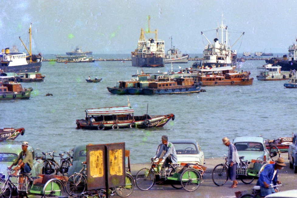
Photo by author, 1971
What used to be a breakwater was further reclaimed offshore, and MBS (Marina Bay Sands) hotels, conventions and casinos appeared.
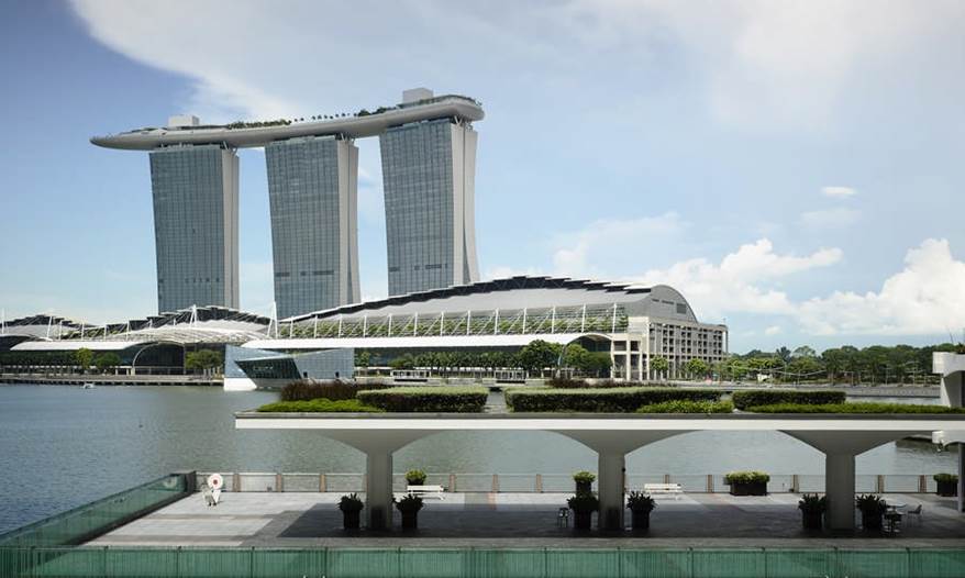
Photo by author, 2011