JAP | ENG
Phnom Penh Business Trip
2006-2013
#1/4
Mekong Floodplain
The Mekong River is the largest international river in Southeast Asia.
It originates in the depths of Tibet Autonomous Region of China and flows 4,350 km to form Vietnam’s Mekong Delta and end in the South China Sea.
Its drainage basin covers 795,000 km2 (twice Japan’s land area) that includes China, Laos, Thailand, Kamboja and Vietnam.
This means that the amount of rain collected over an area twice the size of Japan flows into one river.
The Mekong River carries 457 billion tons of water per year.
This is equivalent to 50 times the annual flow of water in the Tone River, the largest river in Japan.
The Mekong River is at its highest volume throughout the year from July to October, when the main stream backflows into the Tonle Sap River and countless other tributaries, creating floodplains in Phnom Penh and around Tonle Sap Lake for several months.
As shown in the photo below, the lowlands are covered with floodwater, and the original location of rivers and swamps cannot be recognized from above.
Mekong Floodplain photographed from an airplane in 2006.
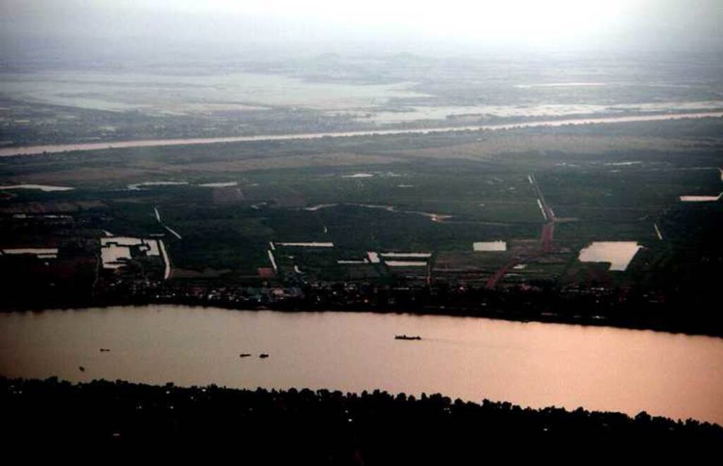
Photo by author, 2006
The Mekong River floodplain, around Phnom Penh in the rainy season
All the plains except for the long and narrow river terraces are submerged.
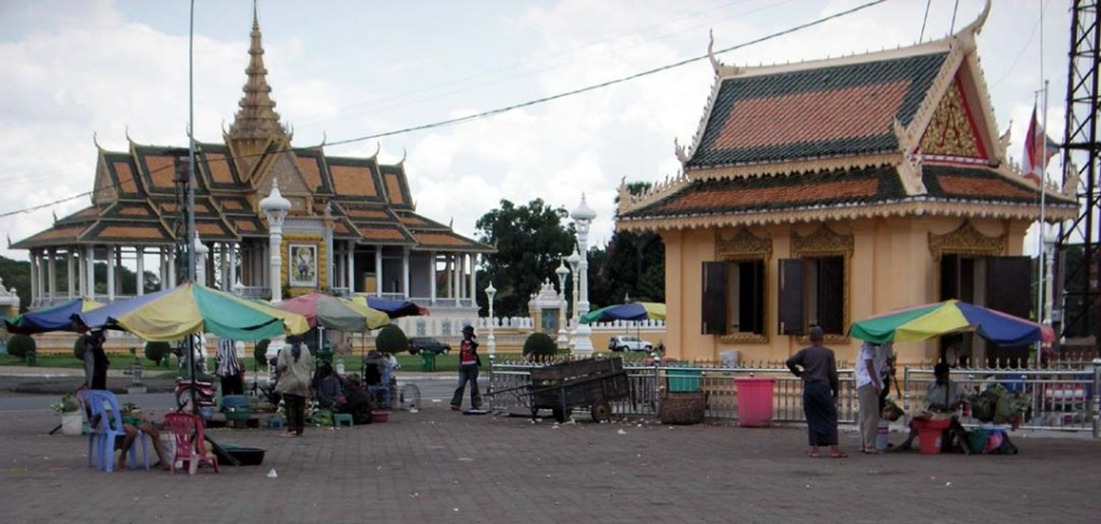
Phnom Penh city is located about 500 km upstream from the coast of the Mekong Delta in Vietnam, but it is only 10 meters above sea level, so it is a city that is barely able to avoid being submerged.
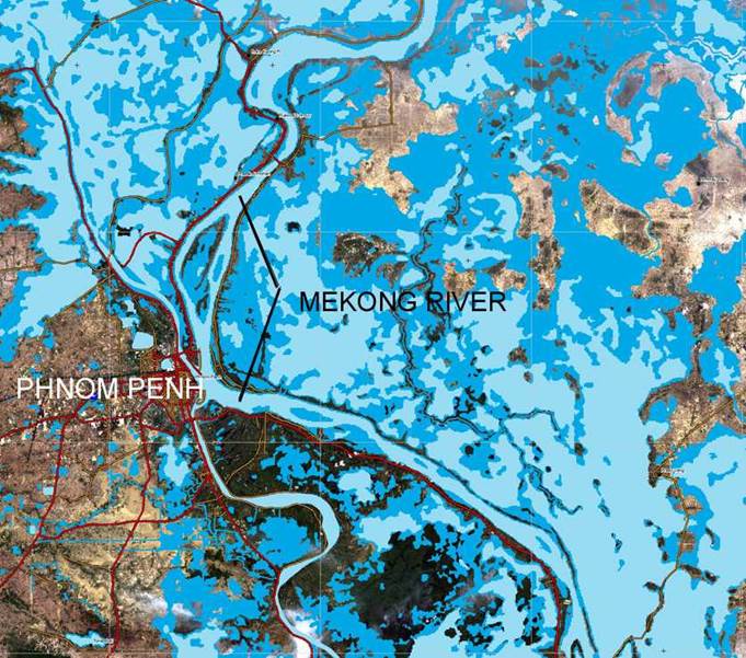
The confluence of the Mekong River and the Tonle Sap River and the area around Phnom Penh during the dry season.
During the rainy season, the Mekong River flows back into the Tonle Sap River, and the upstream Tonle Sap Lake is three times as large.
Photographed from an aircraft by author in May 2006
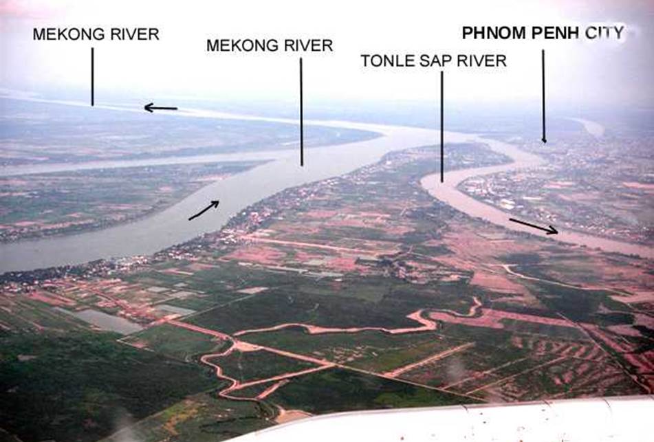
Photo by author in May 2006
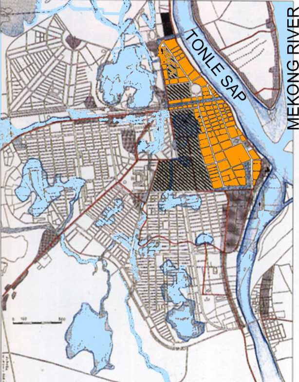
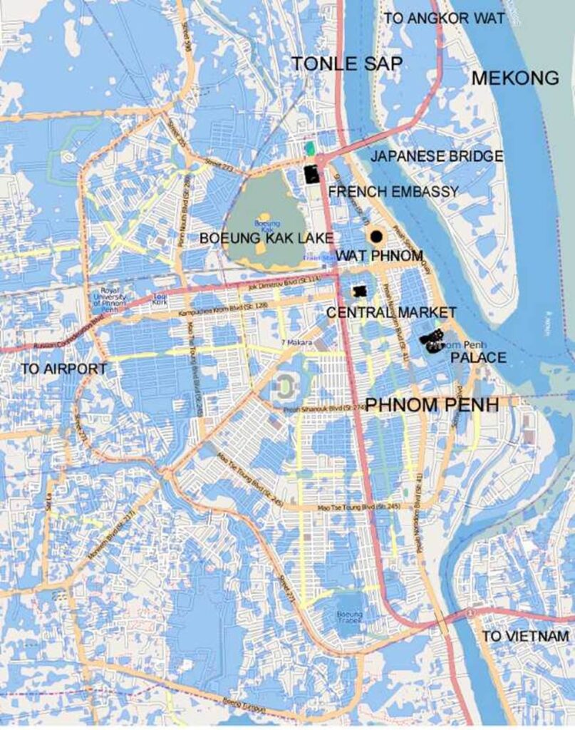
Colonial city map of Phnom Penh
In the 1870s, French colonizers built hotels, schools, banks, and public facilities, and the skeleton of the city was built from the villages on the riverbanks. However, due to geographical constraints, the suburbs were extensively covered with many wetlands and recreational areas, which subsequently constrained the urban living environment.
King Norodom moved the capital of Cambodia to Phnom Penh in 1886.
A map of Phnom Penh in 1922, when the city was called the Pearl of the Orient.
Flooded capital Phnom Penh
The main roads are spared from flooding, but the inner districts surrounded by the main roads are basin-like areas that are a few meters below the main roads.
Once flooded, you have to wait for the dry season until the water recedes.
Solving public health and traffic problems is not easy.
A map of the city of Phnom Penh at the height of the flooding.
Puddles remain over a wide area of the city, and it will take a long time for them to subside.
Cambodian Civil War
The Cambodian Civil War was a long period of civil war from the fall of the Kingdom of Cambodia in 1970 until the establishment of a democratic government in 1993.
Therefore, during this period, security was unstable, and people visiting for work and sightseeing were rare.
Preparing to land at the airport. The area is surrounded by wetlands.
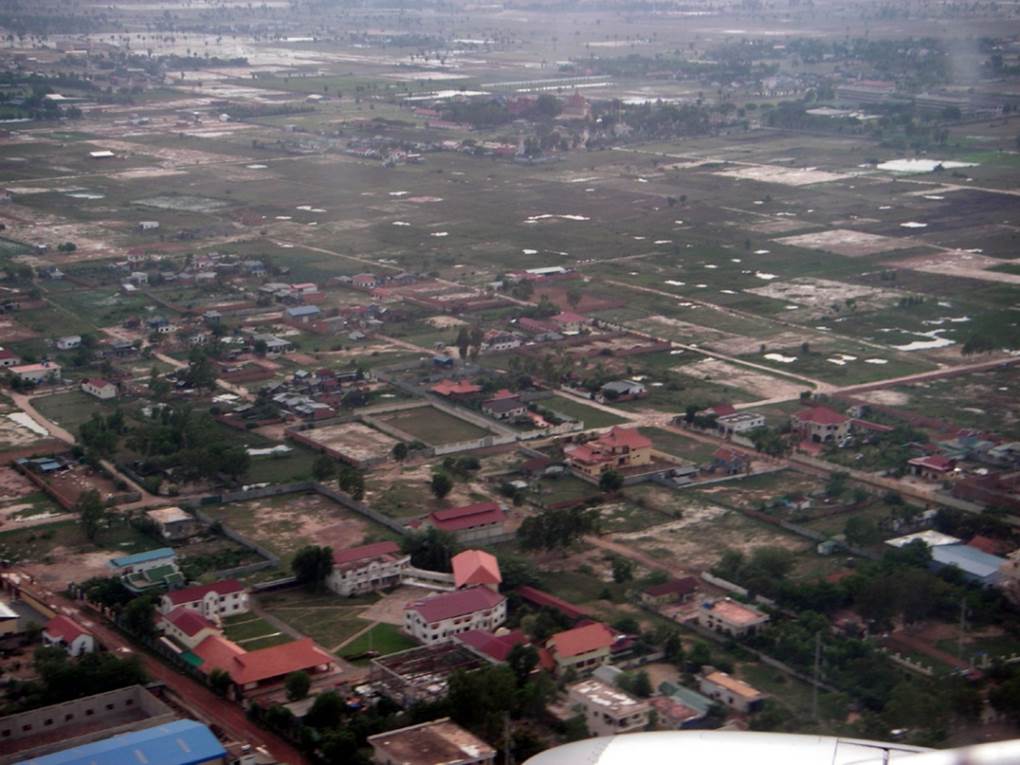
Photo by author, 2006
The airport is about 7km east of downtown Phnom Penh, which is not too far.
A few years after the Cambodian civil war ended, a French-Malaysian private consortium began modernizing the airport facilities in 1995, and it was finally completed in 2001.
When I first arrived at this airport, five years after it opened (in 2006), the terminal building was still new. It was also equipped with an air bridge, and was capable of handling large passenger aircraft.
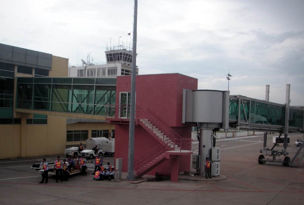
Photo by author, 2006
Airport pick-up area.
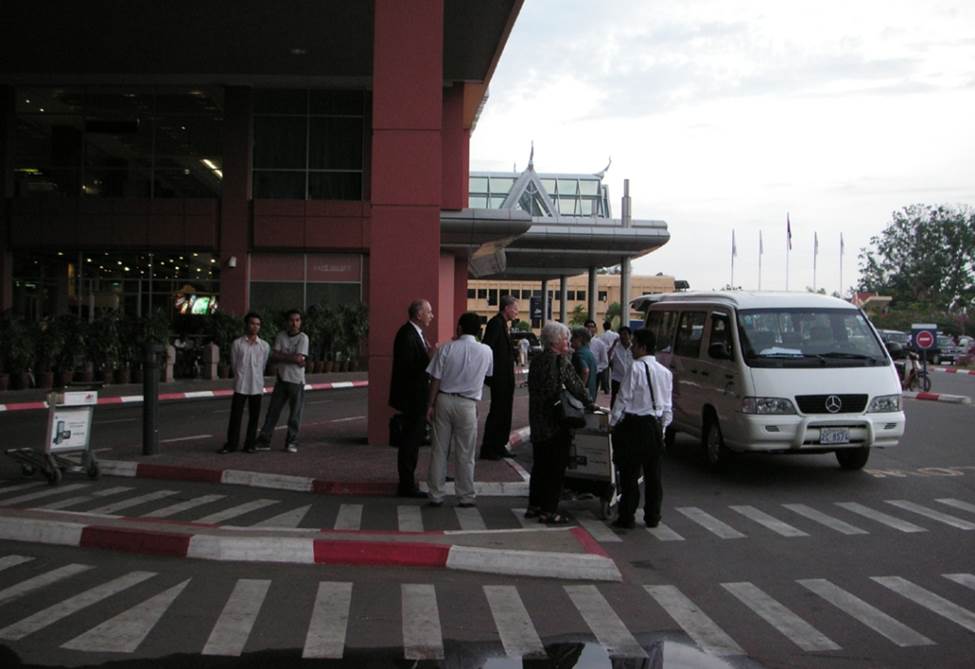
Photo by author, 2006
Phnom Penh airport after rain.
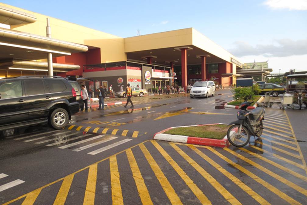
Photo by author, 2006
Phnom Penh hotels
Checked into a business hotel in the city.
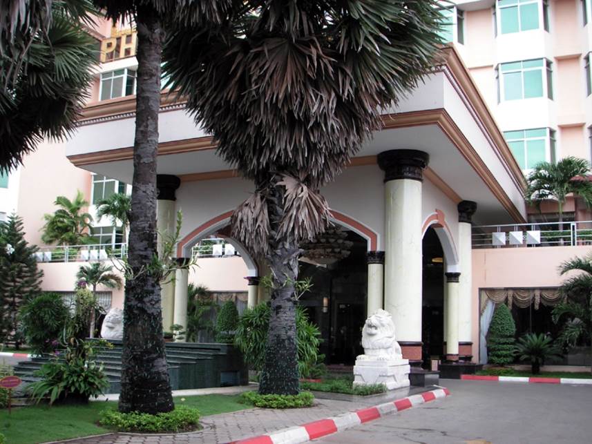
Photo by author, 2006
If you leave the hotel and walk a little way to the left along the main street, you will see the huge French Embassy. If you go to the right, you will reach Phnom Penh Central Station of Cambodian Railways. On the other side of the road is the colonial Raffles Hotel and the huge U.S. Embassy.
Behind the hotel is a large floodplain surrounded by slums.
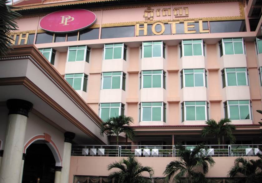
Photo by author, 2006
Royal Palace in Phnom Penh
The King’s Palace of the Kingdom of Cambodia. Located in the center of Phnom Penh. Only a part of the Palace shown in this illustration is open to the public.
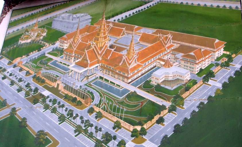
It was rebuilt by a French architect in 1917, and is said to have been used by King Sisowath from 1919. The building size is 30m x 60m and the spire is 59m high.
Of course, you can’t enter the building where the King lives, but you can tour a significant part of the Palace.
Chan Chaya Pavilion in front of the palace
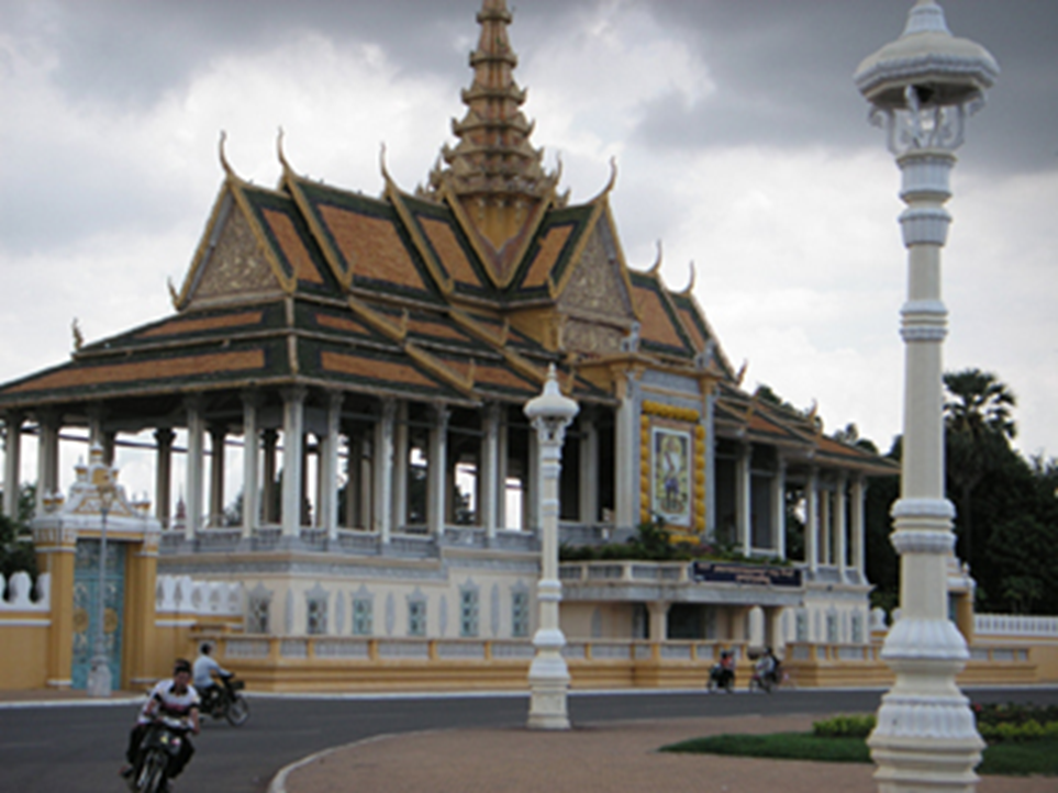
Photo by author, 2006
The public square in front of the palace.

Photo by author, 2006
The square in front of the palace facing the Mekong River is open to public.
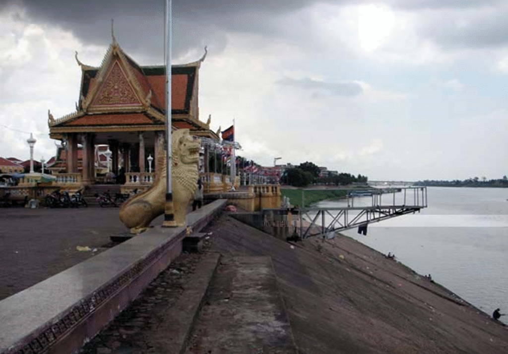
Photo by author, 2006
National Museum of Cambodia is located north of the Royal Palace.
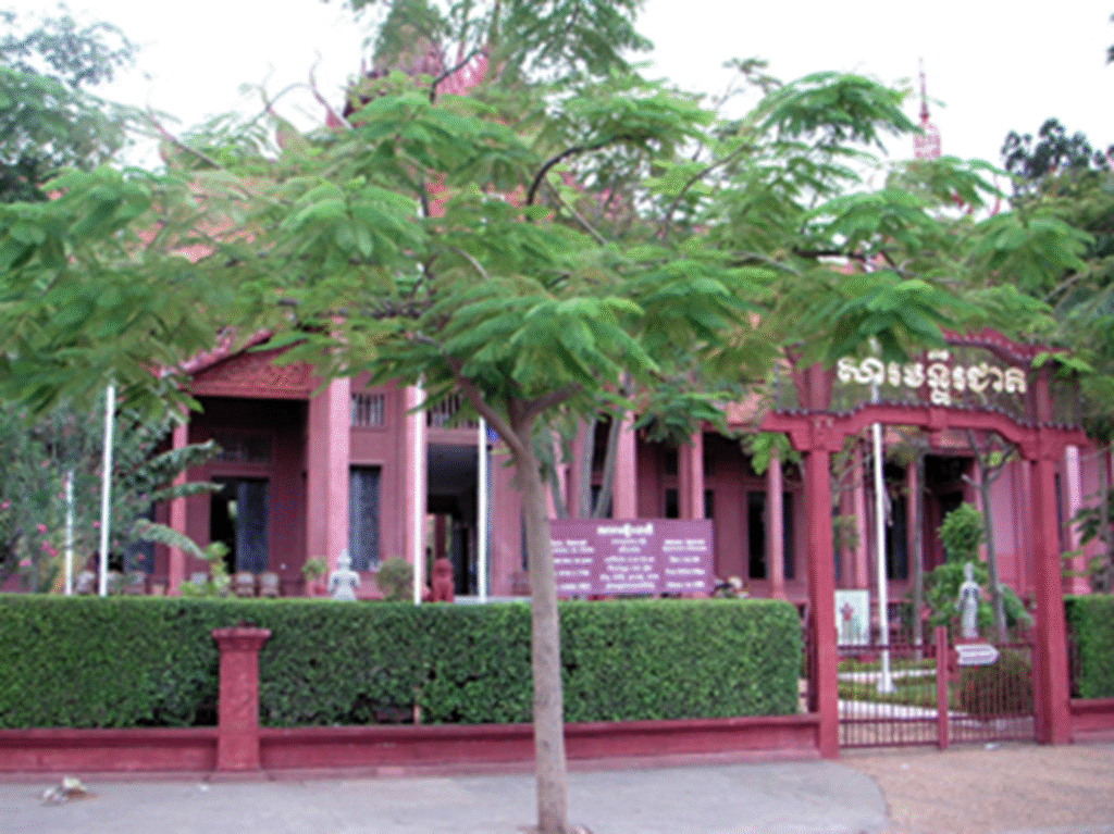
Photo by author, 2006
An antique shop is located just north of the National Museum..
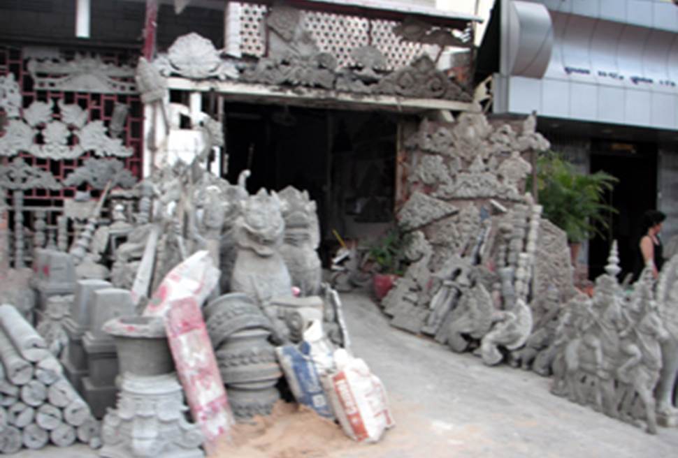
Photo by author, 2006
I found this pagoda on the edge of Phnom Penh city. Compared to the royal palace building, which is a sub-style of Thai architecture, this building is more similar to Cambodian Khmer architecture, and is a comfortable building.
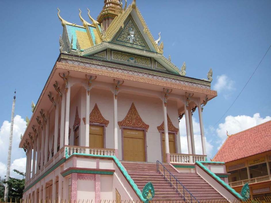
Photo by author, 2006
Photo by author, 2006
Photo by author, 2006
Photo by author, 2006
The base of the building is made of a material similar to the one found around Angkor Wat.
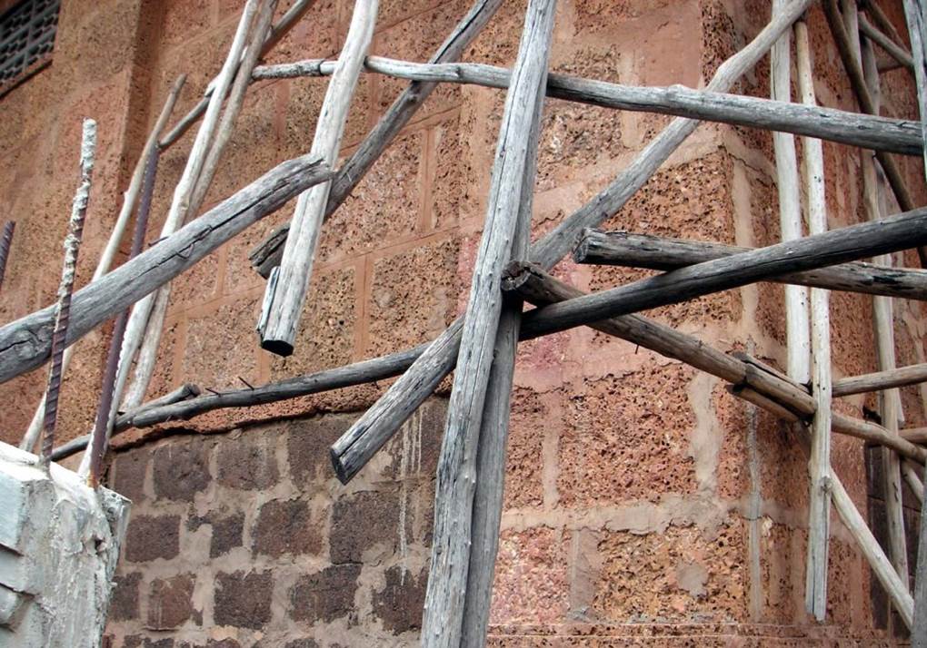
Photo by author, 2006
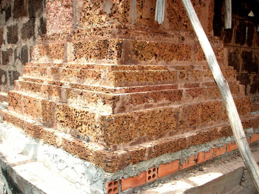
Photo by author, 2006
French Colonial
French colonial buildings of the 1920s-30s. It is not is a good state of preservation, but it survived the war and is therefore of rare architectural value.
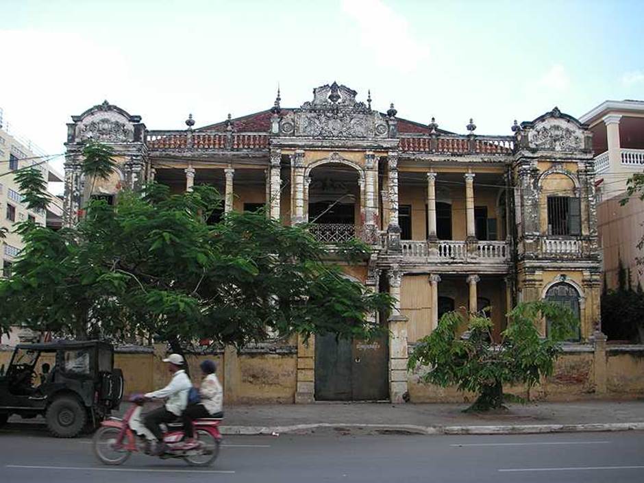
Photo by author, 2006
This is a French colonial building in urgent need of repairs
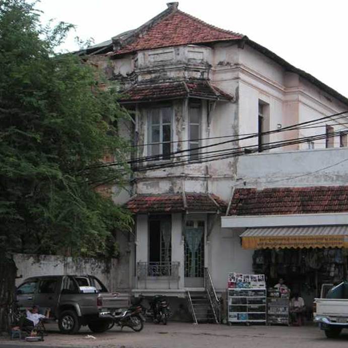
Photo by author, 2006
A French-style heritage building on the waterfront in central Phnom Penh.
There are bars and cafes on the first floor, and it is a lively place at night.
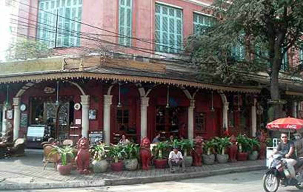
Photo by author, 2006
Walking through this bar-heavy neighbourhood, I noticed that I often saw elderly retired Western men. I presumed that they had come to Phnom Penh, where prices and labour costs are low, and were enjoying their retirement in this entertainment district using their pensions from their home countries.
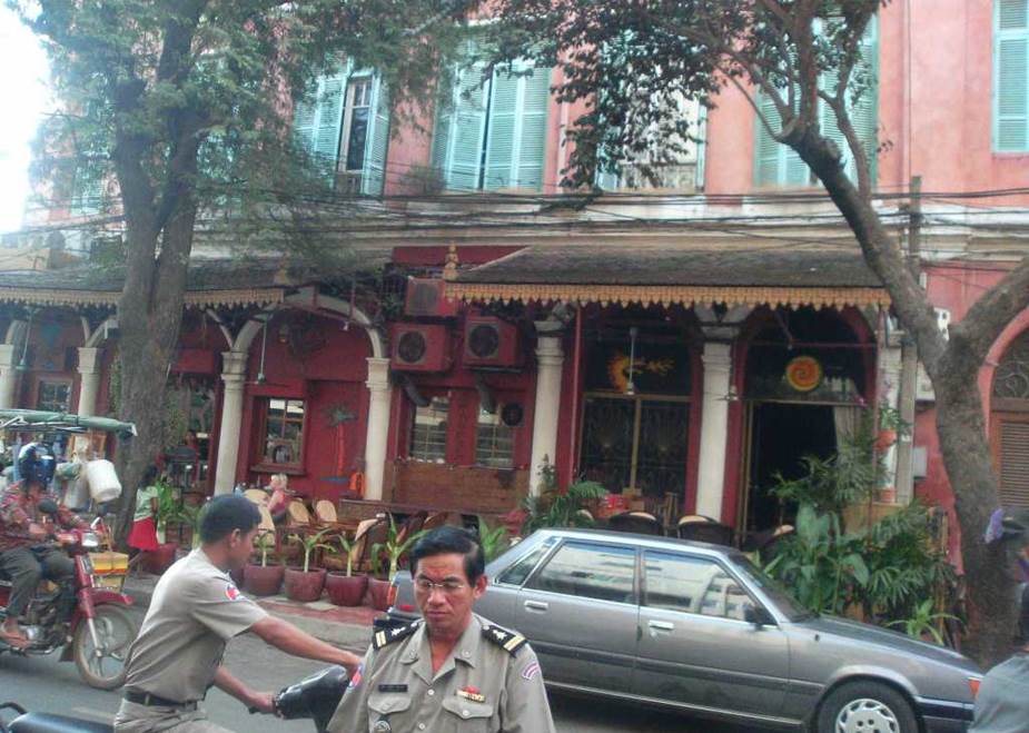
Photo by author, 2006
The main road in Phnom Penh.
Toyota and Lexus are often seen.
This shows that there must be a lot of rich people here.
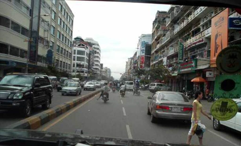
Photo by author, 2006
Phnom Penh Central Market.
Phnom Penh Central Market.
Note the roofs of the houses in the densely built-up area around it.
Photographed on my first visit in June 2006.
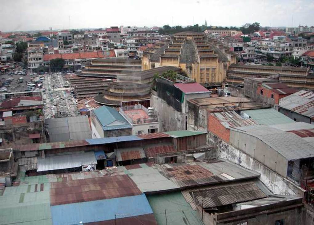
Photo by author, 2006
Phnom Penh Central Market, 2007.
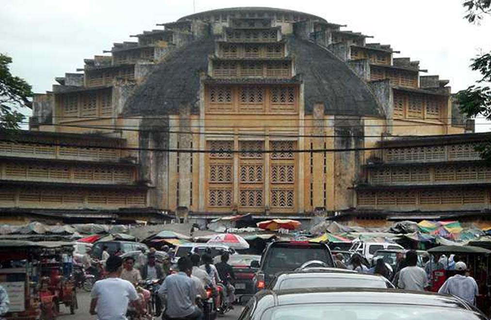
Photo by author, 2007
Phnom Penh Central Market.
Photographed six years later in 2013.
The wrong color choice completely lost the sense of volume of the building.
This is why it is so difficult to preserve architectural heritage.
Photographed during my 15th visit (last trip).
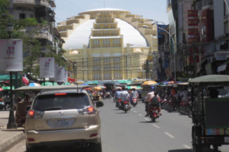
Photo by author, 2013
City Square
The square is overcrowded with motorbikes and people.
It seems like it will be lively and noisy even late at night.
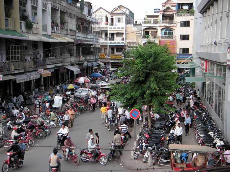
Photo by author, 2006
Open-air market
Shoppers and people relaxing outdoors.
After the harsh Pol Pot era ended, families returned to the city and many children were born, creating an overwhelmingly young population in Cambodia.
Although they are poor now, the city is filled with an atmosphere of anticipation for a bright future.
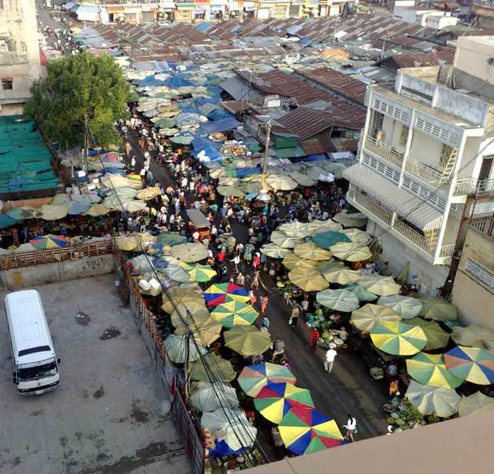
Photo by author, 2006
People relaxing at a food stall while some are preparing ingredients.
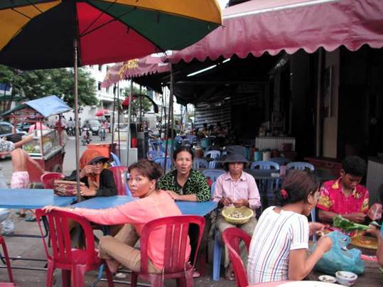
Photo by author, 2006
Various mode of transportation
Between Phnom Penh and Angkor Wat, drive at breakneck speed on the national highway. A long-distance minibus with several passengers on its roof is overtaking a truck carrying bamboo baskets! Cars in Cambodia, Thailand, Myanmar, and Vietnam all drive on the right side of the road.
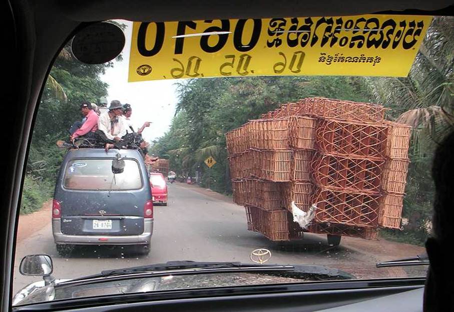
Photo by author, 2006
A taxi in the city waiting for customers. A two-wheeled vehicle with a seat attached. You can do business with just one motorcycle.
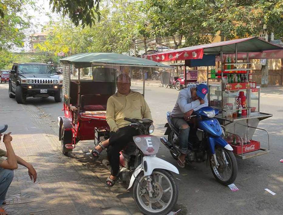
Photo by author, 2006
People carrying goods
A person transporting coconuts with a cart, using human power.
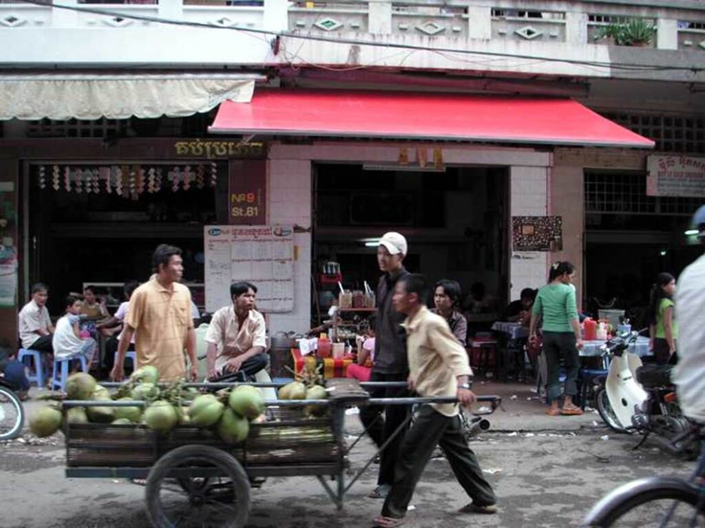
Photo by author, 2006
Ice blocks are purchased from the ice factory and transferred to a motorcycle cart.
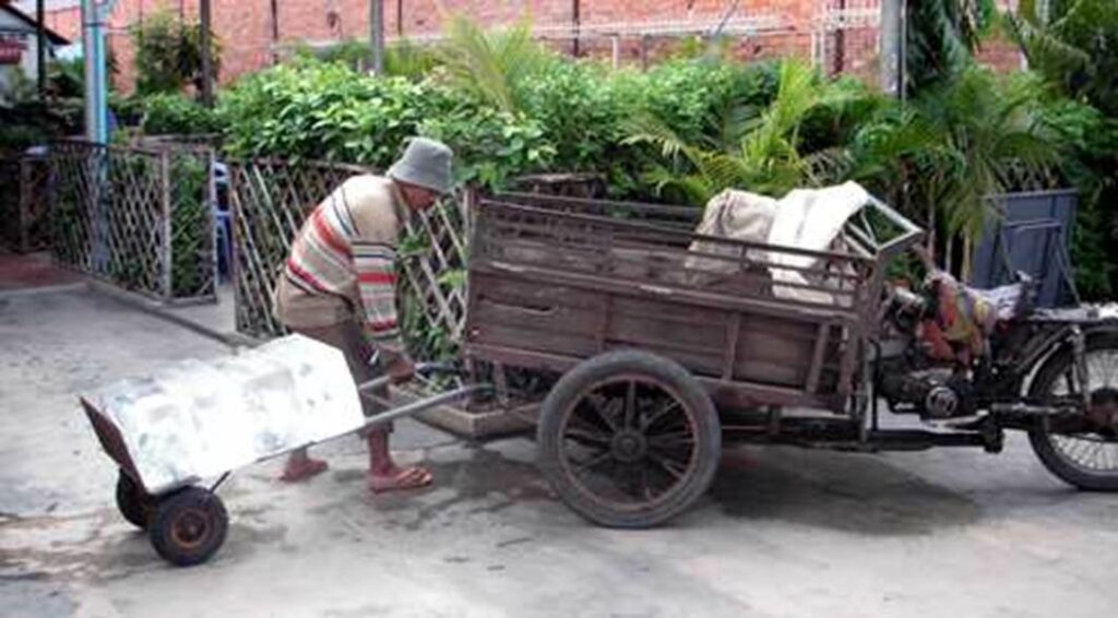
Photo by author, 2006
Motorcycle taxis waiting for customers. The seats look comfortable.
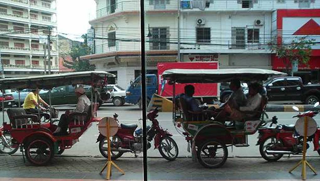
Photo by author, 2006
Royal Cambodia Railway Phnom Penh Station.
It was completed in 1932. After the civil war, the railroad tracks and communication facilities fell into disrepair, and now they are barely functional.
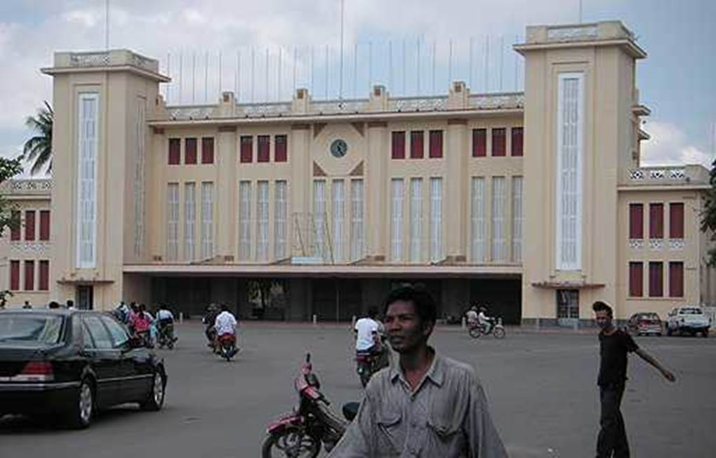
Photo by author, 2006
The splendid waiting hall of the train station.
There were no passengers. A deserted space.
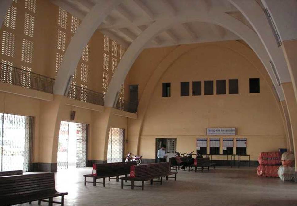
Photo by author, 2006
Platform outside the waiting hall. There is a railway line extending from here to Bangkok, and there should be demand for international trains, but there are no people here either. It seems to be closed.
The reason for this is that the condition of the track maintenance is poor, the gauge is 1000 mm (1067 mm for JR conventional lines), and since it is a non-electrified single line, it can only reach about 35 km / h. Since the gauge is slightly different, it is not possible to adopt a used car from Japan like in Myanmar.
As residents use long-distance buses, which are more convenient and faster, the survival of railway culture is in jeopardy.
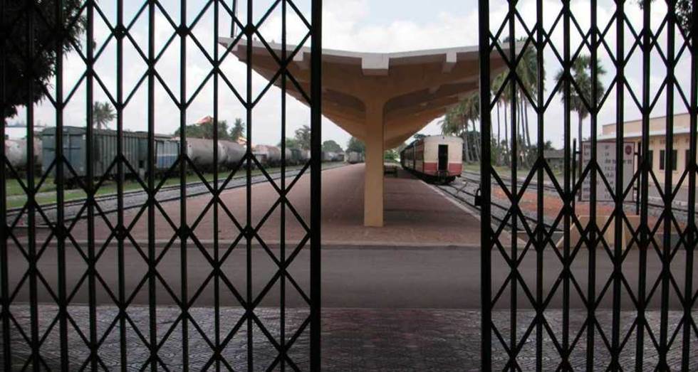
Photo by author, 2006