JAP | ENG
Malaysia Travelogue #2/4
1974
Ipoh, Penang
In a privately owned Cessna aircraft,
Kuala Lumpur via Ipoh to Penang Island
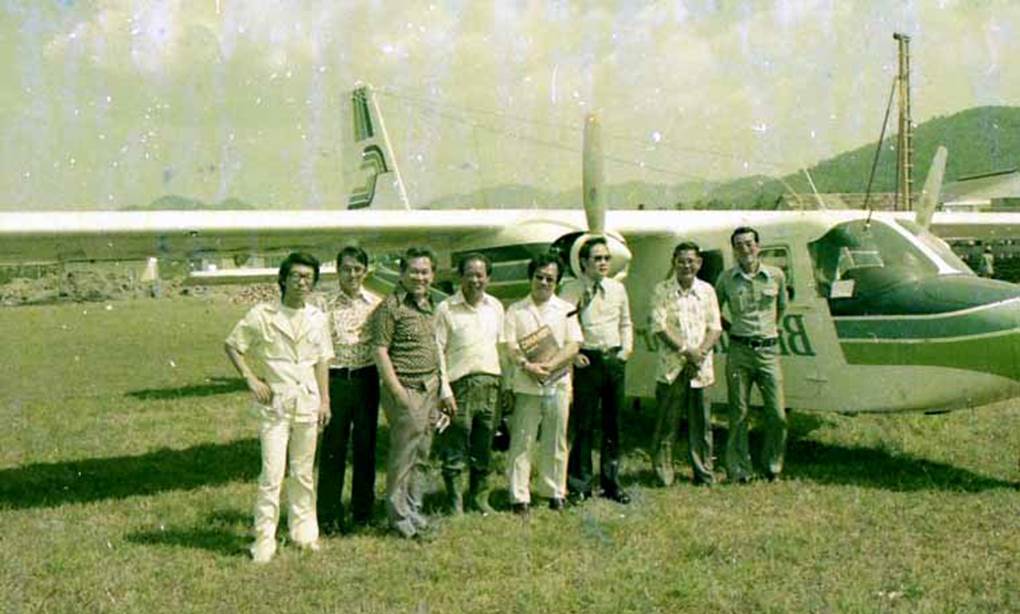
A few years after the race riots, I was invited by the owner of the Federal Hotel in Kuala Lumpur to accompany him on a tour of land owned by his family on Penang Island in his private Cessna.
The photo below shows the scene when we landed at the temporary airport in Ipoh, the capital of Perak state, north of Kuala Lumpur
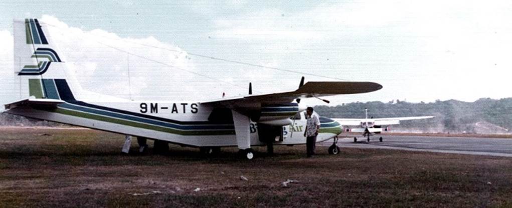
Malaysia, Ipoh City Airport, Cessna plane landed safely
Photo by author, 1974
Ipoh
In the 20th century, tin ore reserves were discovered in Perak, Malaysia.
During the British colonial era, many investments were made, and the town of Ipoh was born as the center of the investment. The work in the mines required a large number of people, many of whom were Cantonese immigrants.
As a result, 70% of the population of Ipoh, a provincial city in Malaysia, is Chinese, and Cantonese is the dominant language in the city.
Perhaps because of the high content of minerals in the water, it is a city where food and coffee are delicious.
Remnants of abandoned ores
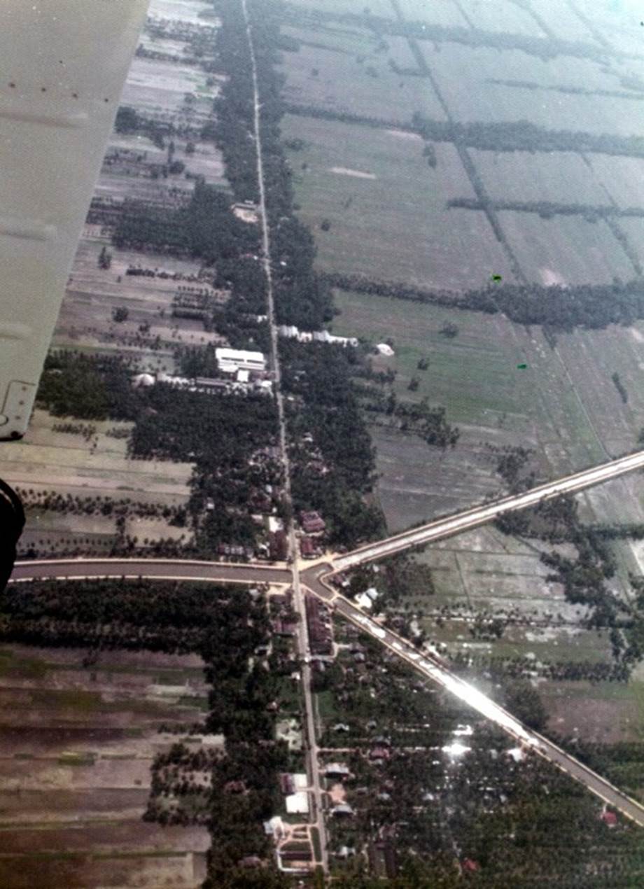
The advantage of flying low in a light aircraft is that you can take pictures like the one below.
Below are the remnants of a tin mine near Ipoh.
In 1970, the international price of tin collapsed, and the number of abandoned mines increased.
This also brought an end to the development of the town of Ipoh.

Remnants of a tin mine Photo by author, 1974
Rice-growing areas in Malaysia
As the light aircraft fly north across the Malay Peninsula, the pilots skillfully fly between valleys to avoid rising cumulonimbus clouds.
From the central to southern parts of the peninsula, most of the land surface is covered with natural rubber forests and oil palm plantations.
In contrast, in the northern state of Kedah, bordering Thailand, rice paddy fields, as shown in the photo, stretch out. This is Malaysia’s so-called grain-producing region.
Kedah granary Photo by author, 1974
Penang Island
In 1978, Penang Island’s airport was a very small building standing alone near the runway. A wave of resort development was surging into Batu Ferringhi, the most scenic spot on Penang Island.
A model of the airport’s new terminal plan was displayed in the waiting room of the old airport. Today, this airport building has also been demolished to make way for an even larger terminal building.
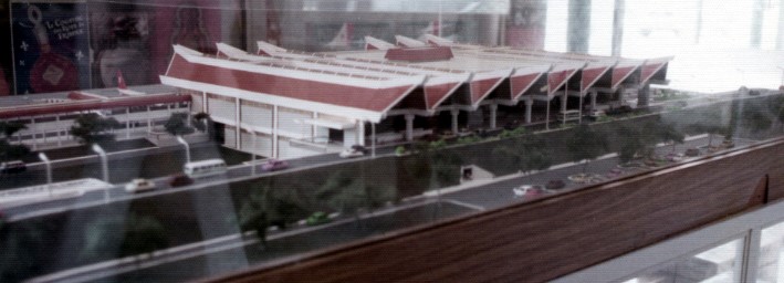
Photo by author, 1974
A tree-lined avenue leading from Georgetown, a city on Penang Island, to the botanical gardens.
There are 1960s model British cars on the road.
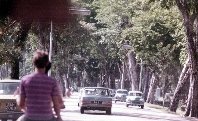
Photo by author, 1974
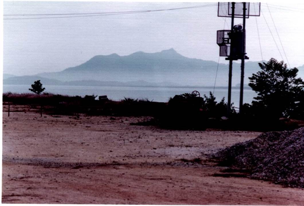
Photo by author, 1974
Photo (above and below) taken while inspecting the owner’s property.
This site is one of the most scenic spots on Penang Island.
View of the Malay Peninsula mountain range across the strait.
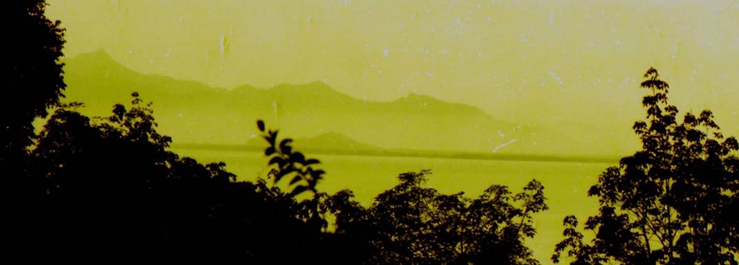
Photo by author, 1974
You can see the Batu Ferringhi coastal road from photo below.
This place is the most scenic spot on Penang Island.
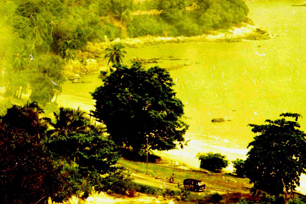
Photo by author, 1974
A construction worker clearing the jungle slope on the site.
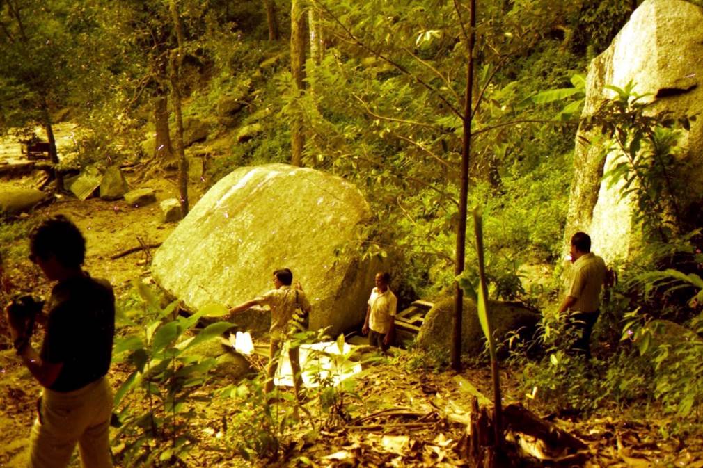
Photo by author, 1974
Resort Hotel Proposal
I made a design proposal for a seaside resort hotel on this sloping land.
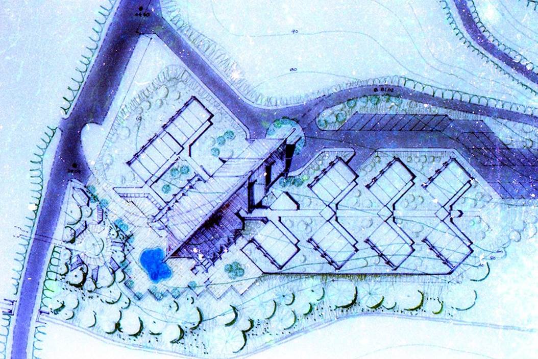
Created by author’s (Pladesco) office in 1974
Resort hotel proposal. (Mount Pleasure, Batu Ferringi, Penang)
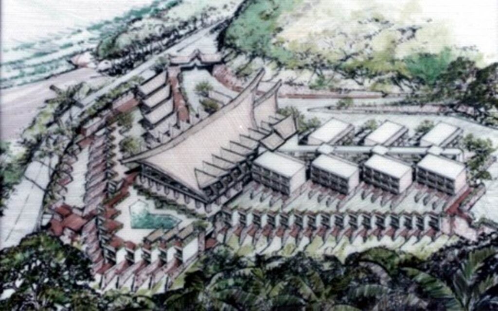
Created by author’s (Pladesco) office in 1974
Interviews with local newspapers
A model of a resort hotel on the Batu Ferringhi coast of Penang Island was created in Kuala Lumpur for presentation.
A local newspaper came to cover the unveiling of the project.
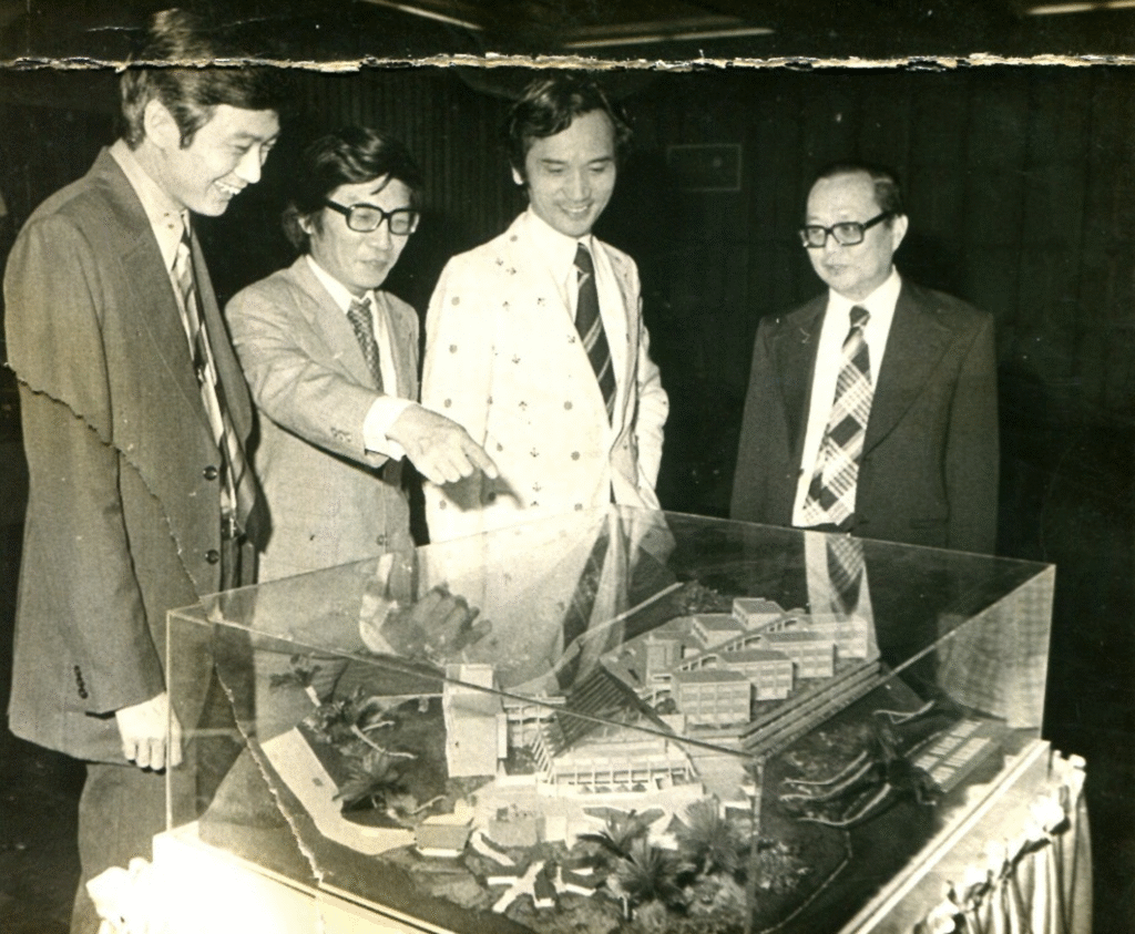
Photograph of a local newspaper in 1974.
Author is second from the left