JAP | ENG
HISTORIC CENTER OF JAKARTA 2014
Jakarta is the capital and largest city of Indonesia.
It has a population of over 9.5 million, and the greater Jakarta metropolitan area, including the suburbs, had a population of 31.2 million in 2016, making it the second largest in the world after Tokyo.
It is one of the world’s leading megacities and one of the leading global cities in Southeast Asia.
It is also home to the secretariat of the Association of Southeast Asian Nations (ASEAN)
Batavia
Batavia was the name of Jakarta, the capital of Indonesia, during the Dutch East India Company era.
Located at the mouth of the Chilean River, Batavia was known as Sunda Kelapa from the 12th century to the early 16th century, and many merchants came from the surrounding waters. Later, in 1619, the Dutch East India Company built the fortress Batavia Castle and made it a trading base in Asia.
A number of Dutch-era buildings remain. Today, it is a harsh traffic hell area.
Traffic jams and hustle and bustle from cars make it difficult for tourists to take their time and appreciate the colonial heritage.
Tourist map of the old Batavia area.
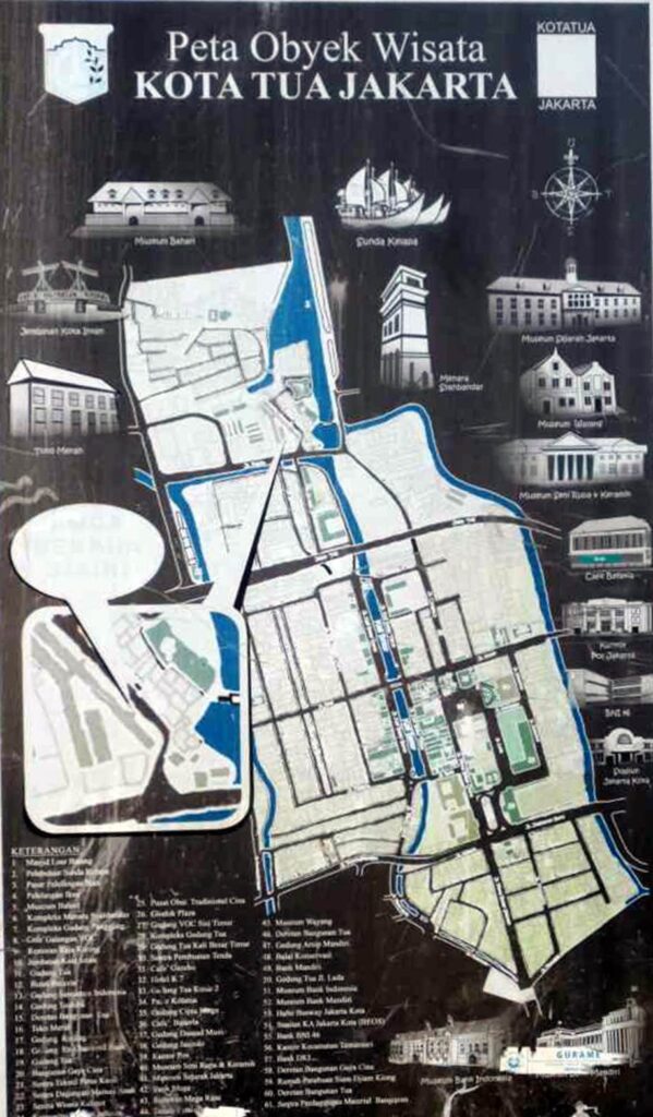
Photo by author, 2014
Batavia Castle, the fortress of the Dutch East India Company. The area facing the sea at the bottom of the photo is the port of Sunda Kelapa. Before the Dutch arrived, it was called Sunda Kelapa (Sundanese palm fruit) in Sundanese.
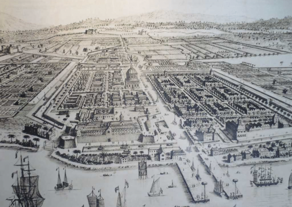
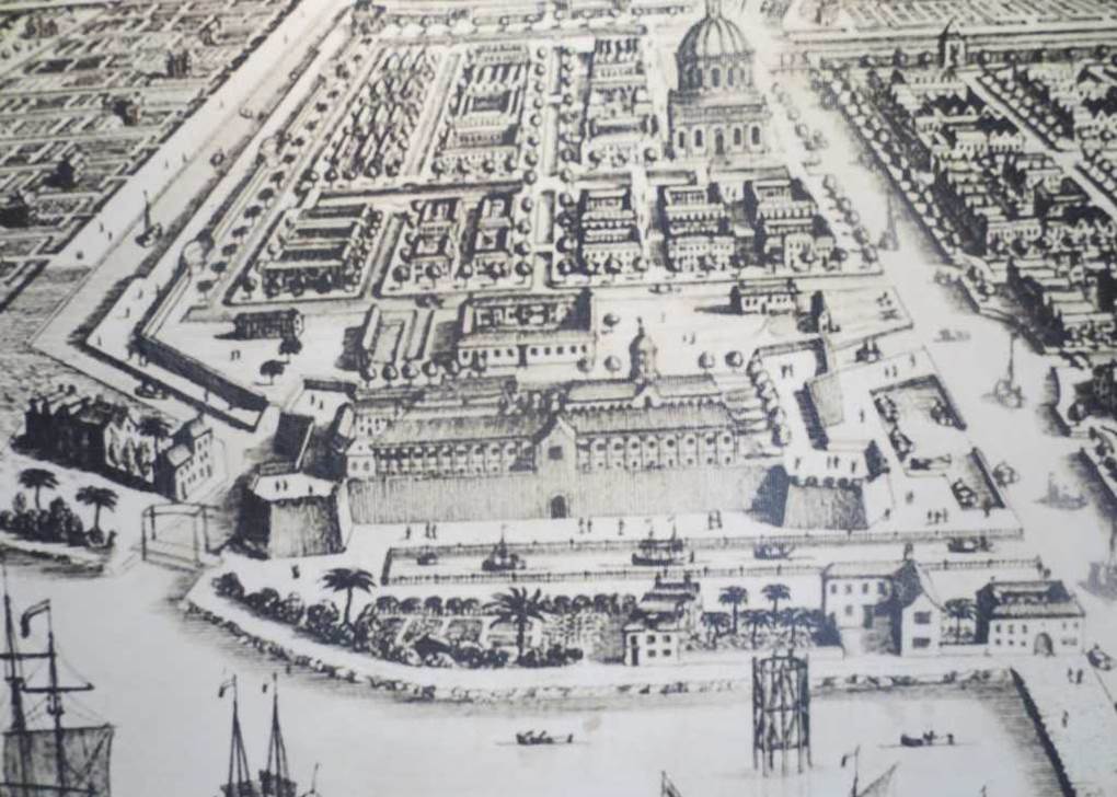
Map of the fortified Batavia Castle, surrounded by waterways and canals. To the north (left) was the port of Sunda Kelapa.
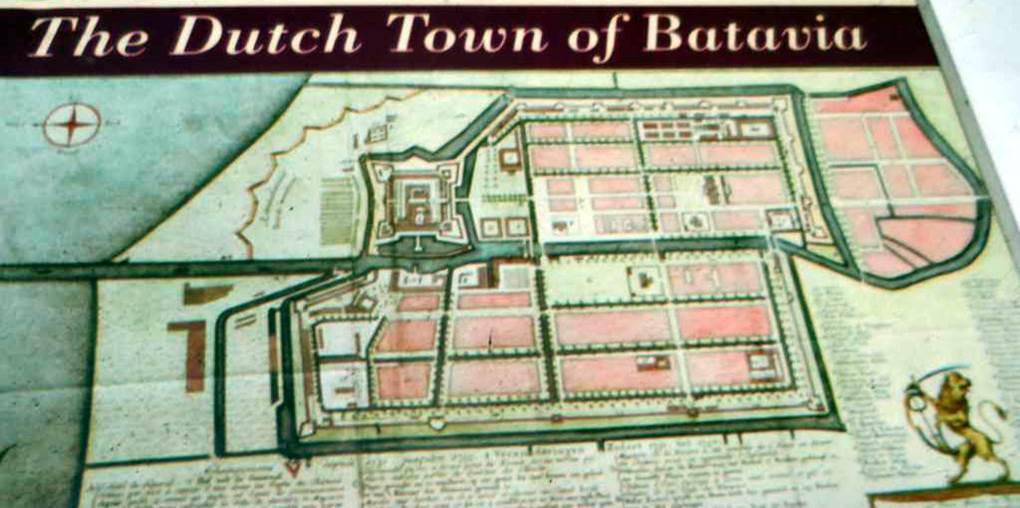
Photo by author, 2014
Waterways of Batavia. Although it still exists, many of the places on both sides of the river have become slums.
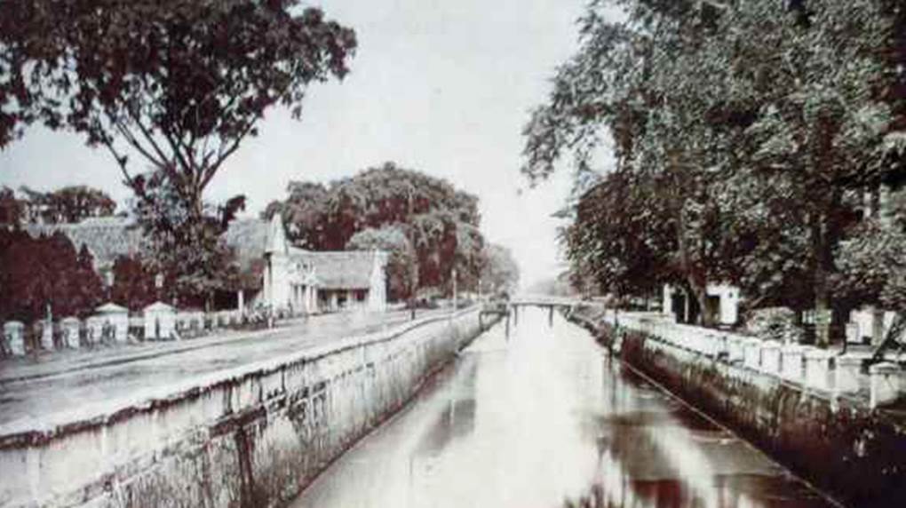
Photo by author, 2014
Kota Intan Bridge
A drawbridge over a canal built by the Dutch East India Company (VOC) in 1628.

Current drawbridge.
It is now a “drawbridge that does not draw” and is left for tourism. It is reminiscent of the region’s colonial rule in the past.
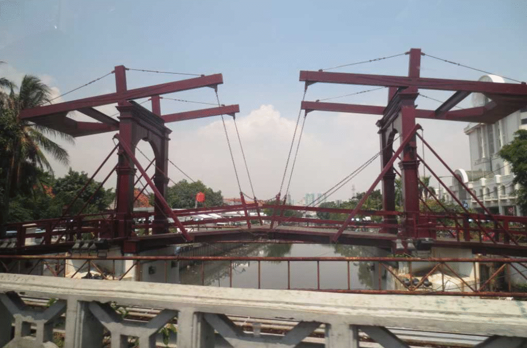
Photo by author, 2014
Not far from the center of Jakarta, a fast-growing city of 10 million people, there are poor areas that does not benefit from the city development, and people live in fragile houses that could collapse if strong winds blow, let alone heavy rains.
To further complicate matters, Jakarta has a serious problem of disparities among its residents. The most disadvantaged people are being driven to the most dangerous areas along the coast.
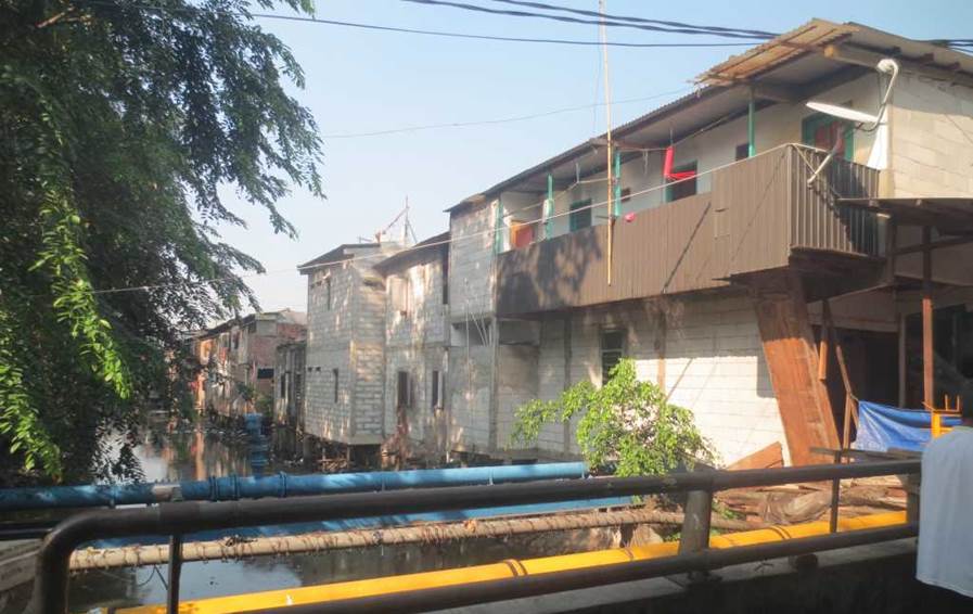
Photo by author, 2014
Railways and highways cross at grade, adding to traffic congestion.
Jakarta’s population has been expanding for many years, but infrastructure investment has not kept up with it, and the transportation network is choking.
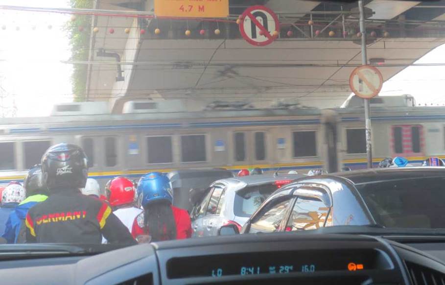
Photo by author, 2014
Anyone can freely enter the railway premises.
There are garbages scattered around and no proper management.
Jakarta Old Town.
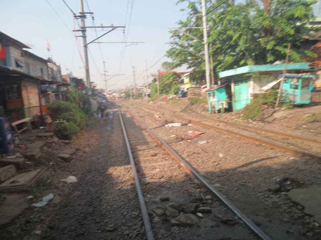
Photo by author, 2014
I visited the Port of Sunda Kelapa, which once flourished as the front gate of Batavia。
Due to my work, I was accompanied by an old acquaintance from Jakarta, and I had the opportunity to see the former Batavia district at the northern end of Jakarta, which I had never visited before.
Syahbandar Tower
Harbour Watch Tower
A patrol tower built right in front of the port of Sunda Kraba, which flourished during the Batavian period and was crowded with ships full of trade goods at the time. We finally arrived there after passing through a crowded street.
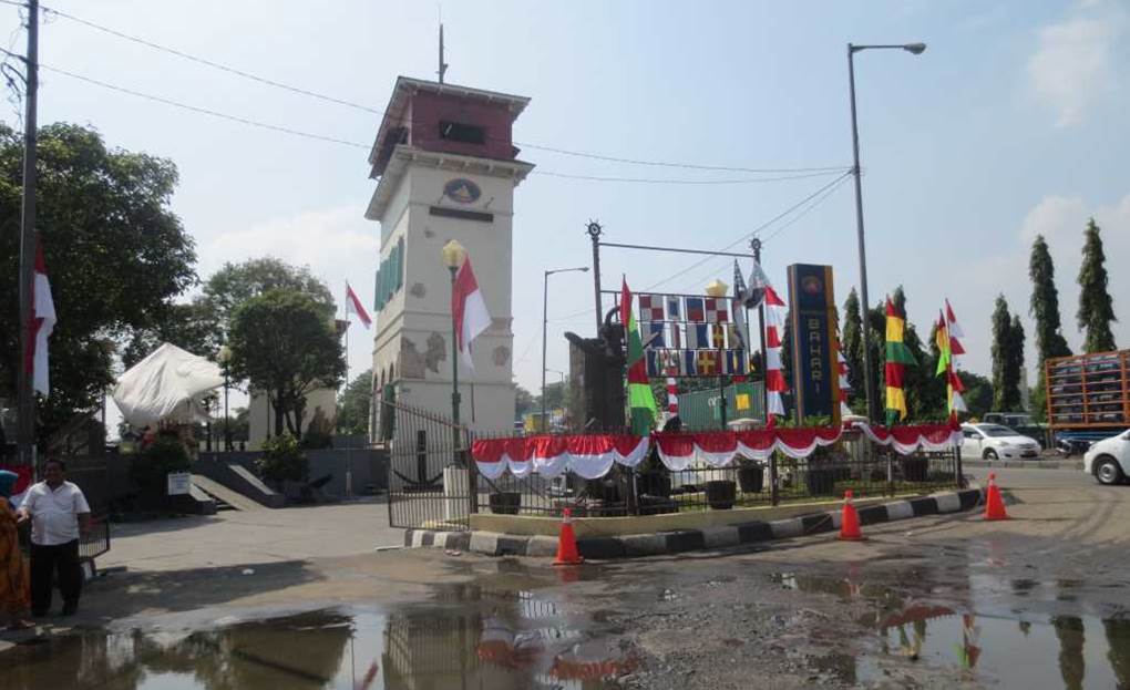
Photo by author, 2014
After passing through a small alley, we reached the lookout tower.
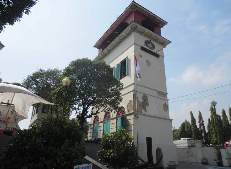
Photo by author, 2014
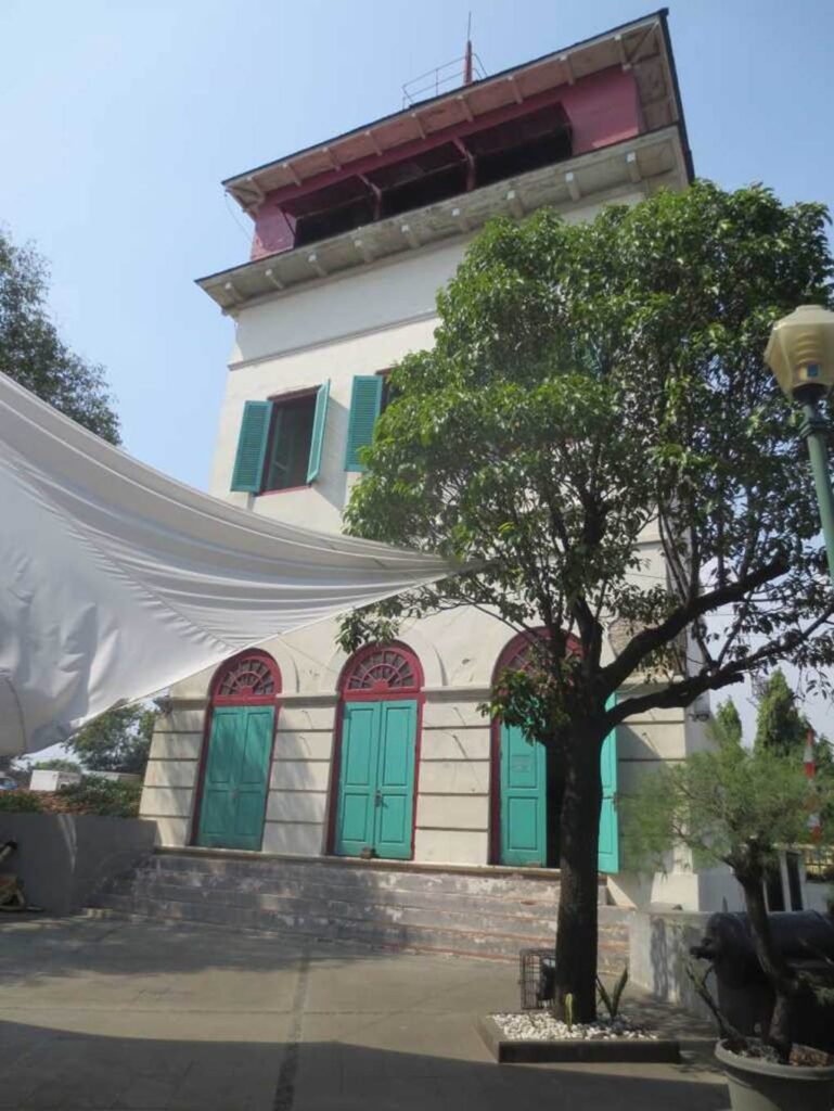
Photo by author, 2014
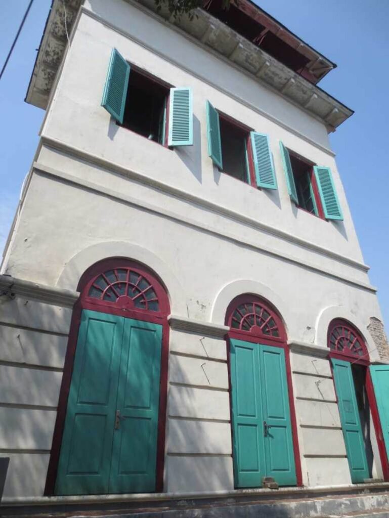
Photo by author, 2014
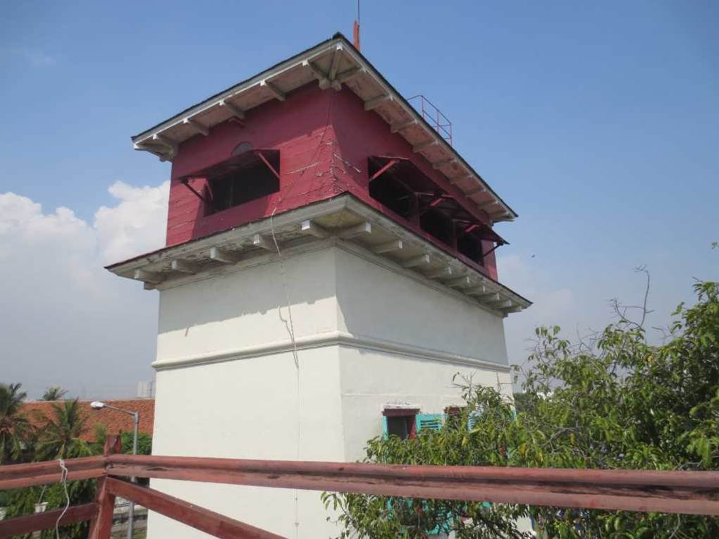
Photo by author, 2014
The anchor of the ship used at that time was placed under the tower.
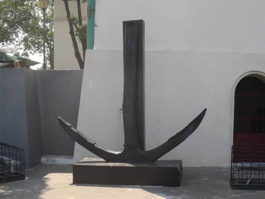
Photo by author, 2014
Defensive cannons were once installed at key points around the river mouth and bay. Right now, the focus is on the buildings on the land that have been reclaimed, and there is a sense of otherness.
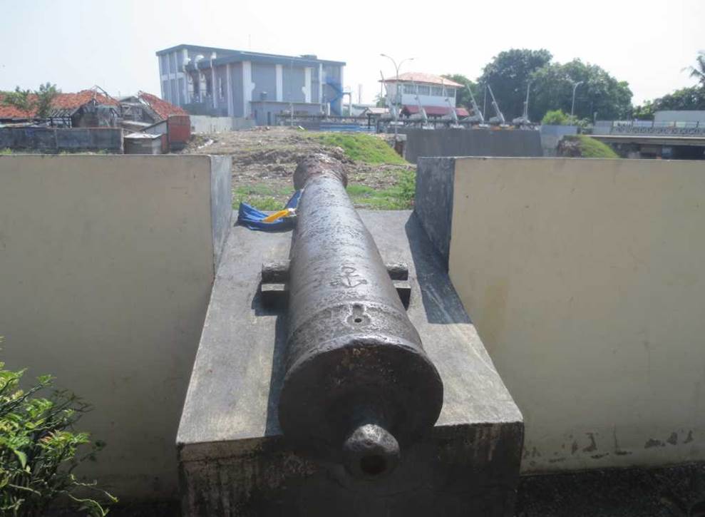
Photo by author, 2014
This cannon is also focused on the land that has been reclaimed in a chaotic manner.

Photo by author, 2014
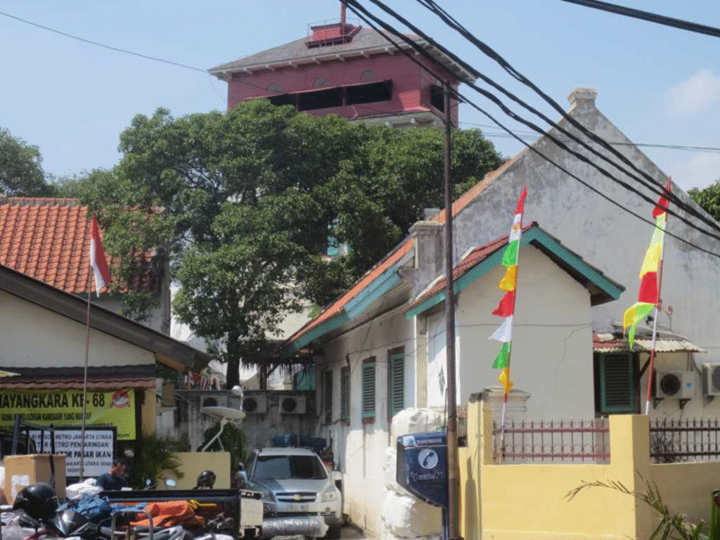
Photo by author, 2014
Next, we saw an old Dutch-era warehouse building near the watchtower.
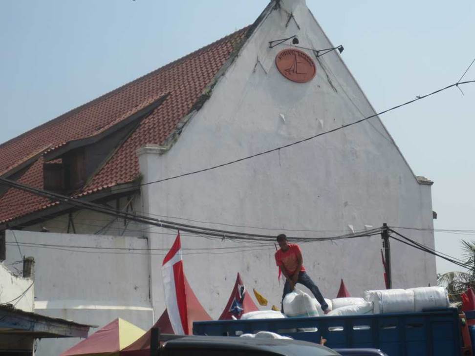
Photo by author, 2014
Maritime Museum(Museum Bahari)
It was built in stages by the East India Company between 1652 and 1771.
It was a warehouse for storing, sorting, and packaging spices and other agricultural products.
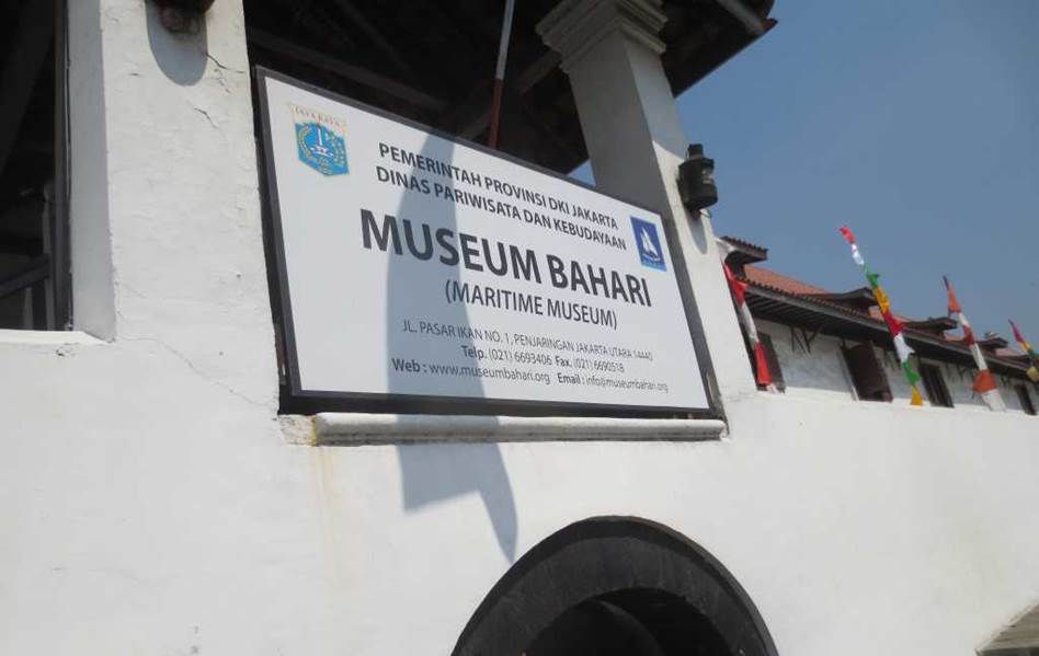
Photo by author, 2014
It was a large barracks-like building surrounded by crenellated outer wall, but it was a warehouse where the East India Company stored trade goods such as nutmeg, pepper, tea and silk, copper and tin. It is now used as a maritime museum.
However, despite the large area, there are few exhibits and it is covered with dust. There seem to be few visitors, and there is not much to see that would attract tourists.
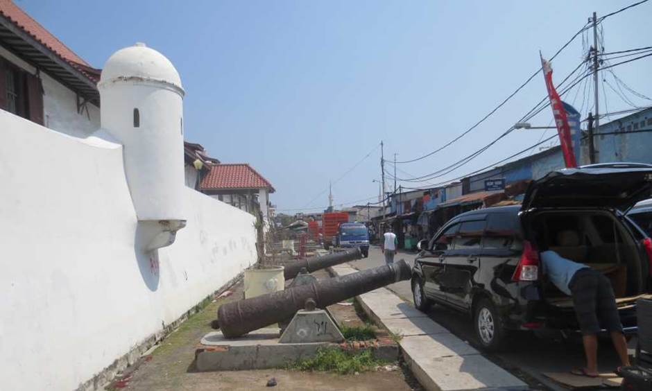
Photo by author, 2014
A courtyard sandwiched between two former warehouse buildings.
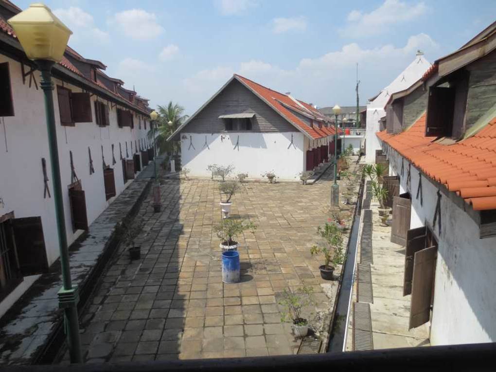
Photo by author, 2014
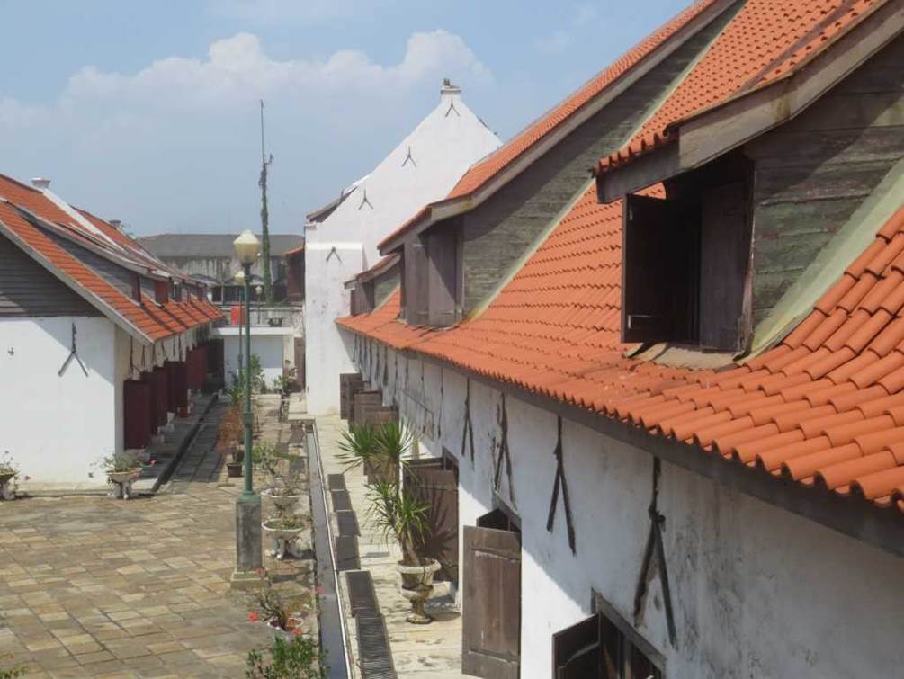
Photo by author, 2014
An outdoor passageway between two former warehouse buildings.
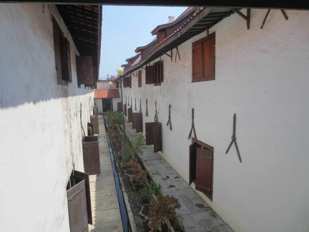
Photo by author, 2014
Entrance to the Maritime Museum
Since it is inscribed ANNO 1719, it is understood that it was built in 1719.
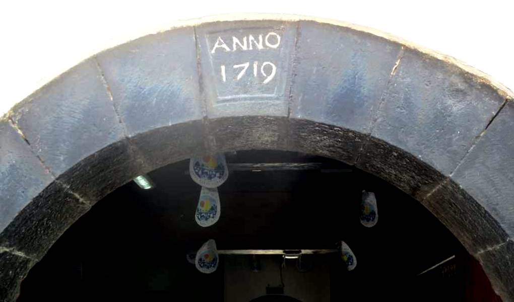
Photo by author, 2014
Inside, a huge piece of timber that would have been quarried from the rainforest is used as a structural material (interior pillars and beams) for the heavy duty warehouse.
Products such as pepper, flavorings, cloves, nutmeg, and mace, which brought enormous wealth to Europe, were stored here.
It was from the wooden structure, rather than the exhibits themselves, that one could sense the lingering scent of a bygone era.


Photo by author, 2014
A model of a Dutch ship was on display.
I don’t know how accurate this model as to its historical past.
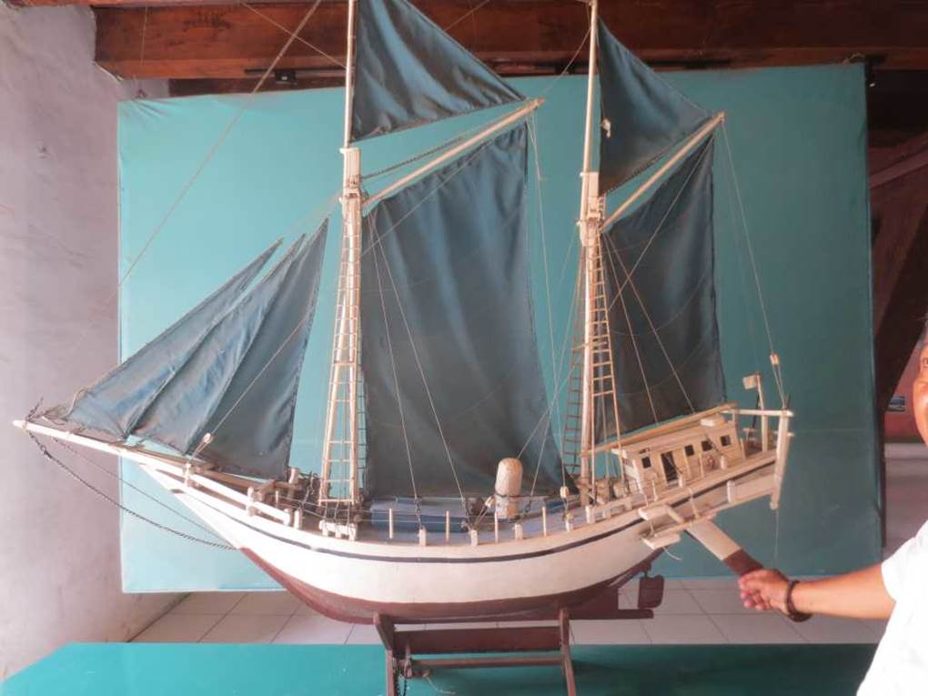
Photo by author, 2014
This former Dutch port was visited by merchants from various regions such as the Arab world and India. It was an international port for the spice trade.
Photo by author, 2014
Jakarta’s benchmark.
Photo by author, 2014
Jakarta suffers from regular floods
The 2007 floods killed 85 people, damaged homes at least 350,000 people, and flooded 70% of Jakarta’s city area, with water depths reaching 4 meters in some areas. In recent years, land subsidence has been underway, and according to a survey by an international organization, Jakarta is sinking by 5~10 cm every year.
Subsidence (land sinking) in Jakarta
Jakarta is not only experiencing land subsidence, but also rising sea levels.
By 2050, one-third of the city could be submerged.
This is an unprecedented crisis that threatens the survival of the city.
In Jakarta, only a quarter of residents have access to running water.
This means that many residents have to dig wells underground.
This is because it is cheaper than having running water pipes installed.
In the process, the land is sinking.
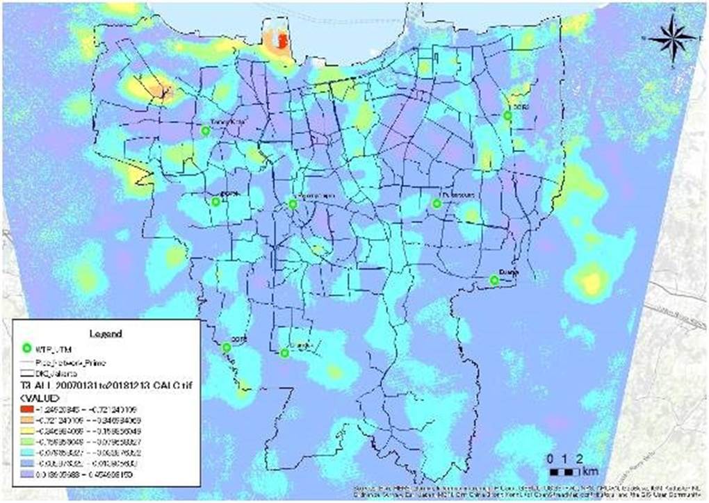
JICA uses satellite image analysis technology to create a two-dimensional distribution of land subsidence
What used to be the sea has been reclaimed and turned into a slum village.
On the left is a former Dutch warehouse, and in the distance is an Islamic mosque built on a landfill.
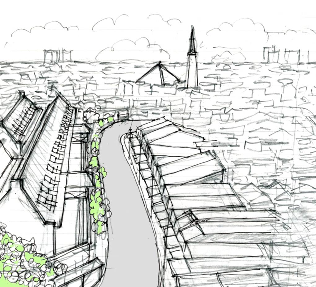
Author’s sketch
Road in front of the Maritime Museum
Going further in from this road, we came to a slum area of illegally occupied land. Accompanied by a local, we set off into the slum area to broaden our horizons.
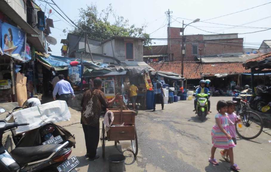
Photo by author, 2014
Slum Tour
At the end of a dry waterway, crossing this simple bridge changes the scenery and leads to a slum society where tourists are forbidden.
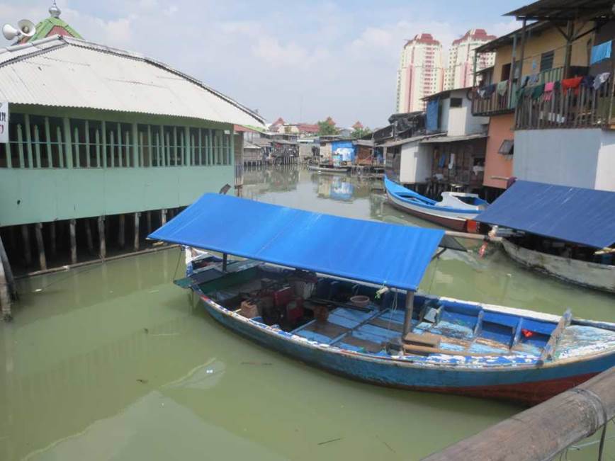
Photo by author, 2014
There are many small boats moored in the waterway between the slums.
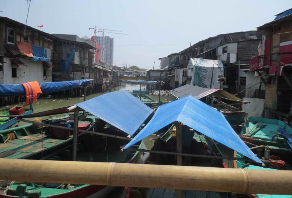
Photo by author, 2014
Homemade houses made from salvaged materials are built close together.
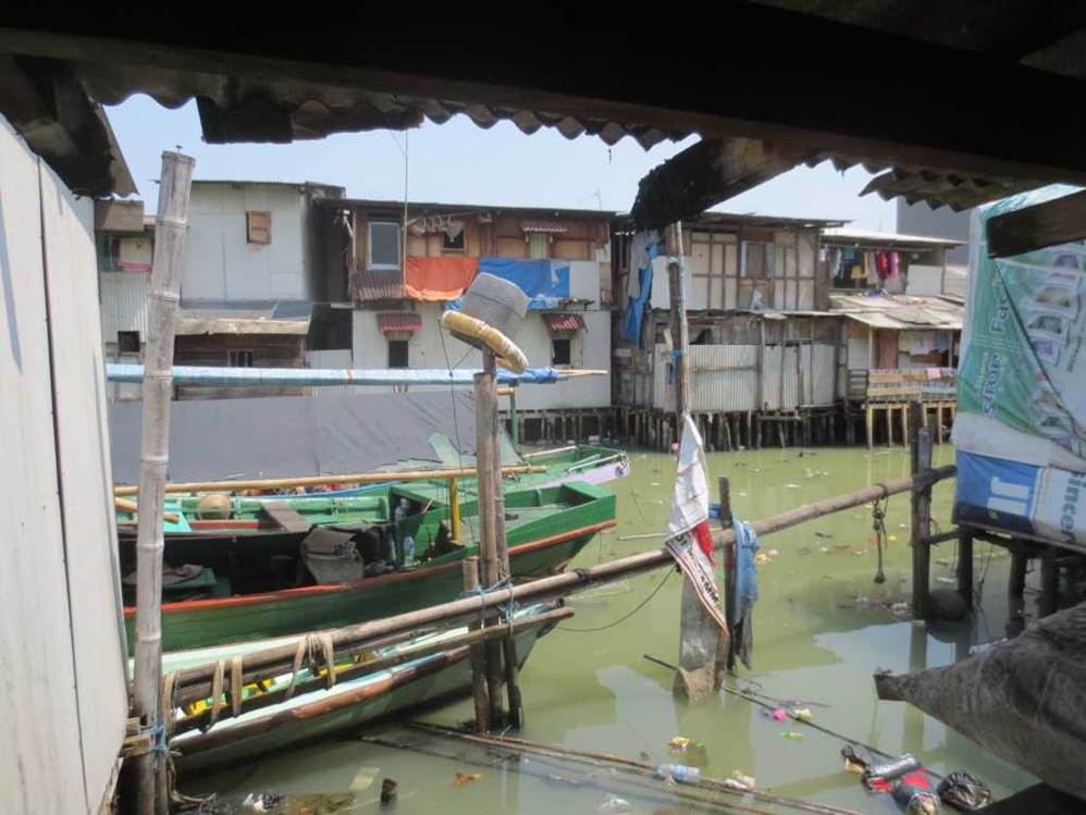
Photo by author, 2014
The sludge in the waterway is sticking out on the surface of the water.
It also has a foul smell.
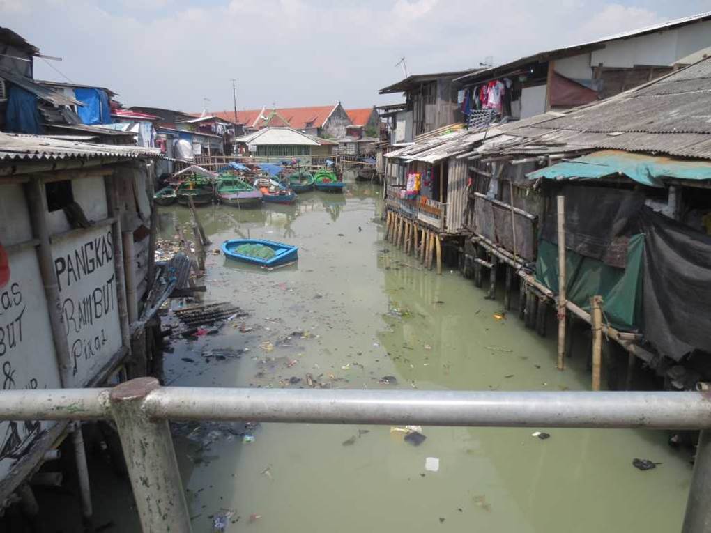
Photo by author, 2014
The surface of the channel is gray. It is in a sludge state with garbage and excrement. The water is stagnant and has stopped flowing.
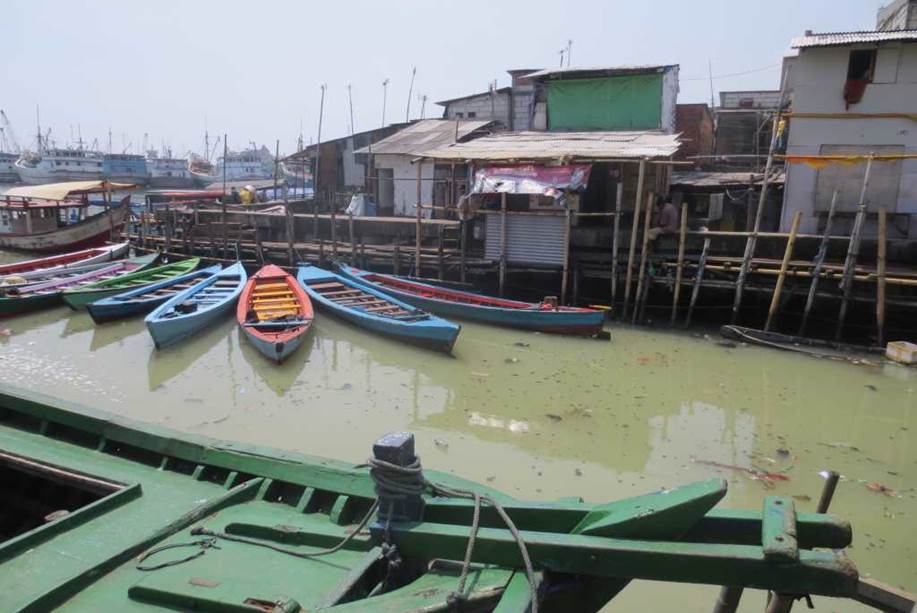
Photo by author, 2014
There appears to be a toilet under the tin roof.
Excrement goes straight to the surface of the water.
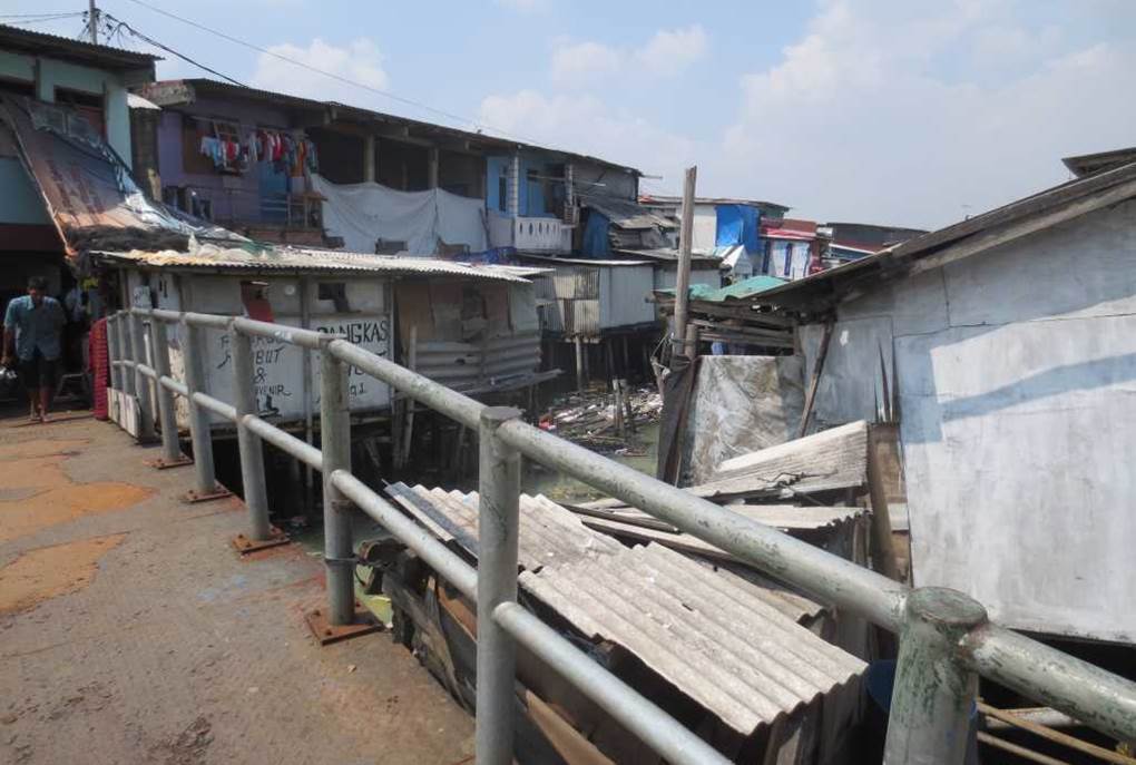
Photo by author, 2014
The waste and houses are all mixed together.
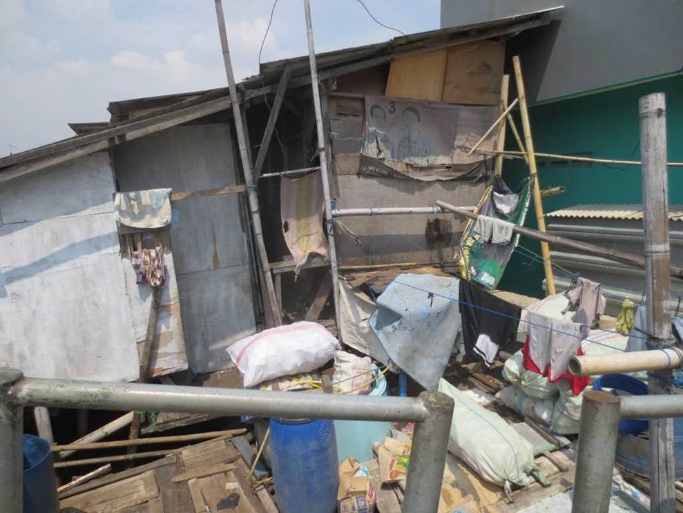
Photo by author, 2014
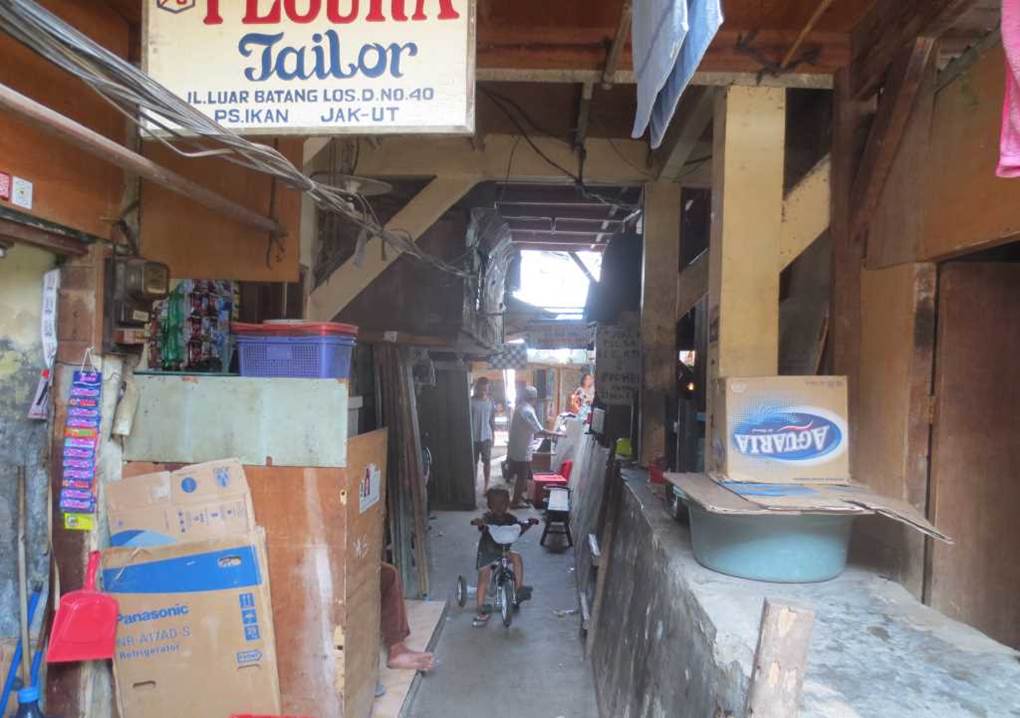
Photo by author, 2014
There was also a store that sold a lot of products.
The life’s necessities are easily available at hand.
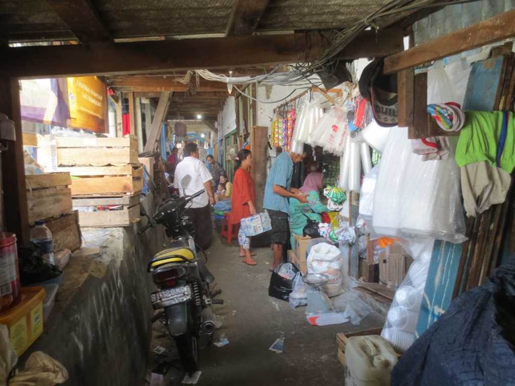
Photo by author, 2014
Residents chatting and relaxing in the shade under the low, crumbling roof.
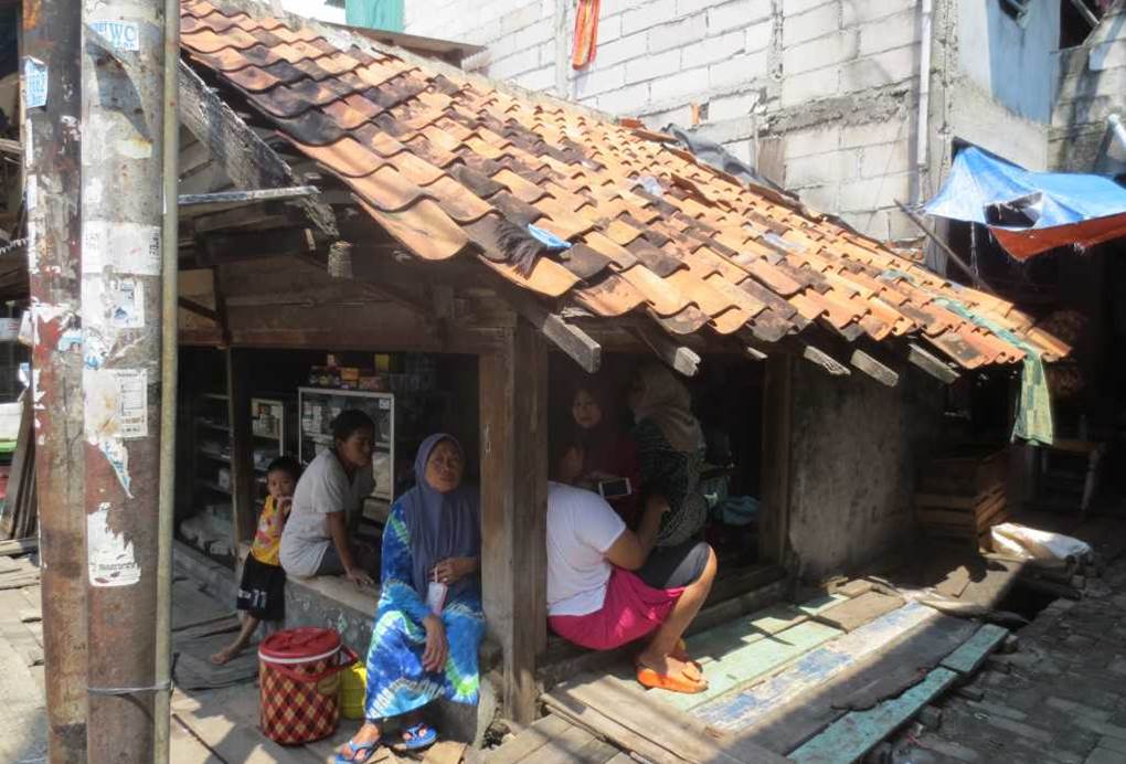
Photo by author, 2014
As I walked along the narrow and intricate alleys, I came to a slightly wider street. Toddlers are playing on the slide. Three children are waiting for their turn, and it is a lively environment.
There was also a “candy store” on bicycle, and a crowd naturally formed, creating a relaxed atmosphere. Although it is a slum area, the residents here are full of vitality.
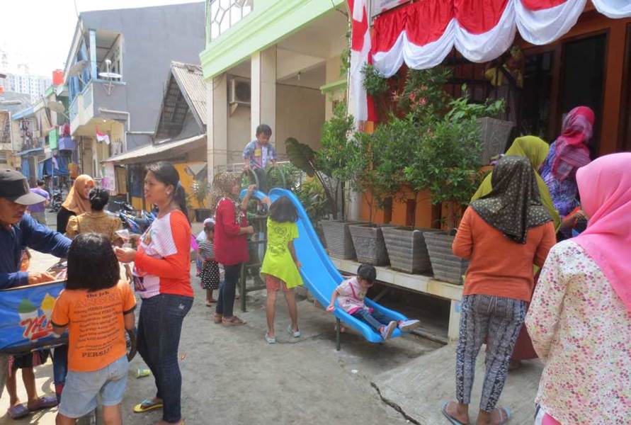
Photo by author, 2014
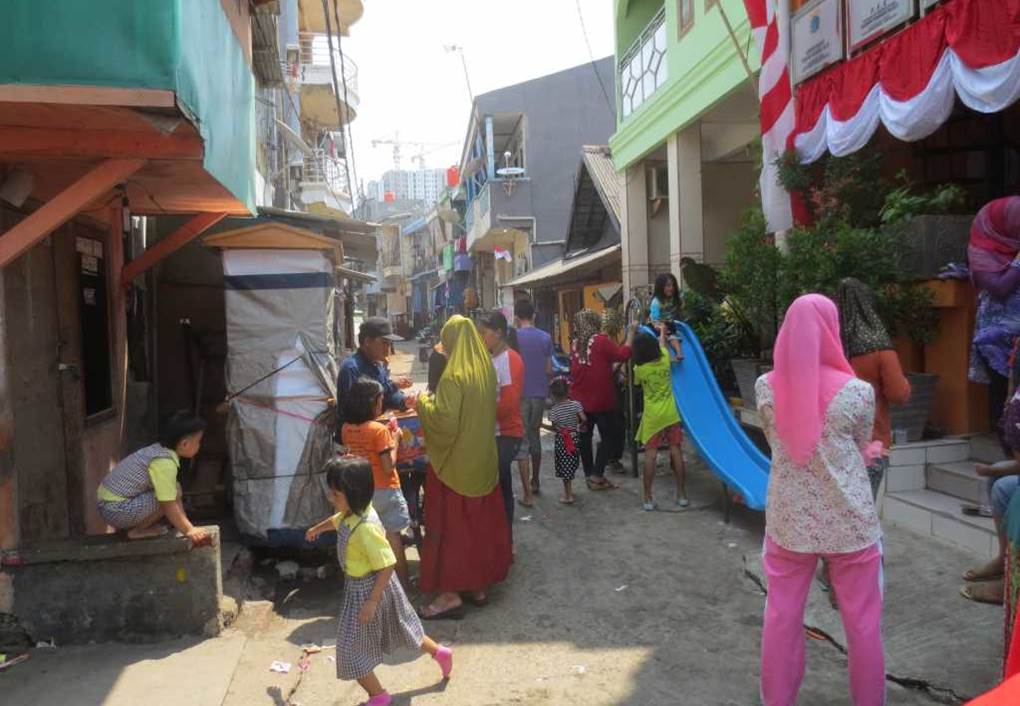
Photo by author, 2014
Luar Batang Holy Mosque
Masjid Jami’ Keramat Luar Batang
As I continued walking, I came to a roadway and the minaret of the mosque appeared in front of me.
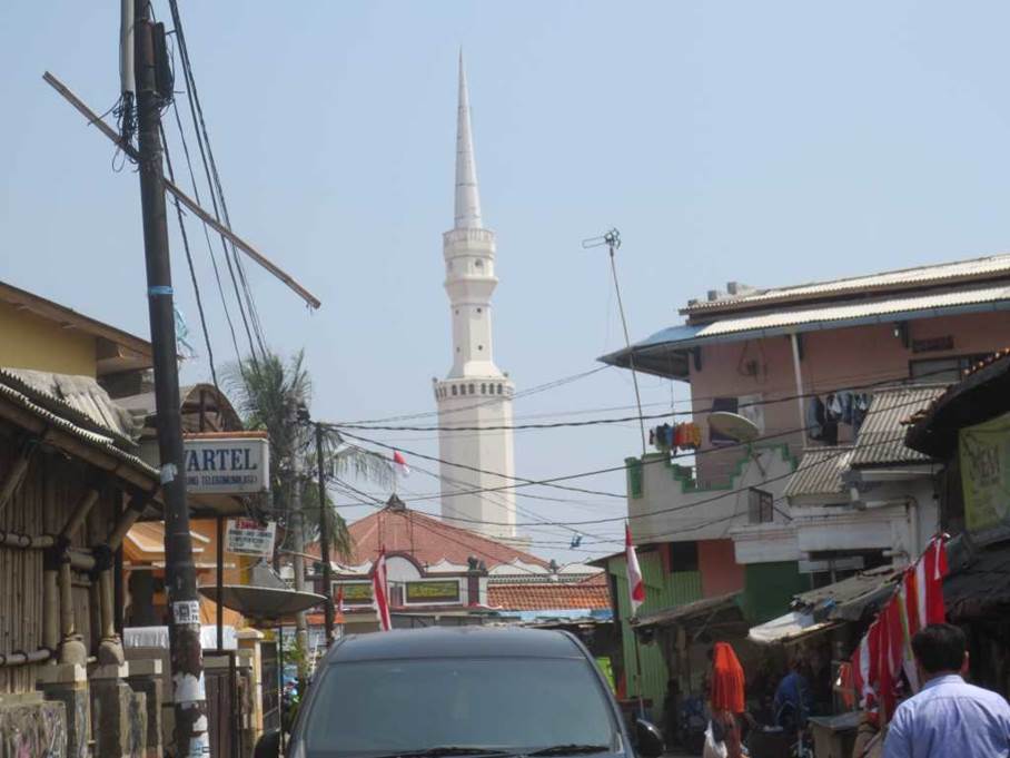
Photo by author, 2014
There was a small parking lot, and after getting permission, we went through the gate and entered.
The Indonesian flag was flying above the gate.
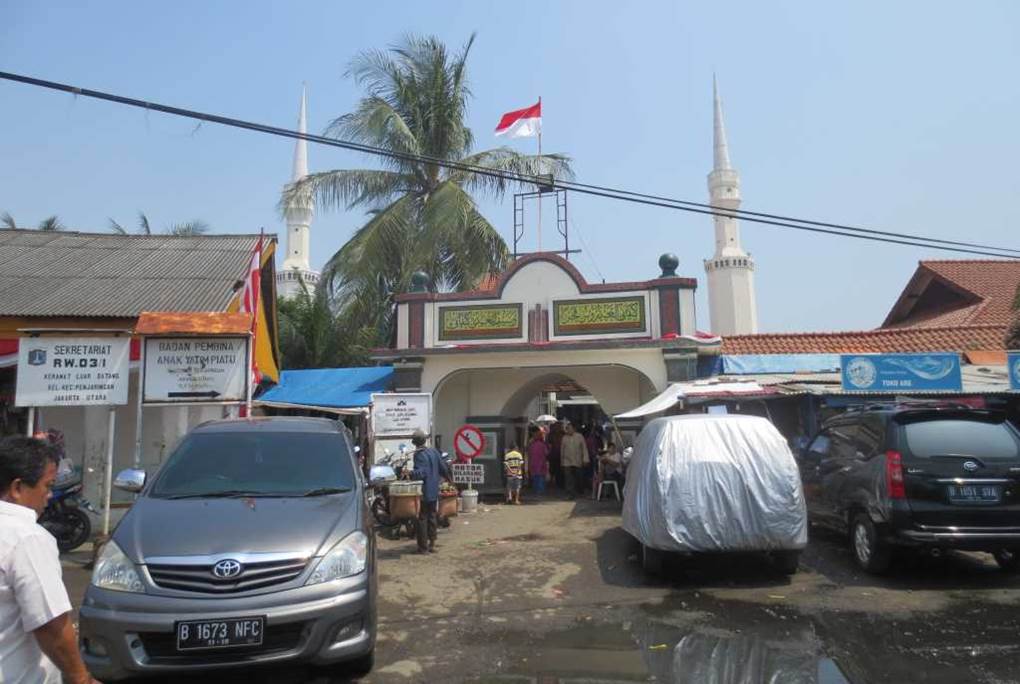
Photo by author, 2014
I was allowed to enter the mosque grounds with the permission of the attendant.
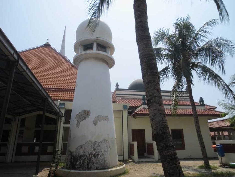
Photo by author, 2014
Minaret. It has a simple but attractive design.
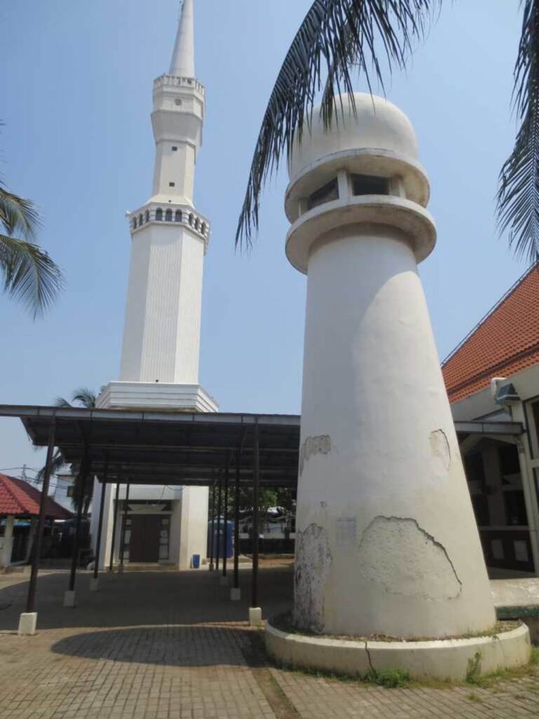
Photo by author, 2014
Children playing enthusiastically in the square inside the mosque.
It is lively and energetic place with lots of children.
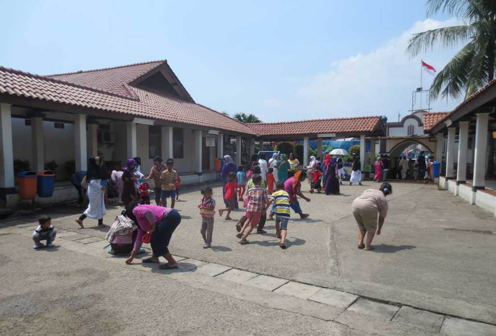
Photo by author, 2014
After passing the mosque, I wandered into the walled area behind it.
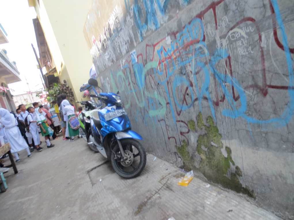
Photo by author, 2014
It seemed that I had entered a corner of a madrassa (religious school) here.
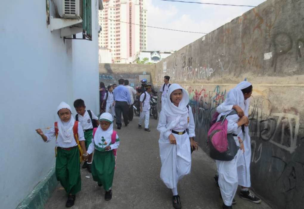
Photo by author, 2014
Looking in the window, I saw many children there, all studying in a classroom.
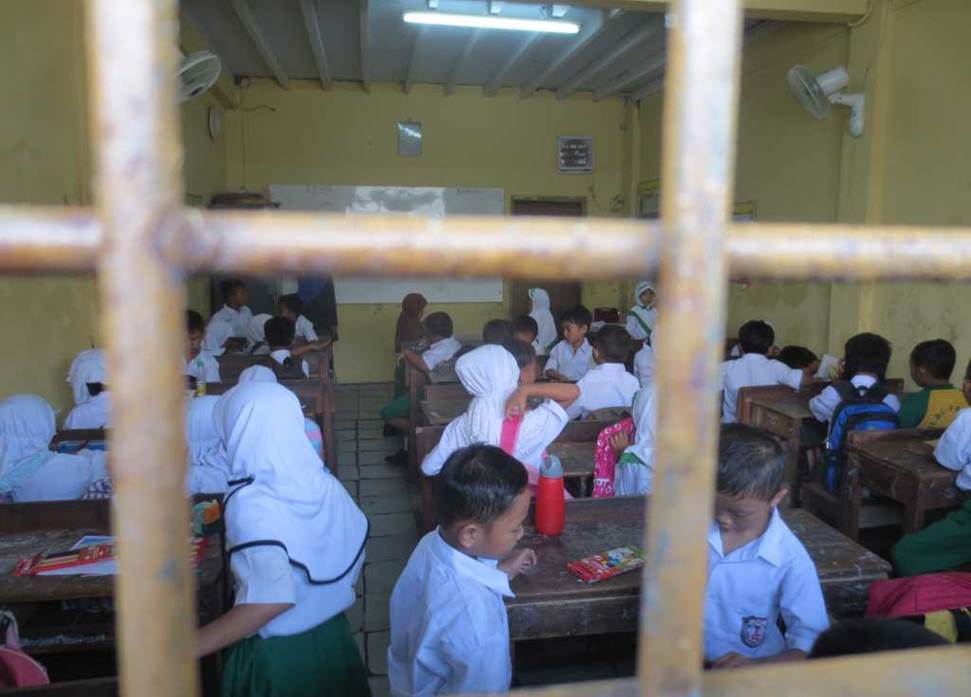
Photo by author, 2014
After school ended, all the schoolchildren came out of the school building at once.
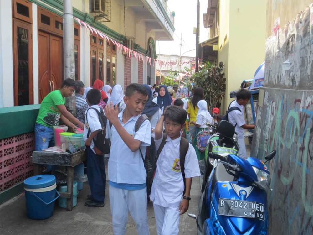
Photo by author, 2014
Some of them go to school on motorcycles.
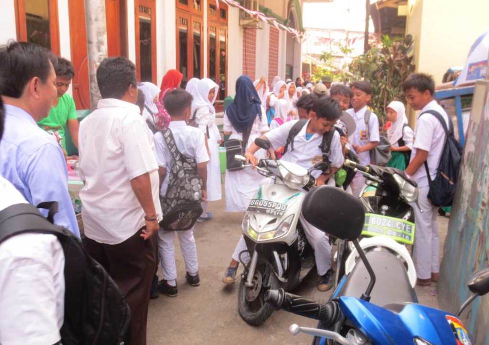
Photo by author, 2014
A vendor who sells toys and other miscellaneous goods on the street.
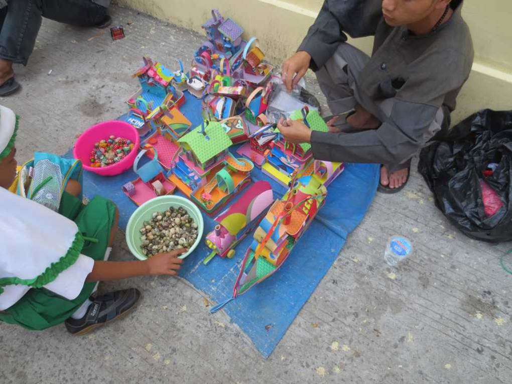
Photo by author, 2014
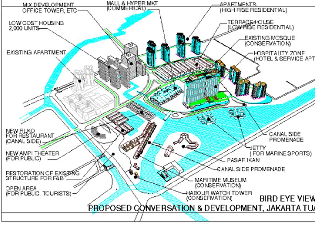
Draft development plan for the former Kota area of Jakarta
My office prepared a draft for redevelopment following the eviction of the reclaimed slum area on the north side of the Jakarta Historic District.
We made a proposal to the Jakarta City Government and presented a draft plan, but it was not realized due to the social impact and environmental cost.
All photos by author, 2014