JAP | ENG
Dhaka, Bangladesh
2011~2014
#2/3
Dhaka Building code and Urban Landscape
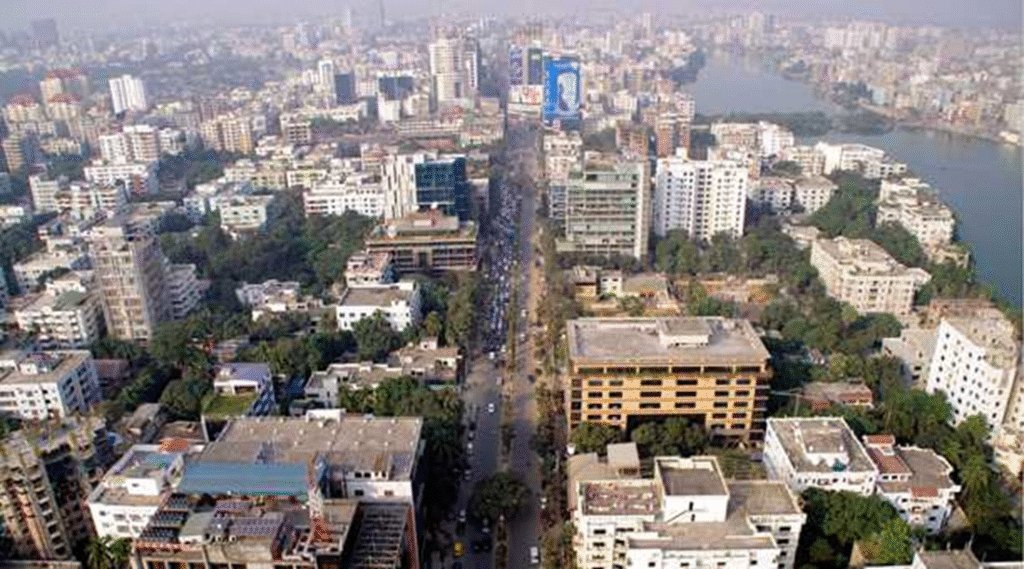
The next morning, I had breakfast in the lounge on the 10th floor of the hotel. I sat on the north side, where I could see the center of the city from the window. When I look outside, the scenery is a something like a magnificent high-rise slum. The first thing that caught my eye were the half-built buildings, several cheaply constructed buildings without scaffolding or safety fences. The hotel I stayed at is good value for money and is often used by merchants. It costs 70-80 dollars a night including breakfast.
Later, I decided to move to a 5-star hotel with breakfast for $150, which is more than a month’s salary for an office worker in Dhaka. When staying abroad for work, good sleep, safety and good food are essential, so this is the only option.

Photo by author, 2011
A half-built building? Or ruins?

Photo by author, 2011
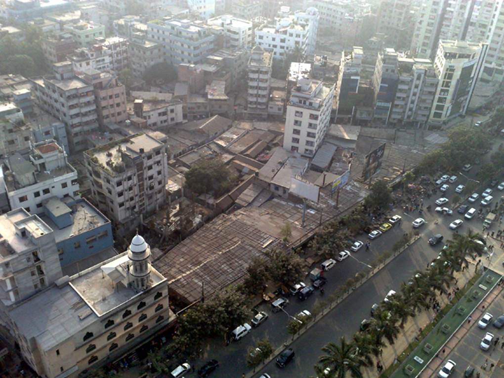
Photo by author, 2011

Photo by author, 2011
A big factory in the center of the city!
In a very densely populated area in the center of the city, there is a relatively large old garment factory as shown in the photo below. When I went down to the ground to observe, I found that the front road was only 3 meters wide and was crowded with people all day. It would be difficult for fire trucks to enter, and if a fire broke out, it would be a catastrophe.
On the left is a condominium with about 100 units that had almost complete construction. Photographed in 2013. It is a rare and rather frightening urban landscape.
In September 2012, a major fire occurred at a garment factory on the outskirts of Dhaka, killing 217 people. The escape stairs had been locked to prevent theft..
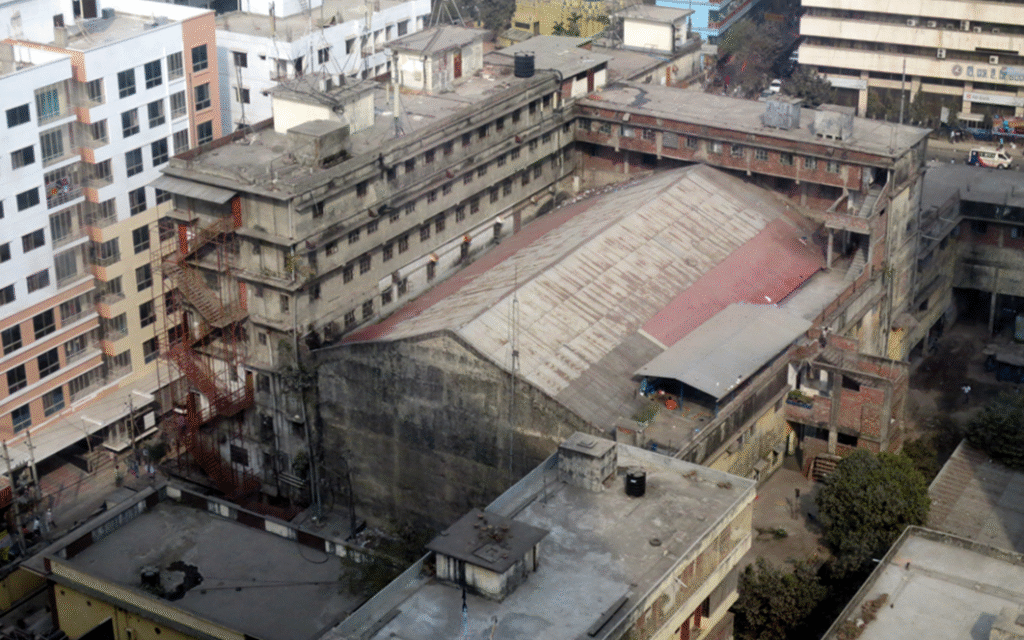
After that, the factory building will be demolished.
Photo by author, 2013
Backstreet shops
In order to observe the activities of ordinary citizens, it is important to have a sense of presence, to be able to feel the air, the smells and the noises, and there is no better means of transportation for this than the rickshaw.
A shop in the alley that repairs and sells discarded TVs.
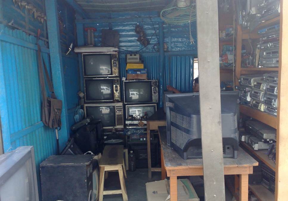
Photo by author, 2011
A backstreet barbershop.
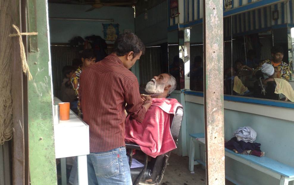
Photo by author, 2011
Shop selling muttons.
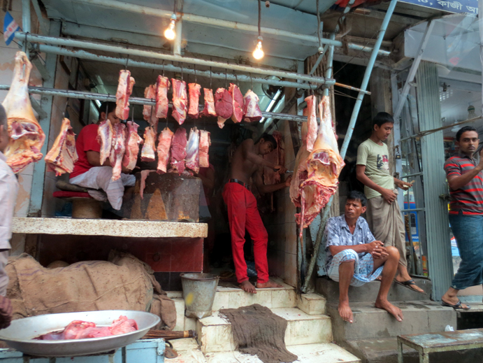
Photo by author, 2011
The old sign said TOKYO LIGHTING INDUSTRIES.

Photo by author, 2011
A general store in town. All the products are sold in small packages to make them more affordable for poor families.

Photo by author, 2011
Standing and drinking at a food stall in the back alley.
Food stalls serving juices and teas. I was walking around the old town with a friend from Dhaka and decided to stop here for a drink. A cup of ginger tea costs 5 yen. It was delicious. Standing and drinking tea in a glass cup like this outdoors is better than a few hundred yen drink at a chain coffee shop in a developed country or big city. I have my doubts about the hygiene though…
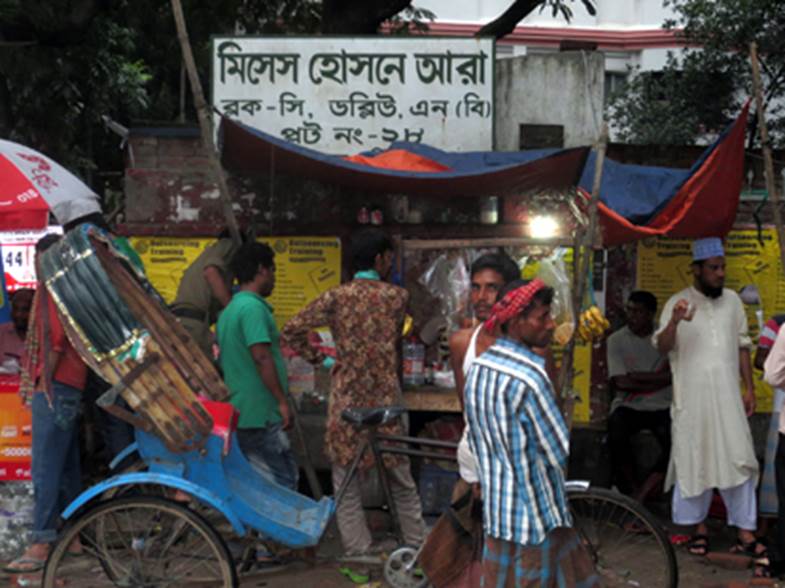
Photo by author, 2011
It is common to see people carrying things on their heads.
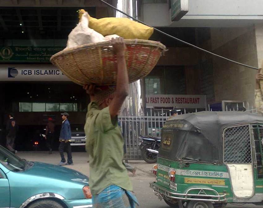
Photo by author, 2011
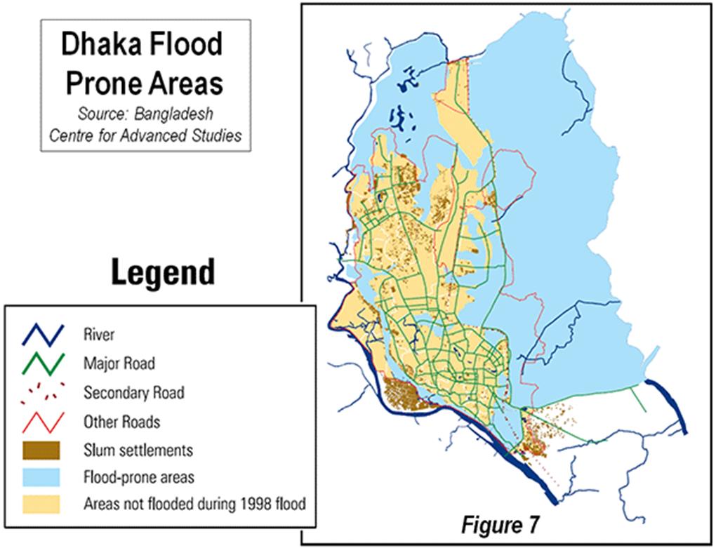
The expansion of the city, from Old Dhaka of the Mughal dynasty to today.
When the Mughal dynasty was at its height, the so-called Old Dhaka, which would become the basis of Dhaka, was born in the center of the eastern border region of Bengal. Since then, the urban space has been expanding and enlarging continuously for over four centuries.
The hinterland of Old Dhaka, which became the base of the city, had topographical problems, and was forced to experience limited and irregular growth.
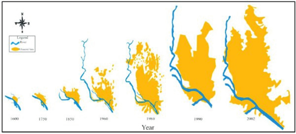
Dhaka lies on a tributary of the Ganges and the Brahmaputoa Rivers, and is thus spared from flood damage from these large rivers and their tributaries, but there is a network of tributaries in the surrounding area, and the plateau that can avoid flooding is extremely limited.
The highest elevation is the airport, 15 kilometers to the north, at 11 meters above sea level.
Only the 7-8 km wide strip from Old Dhaka to the airport, which was built on the banks of this river, is a riverside terrace-like terrain that can be spared from flood control.
Therefore, the area constraints on urban development have led to high density and the development of slums..
The yellow part in the figure below is a plateau-like terrain that has problems with drainage during the rainy season.
The light blue part is a low-lying area with poor drainage that is prone to flooding.
Dhanmondi and Kalabagan: Contrasting City Blocks
Dhanmondi District
In the 1950s, there was a city block called Danmondi was developed as a high-end residential area for the elites.
A large urban plan was implemented with a pond at the center. At the time of completion, it was a high-standard two-story residential site that included a water park. However, its convenient location and spacious streets have worked against it, and today it has been transformed into a high-density, high-rise residential area.
The residential land price in this area is equivalent to 10,000 yen per square meter, which is similar to the land price in Tokyo. For the common people of Bangladesh, this is an astronomical figure.
Kalabagan District
On the other hand, there is a district called Kalabagan, which is about 1 km square, bordered by the main road to the east. It is an unplanned, high-density, subdivided area that is a potential slum. The roads in the district are disorderly, as shown in the figure, and spread out like a maze, 3-4m wide. As a result, it is not suitable for the passage of more than pedestrians, rickshaws, and auto-tricycles. Even fire trucks have difficulty entering.
The sketch below shows a layout of roads in these two blocks. The Kalabagan area is crowded with low-rise and mid-rise buildings along the road, have blind spots in various parts of the winding road, making it a spatial configuration where crime is likely to occur. The Dhanmondi district has a wide planned road, while the Karabagan area has a network of naturally occurring lanes. It must have been a town formed at a time when there were few cars. These contrasting blocks are adjacent to each other, separated by a single main street.
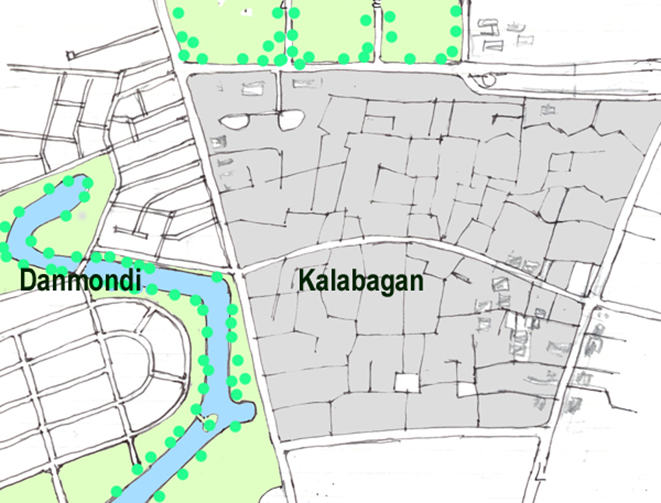
Photo by author, 2011
The streets of Dhanmondi district.
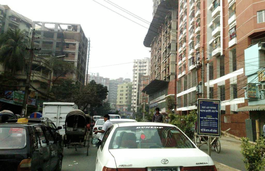
Photo by author, 2011
Kalabagan district shrouded in air pollution.
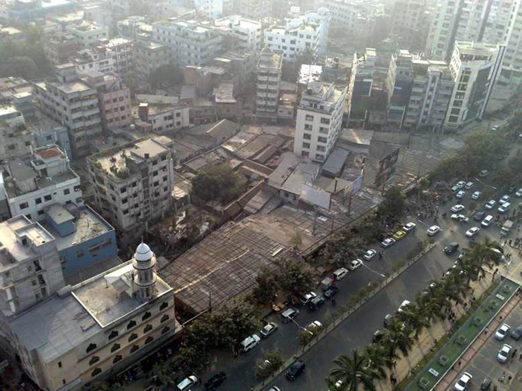
Photo by author, 2011
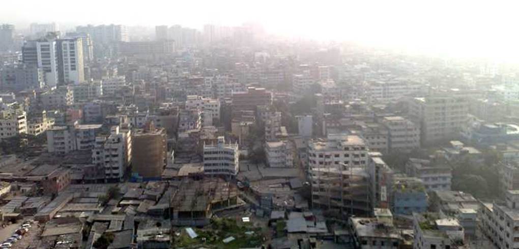
Photo by author, 2011
Adjacent districts of Gulshan and Korail Bosti
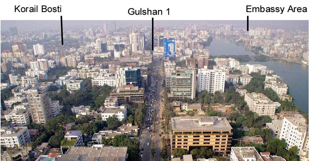
Gulshan District
There is an area called Gulshan that was planned and formed around 1970 as a high-end residential area in Dhaka.
To the west is the Banani district, and to the west is the Baridhara district, where embassies and other facilities are located. Separated the three districts are Lake Bonani and Lake Guishan, providing a waterside environment for each district.
The original planning concept was to provide a high-end residential area by the waterfront, but due to the superior infrastructure of the existing area, the main street was transformed into an office district that included foreign companies.
The plan for the three districts, including Gulshan, was conceived during the East Pakistan era, before Bangladesh’s independence. In the 1970 plan, it was a model town of a large block of purely residential areas.
Later, after Bangladesh’s independence, by around 1990, the large residential area was converted into mid-rise and high-rise condominiums, commercial facilities such as business buildings, shopping malls, and restaurants were built on the main streets, and the area was also encroached upon by hotels and facilities for foreigners, becoming the complex area that it is today.
The intersection where the main roads of the city intersect is covered on all four sides with gaudy signs and used as a chaotic parking lot. The place that should be the core of the city is in chaos, and it is robbing the city of its dignity.
A single main road runs north to south through the center of the land between the two long, narrow lakes. The areas facing the lakes lack public areas such as hydrophilic promenades or green belts. Because the water surface is next to private land, garbage is illegally dumped on the border, making the border between the water surface and the land unclear, and creating what is essentially an eroded landfill. After that, illegal buildings and slums are likely to appear on the reclaimed land.
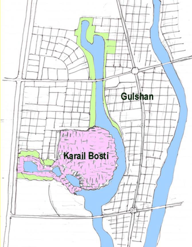
Karail Bosti district
Author’s sketch
And when the reclamation of the water surface is carried out in such a non-disruptive manner, the water area gradually narrows, and as a result, environmental pollution gradually progresses due to water pollution. Before you know it, you will need a large budget for recovery, and if that budget exceeds the limits of the authorities, the government that prevents the spread of slums will be defeated, and the infrastructure and character of the city will not be able to be preserved.
Korail Bosti
One example of a slum that has developed in this way is the Korail Bosti area.
This slum covers an area of 3.5 km2 and has a population of 73,000 people. The population density is 20,000 people per square kilometer, which is about twice as high as the average residential area in Dhaka. This slum exists back-to-back with the high-end residential area in the area. The contrasting existence of these two is noteworthy.
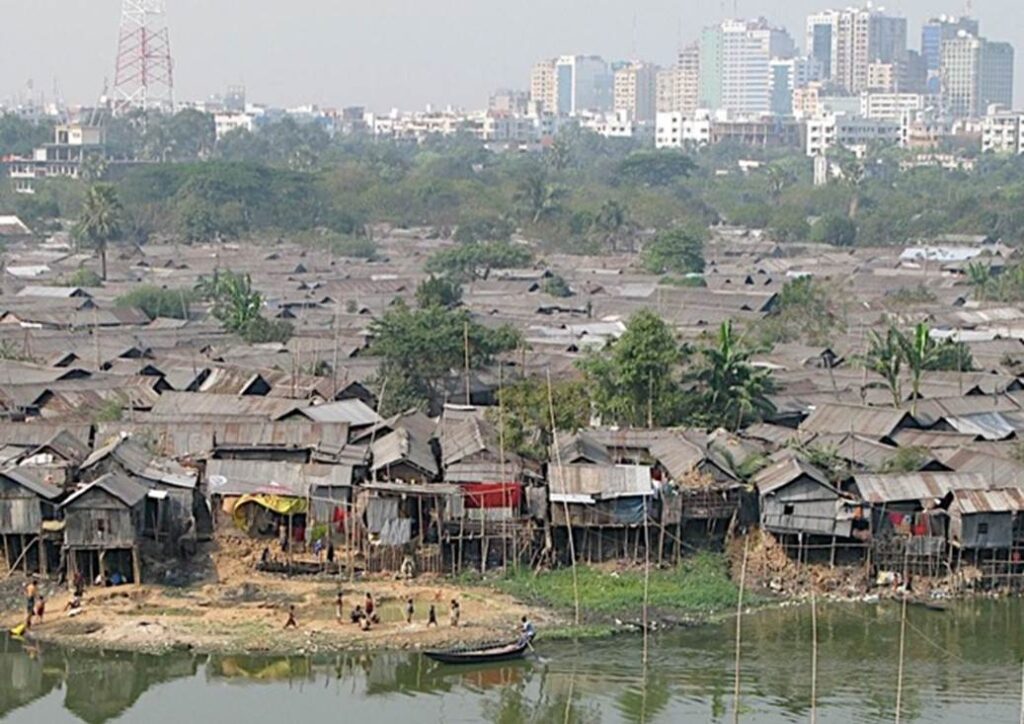
In such cases, slums are defined as clusters of houses that have been built in a chaotic fashion by people who have come to the city from rural areas in search of work, filling in water areas, building block walls, and using salvage materials to create homes.
Due to its illegal construction, it is not possible to receive government services such as water, electricity, sewage treatment, and garbage collection. Roads are left to nature and become like a maze. In order to maximize the area of the house, the width of the road is extremely narrow. Ambulances, fire trucks, and even ordinary vehicles are not able to enter.
Once these slums are established, they are difficult for the authorities to deal with, because they come at a cost of social conflict that is too big to handle.
Bird’s eye view, Dhaka’s largest slum district. It stands majestically in the center of the planned surrounding townscape.
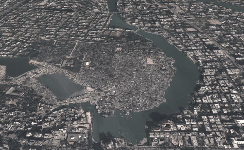
Korail Bosti district
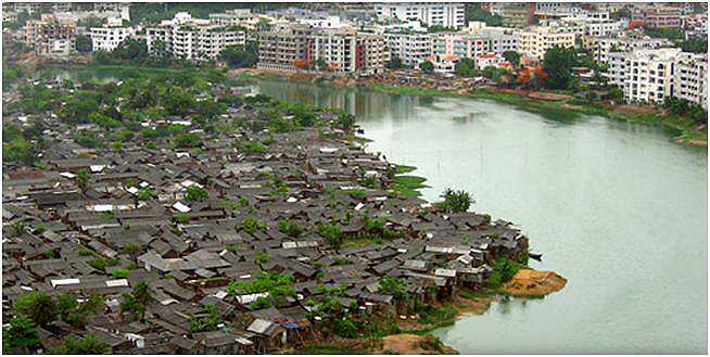
Expanding and encroaching slums
Natural building erosion begins from the road around the pond towards the center of the pond. The buildings in this area are mostly small businesses with tin roofs.
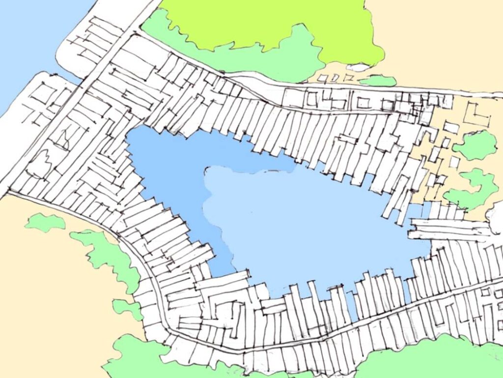
Author’s sketch
Gulshan District
The main street of the Gulshan district. Banks, office buildings, hotels, etc. are concentrated on this street.
There is a parking lot at the Gulshan 1 intersection, but there is no pedestrian bridge, and the traffic system gives priority to cars. This creates a strong desire to own a car.
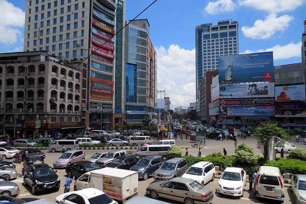
Photo by author, 2011
A group of billboards in front of the building at the main intersection of Gulshan.

Photo by author, 2011
Holey Artisan Bakery
Located on the shores of a lake in the Gulshan district, it is the most famous restaurant in Dhaka, where an terrorist attacks occurred. The terrorist attack on July 1, 2016 caused death of 29 people, including 17 foreigners (9 Italians and 7 Japanese, 1 Indian), 3 locals, 2 police officers, 5 gunmen, and 2 bakery staff.
Pan Pacific Hotel Dhaka
This hotel became a regular lodging during my 13 visits to Bangladesh, which total to 50 days. This hotel was built by a Japan construction company.
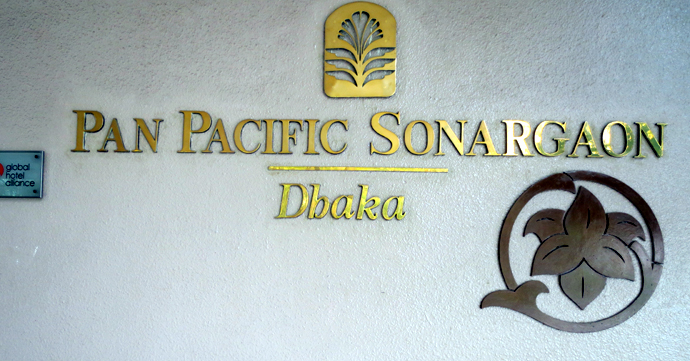
Photo by author, 2011
View from the room at the Pan Pacific Hotel. The sky is always dull. It is located on the shore of the lake, but unfortunately the location is not being taken advantage of because the lake water is severely polluted.

Photo by author, 2011
Hotel coffee shop. Every morning I always have fruit with yogurt, and coffee and bread.
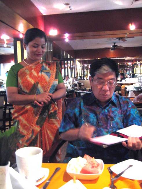
Photo of author, 2011
Leaving the Pan Pacific Hotel, the city suddenly turns chaotic. A big roundabout stands in front of me, and I am confronted with traffic jams and noise. My workplace is a short walk away from the roundabout, but it is extremely dangerous to walk across the roundabout, so I have to rely on a shuttle car for the short distance of just 500 meters.
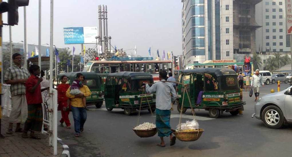
Photo by author, 2011
The existence of disparities.
Two women leaving a hair salon. Are they heading out to a party?
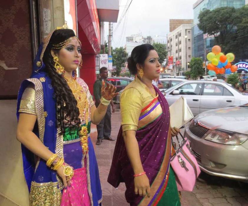
Photo by author, 2011
A wedding hall in a hotel. An acquaintance of mine was invited to a wedding, so I accompanied him. It was a glamorous party for the wealthy, isolated from the hustle and bustle of the city outside.

Photo by author, 2011
Outside the hotel is hell, but inside the banquet hall is heaven. That’s about it.
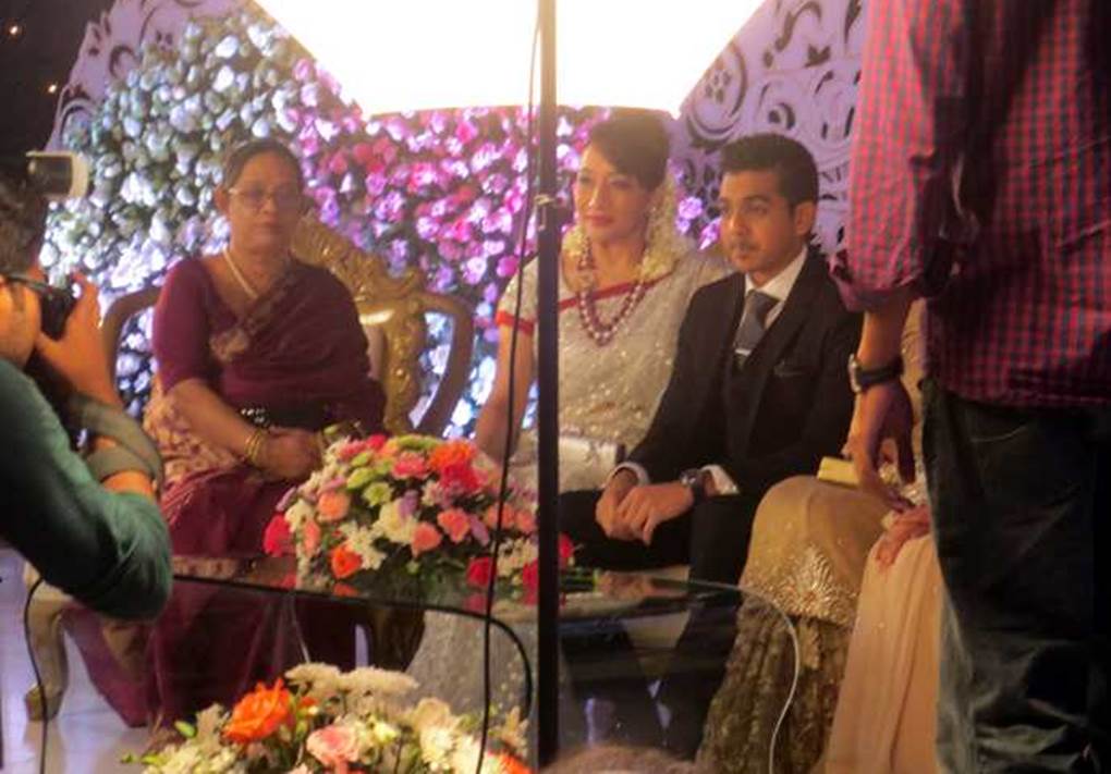
Photo by author, 2011